MyTopo
Carthage Tennessee US Topo Map
Couldn't load pickup availability
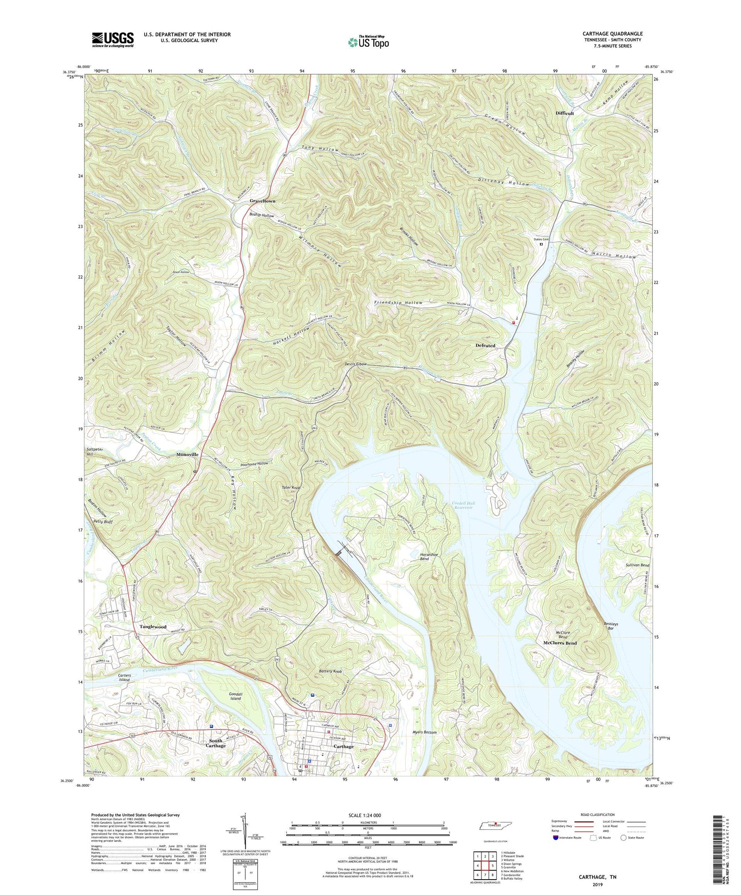
2022 topographic map quadrangle Carthage in the state of Tennessee. Scale: 1:24000. Based on the newly updated USGS 7.5' US Topo map series, this map is in the following counties: Smith. The map contains contour data, water features, and other items you are used to seeing on USGS maps, but also has updated roads and other features. This is the next generation of topographic maps. Printed on high-quality waterproof paper with UV fade-resistant inks.
Quads adjacent to this one:
West: Dixon Springs
Northwest: Hillsdale
North: Pleasant Shade
Northeast: Willette
East: Granville
Southeast: Buffalo Valley
South: Gordonsville
Southwest: New Middleton
This map covers the same area as the classic USGS quad with code o36085c8.
Contains the following named places: Battery Knob, Beasley Hollow, Bessleys Bar, Braden United Methodist Church, Brooks Hollow, Buship Hollow, Carters Island, Carthage, Carthage Church of Christ, Carthage Division, Carthage Elementary School, Carthage Fire Department, Carthage First Baptist Church, Carthage Mine, Carthage Police Department, Carthage Post Office, Carthage United Methodist Church, Commissioner District 1, Commissioner District 6, Cordell Hull Lock and Dam, Cornwell Chapel, Cromwell Branch, Defeated, Defeated Creek, Defeated Creek Fire Department District 3, Defeated Creek Recreation Area, Defeated Elementary School, Devils Elbow, Dickinson Branch, Difficult, Diffucult School, Dillehay Branch, Dillehay Hollow, Dukes Cemetery, Edgefield, Friendship Church, Friendship Hollow, Frog Branch, Gammons Branch, Goodall Island, Graveltown, Green Hollow, Green Valley Church, Hackett Hollow, Harris Hollow, Hogan Creek, Hoggtown Branch, Horseshoe Bend, Kemp Hollow, Kempville Branch, Key Hollow, Lankford Branch, Lankford School, Maces Hill Church, Maces Hill School, Martin Branch, McClure Bend, McClure Bend School, McClures Bend, Monoville, Monoville Post Office, Monoville School, Mount Tabor Church, Mount Zion Church, Myers Bottom, Nickajack Branch, Nixon Hollow, North Carthage Baptist Church, Old Lock and Dam Number Eight, Parthenia Chapel, Petty Bluff, Peyton Creek Church, Poorhouse Hollow, Riverview Regional Medical Center, Riverview Regional Medical Center South, Robinson School, Smith Branch, Smith County, Smith County Ambulance Service, Smith County Courthouse, Smith County Fire Department Central District, Smith County High School, Smith County Highway Department Quarry, Smith County Landfill, Smith County Sheriff's Office, Tanglewood, Tanglewoods School, Tater Knob, Taylor Hollow, Taylors Branch Landing, Toetown Branch, Tony Hollow, Town of Carthage, Turkey Creek, Turkey Creek School, Union Hill School, Wilmore Hollow, WRKM-FM (Carthage), ZIP Code: 37030