MyTopo
Pleasant Shade Tennessee US Topo Map
Couldn't load pickup availability
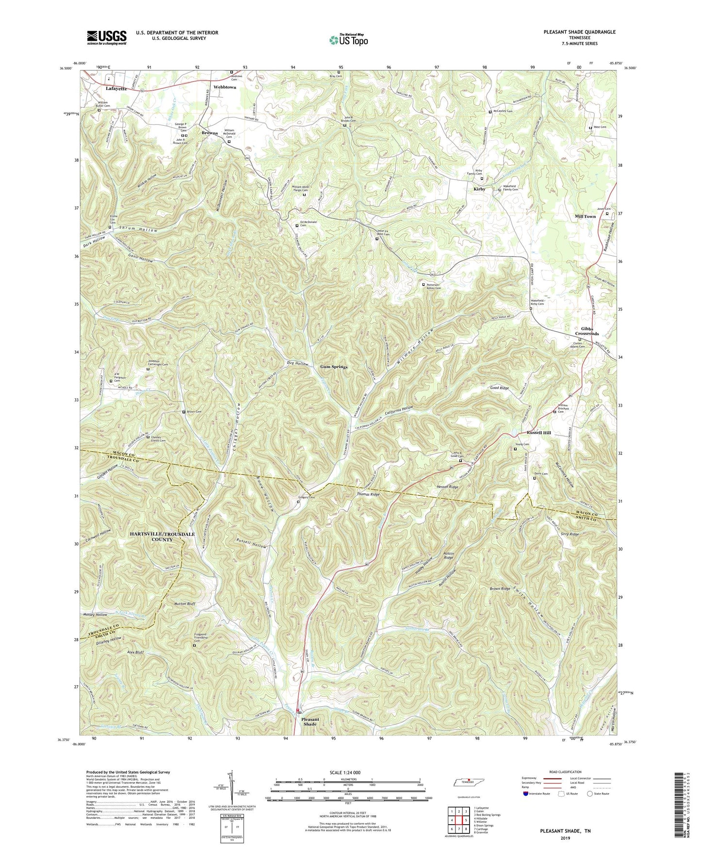
2022 topographic map quadrangle Pleasant Shade in the state of Tennessee. Scale: 1:24000. Based on the newly updated USGS 7.5' US Topo map series, this map is in the following counties: Macon, Smith, Trousdale. The map contains contour data, water features, and other items you are used to seeing on USGS maps, but also has updated roads and other features. This is the next generation of topographic maps. Printed on high-quality waterproof paper with UV fade-resistant inks.
Quads adjacent to this one:
West: Hillsdale
Northwest: Lafayette
North: Galen
Northeast: Red Boiling Springs
East: Willette
Southeast: Granville
South: Carthage
Southwest: Dixon Springs
This map covers the same area as the classic USGS quad with code o36085d8.
Contains the following named places: A W Ferguson Cemetery, Adams Cemetery, Alex Bluff, Andrews Family Cemetery, Aubie Wakefield Cemetery, Austin Branch, Austin Hollow, Austin Ridge, Boston Branch, Bray Cemetery, Brockett Cemetery, Brown Cemetery, Brown Ridge, Browne School, Browns, California Hollow, Chesley Evetts Cemetery, Chigger Hollow, Commissioner District 2, Cromwell Chapel, Davis Cemetery, Dug Hollow, Ebenezer Church, Ebenezer School, Ed McDonald Cemetery, Elisha Cox Cemetery, Frogpond - Friendship Cemetery, Gann Hollow, George P Brown Cemetery, Gibbs Crossroads, Goad Cemetery, Goad Ridge, Gregory Cemetery, Gum Grove School, Gum Springs, Happy Hollow, Hesson Ridge, John R Brooks Cemetery, John R Brown Cemetery, Jones Cemetery, Josephus Cartwright Cemetery, Killrell School, Kirby, Kirby Cemetery, Kirby Family Cemetery, Kirby Grove School, Little Peyton Creek, Macedonia School, Macey, Martin Hollow, McCawley Cemetery, McDonnell Hollow, Mill Town, Mutton Bluff, Olio, Patterson-Kelley Cemetery, Pleasant Shade, Pleasant Shade Elementary School, Pleasant Shade Post Office, Rose Hollow, Russell Hill, Russell Hill Baptist Church, Russell Hill Presbyterian Church, Russell Hollow, Sanderson Branch, Sanderson Church, Sanderson School, Shrum Hollow, Sircy Ridge, Sloan Branch, Smith County Fire Department District 8, Smith Hollow, Sycamore Valley Church, Sycamore Valley School, Thomas Ridge, Union Camp, Upper Cumberland Church, West Cemetery, Wildcat Hollow, William Abner Hargis Cemetery, William Butler Cemetery, William Mcdonald Cemetery, Wilmore Hollow, Young Cemetery, ZIP Code: 37145