MyTopo
Celina Tennessee US Topo Map
Couldn't load pickup availability
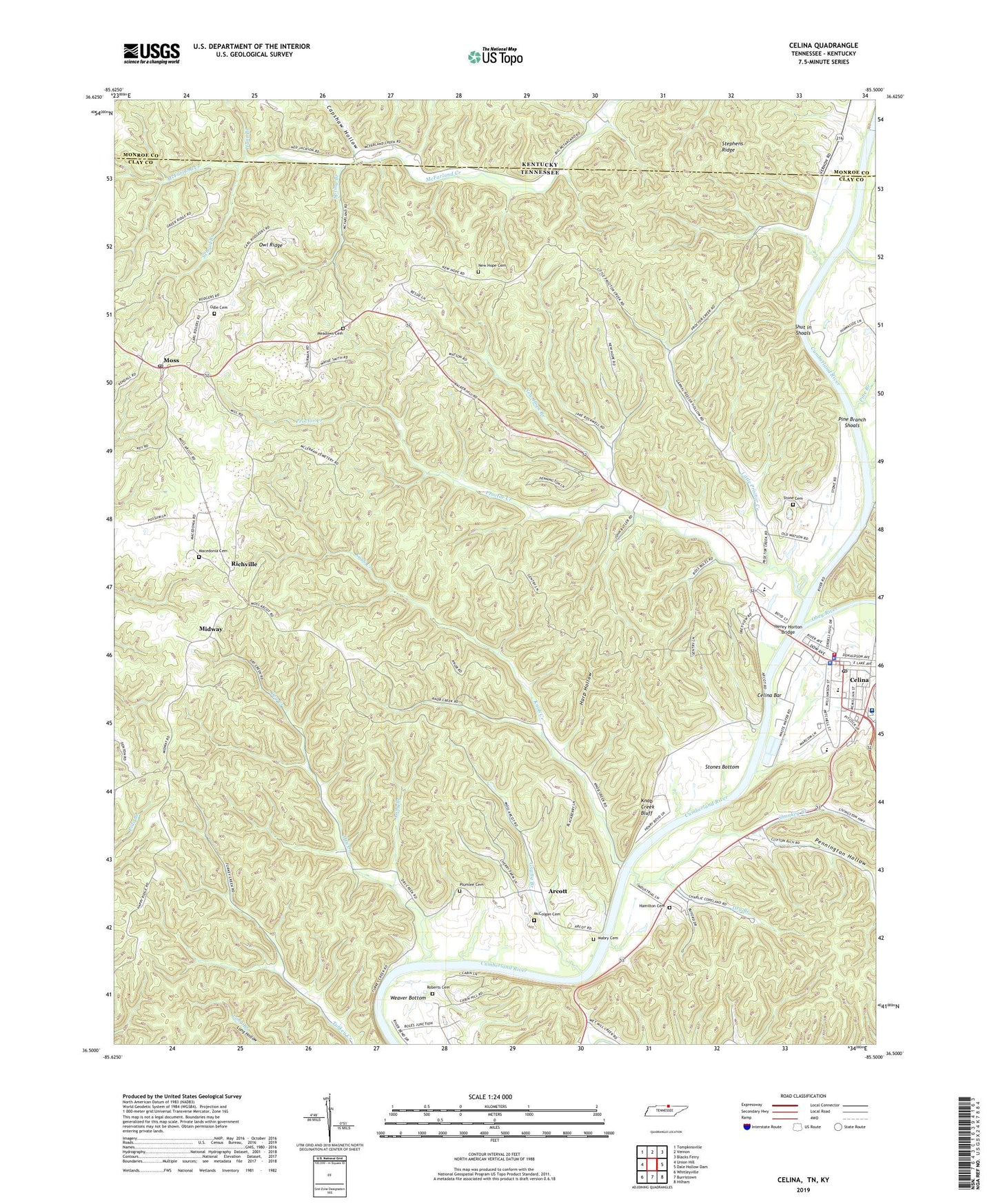
2019 topographic map quadrangle Celina in the states of Tennessee, Kentucky. Scale: 1:24000. Based on the newly updated USGS 7.5' US Topo map series, this map is in the following counties: Clay, Monroe. The map contains contour data, water features, and other items you are used to seeing on USGS maps, but also has updated roads and other features. This is the next generation of topographic maps. Printed on high-quality waterproof paper with UV fade-resistant inks.
Quads adjacent to this one:
West: Union Hill
Northwest: Tompkinsville
North: Vernon
Northeast: Blacks Ferry
East: Dale Hollow Dam
Southeast: Hilham
South: Burristown
Southwest: Whitleyville
Contains the following named places: Arcot Church of Christ, Arcot School, Arcott, Beech Bethany Church, Beech Bethany School, Bennett Ferry, Capshaw Hollow, Celina, Celina Bar, Celina Division, Celina Fire Department, Celina High School, Celina Police Department, Celina Post Office, Celina School, City of Celina, Clay County, Clay County Courthouse, Clay County Hospital, Clay County Sheriff's Office, Cooks Branch, Cumberland River Hospital, Donaldson Park Recreation Area, Dry Branch, Dry Creek, Gnatty Branch, Hamilton Cemetery, Harp Hollow, Henry Horton Bridge, Hunt Branch, Kettle Creek, Knob Creek, Knob Creek Bluff, Liberty Hill School, Little Proctor Creek, Long Branch, Mabry Cemetery, Macedonia Cemetery, Macedonia Church, McColgan Family Cemetery, McFarland Shoal, Meadows Cemetery, Midway, Midway Church of Christ, Midway School, Moss, Moss Church of Christ, Moss Post Office, Moss School, Moss Volunteer Fire Department, New Hope Branch, New Hope Cemetery, New Hope Church, New Hope School, Obey River, Odle Cemetery, Owl Ridge, Pennington Hollow, Pine Branch, Pine Branch Shoals, Plumlee Cemetery, Proctor Creek, Richville, Roberts Cemetery, School Branch, Shankey Branch, Shut in Shoals, Skinnicy Branch, Spring Branch, Stephens Ridge, Stone Cemetery, Stones Bottom, Weaver Bottom