
MyTopo
Cypress Inn Tennessee US Topo Map
Couldn't load pickup availability
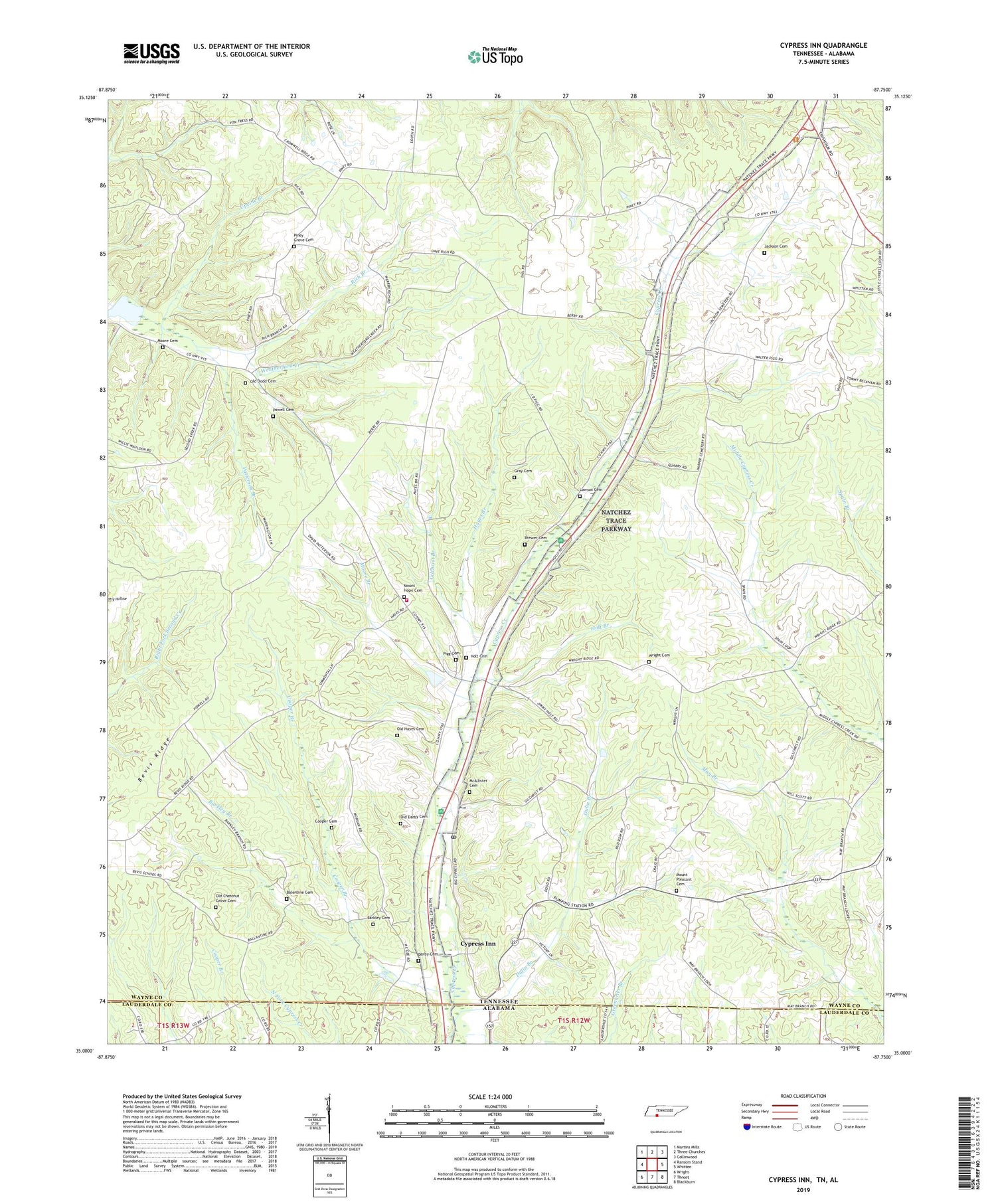
2019 topographic map quadrangle Cypress Inn in the states of Tennessee, Alabama. Scale: 1:24000. Based on the newly updated USGS 7.5' US Topo map series, this map is in the following counties: Wayne, Lauderdale. The map contains contour data, water features, and other items you are used to seeing on USGS maps, but also has updated roads and other features. This is the next generation of topographic maps. Printed on high-quality waterproof paper with UV fade-resistant inks.
Quads adjacent to this one:
West: Ransom Stand
Northwest: Martins Mills
North: Three Churches
Northeast: Collinwood
East: Whitten
Southeast: Blackburn
South: Threet
Southwest: Wright
Contains the following named places: Balentine Cemetery, Barkley Branch, Barkley Cemetery, Barnett School, Berry School, Bevis Ridge, Bevis School, Brewer Cemetery, Cheatham School, Cooper Branch, Cooper Cemetery, Cypress Inn, Cypress Inn Post Office, Cypress Inn Volunteer Fire Department, Darby Cemetery, Darby School, Dodds Mill, Dulin Branch, Gilchrist Branch, Gilchrist School, Gray Cemetery, Hayes Branch, Holt, Holt Branch, Holt Cemetery, Holt School, Hyde Chapel, Jackson Cemetery, Lawson Cemetery, Little Bethel Church, Lutts-Cypress Inn Division, McAllister Cemetery, Moore Branch, Moore Cemetery, Mount Hope Cemetery, Mount Hope Church, Mount Pleasant Cemetery, Mount Pleasant Church, Old Chestnut Grove Cemetery, Old Darby Cemetery, Old Dodd Cemetery, Old Hayes Cemetery, Patterson Branch, Pigg Cemetery, Piney Grove Cemetery, Piney Grove Church, Powell Cemetery, Rich Branch, Rose Gin, Rose School, Scott Chapel, Scott School, Upvine Branch, Weatherford-Bear Lake Number One B, Whittens Stand, Wright Cemetery, ZIP Code: 38452


