MyTopo
Martins Mills Tennessee US Topo Map
Couldn't load pickup availability
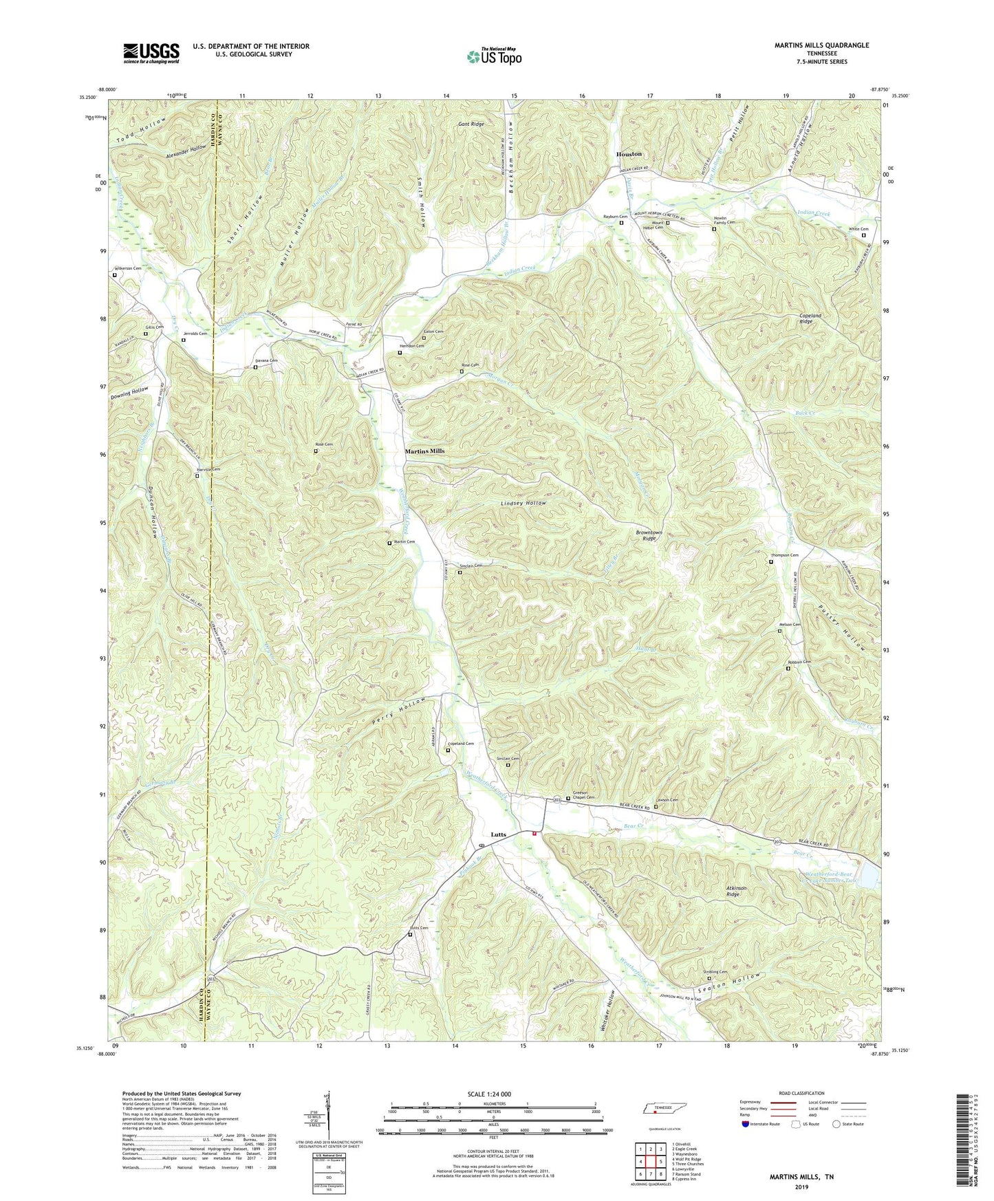
2022 topographic map quadrangle Martins Mills in the state of Tennessee. Scale: 1:24000. Based on the newly updated USGS 7.5' US Topo map series, this map is in the following counties: Wayne, Hardin. The map contains contour data, water features, and other items you are used to seeing on USGS maps, but also has updated roads and other features. This is the next generation of topographic maps. Printed on high-quality waterproof paper with UV fade-resistant inks.
Quads adjacent to this one:
West: Wolf Pit Ridge
Northwest: Olivehill
North: Eagle Creek
Northeast: Waynesboro
East: Three Churches
Southeast: Cypress Inn
South: Ransom Stand
Southwest: Lowryville
This map covers the same area as the classic USGS quad with code o35087b8.
Contains the following named places: Alexander Hollow, Arnold Branch, Arnold Hollow, Atkinson Ridge, Bear Creek, Beckham Hollow, Beckham Hollow Branch, Browntown, Browntown Ridge, Buck Creek, Bundrant Branch, Commissioner District 5, Copeland Cemetery, Copeland Chapel, Davana Cemetery, Davis Branch, Downing Hollow, Dry Creek, Duncan Hollow, Duncans Branch, Eaton Cemetery, Gillis Cemetery, Grace Chapel, Greeson Chapel, Greeson Chapel Cemetery, Harville Cemetery, Herndon Cemetery, Houston, Houston School, Hunt Branch, Jerrolds Cemetery, Lawson Cemetery, Lindsey Hollow, Lutts, Lutts Cemetery, Lutts Post Office, Lutts Volunteer Fire Department, Martin Cemetery, Martins Mills, Martins Mills School, Melson Cemetery, Morgan Creek, Mount Heber Cemetery, Muller Hollow, Muller Hollow Branch, Neighbors Branch, Nowlin Family Cemetery, Perry Hollow, Petit Hollow, Petit Hollow Branch, Pinhook Branch, Pinhook Elementary School, Pusser Hollow, Rayburn Cemetery, Rayburn Chapel, Rayburn Creek, Rayburn School, Robbins Cemetery, Rose Cemetery, Seaton Hollow, Shady Grove Church, Shady Grove School, Short Hollow, Sinclair Cemetery, Smith Hollow, Stribling Cemetery, Thompson Cemetery, Tilley Branch, Todd Hollow, Weatherford Creek, Weatherford-Bear Creek Dam Number Two, Weatherford-Bear Creek Lake Number Two, Whitaker Hollow, White Cemetery, Wilkerson Cemetery