MyTopo
Drummonds Tennessee US Topo Map
Couldn't load pickup availability
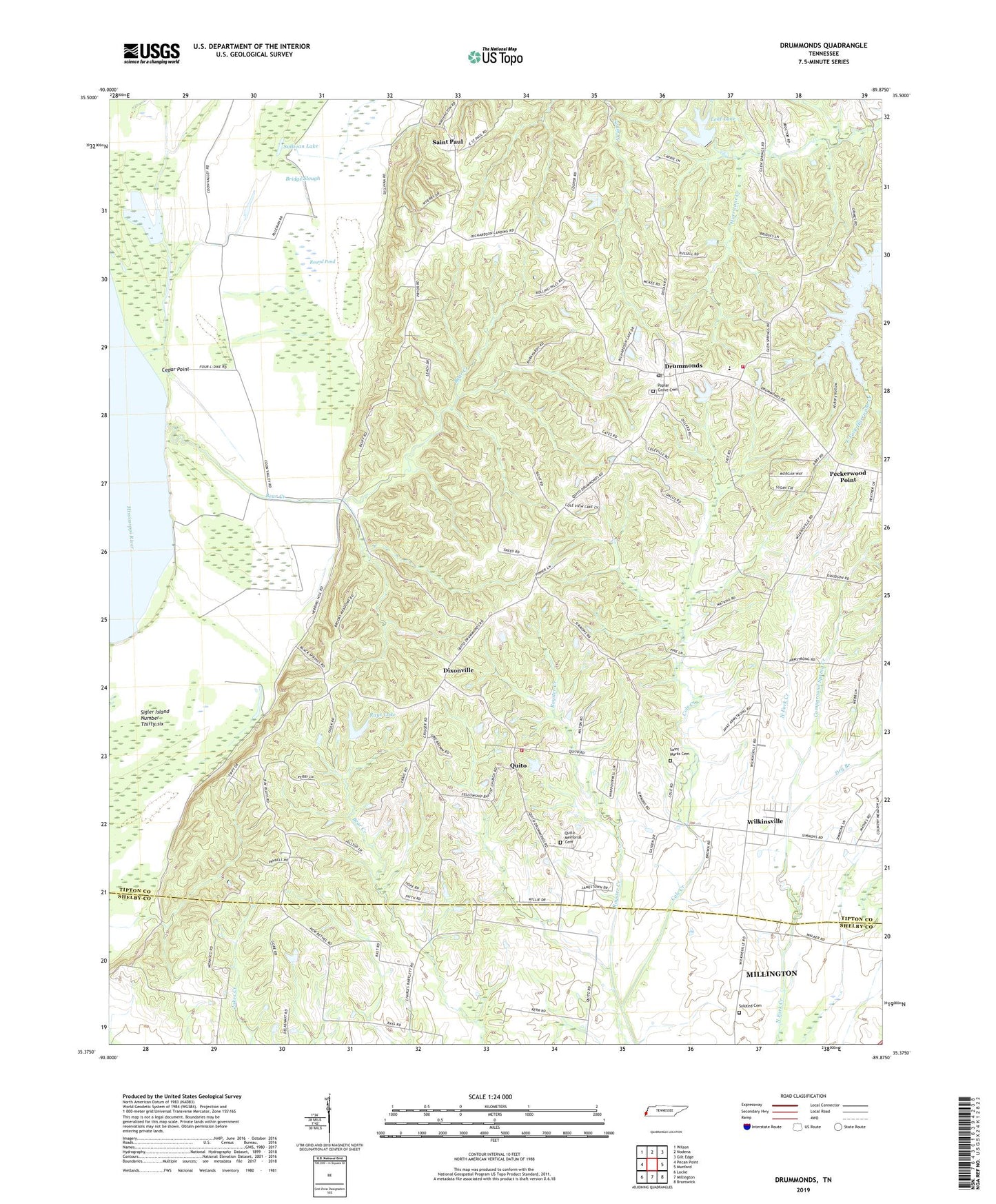
2022 topographic map quadrangle Drummonds in the state of Tennessee. Scale: 1:24000. Based on the newly updated USGS 7.5' US Topo map series, this map is in the following counties: Tipton, Shelby. The map contains contour data, water features, and other items you are used to seeing on USGS maps, but also has updated roads and other features. This is the next generation of topographic maps. Printed on high-quality waterproof paper with UV fade-resistant inks.
Quads adjacent to this one:
West: Pecan Point
Northwest: Wilson
North: Nodena
Northeast: Gilt Edge
East: Munford
Southeast: Brunswick
South: Millington
Southwest: Locke
This map covers the same area as the classic USGS quad with code o35089d8.
Contains the following named places: Bear Creek, Bridge Slough, Campground Spring Creek, Cedar Point, Cedar Point Dikes, Cedar Point Landing, Cole Creek, Commissioner District 6, Cooper School, Densford Revetment, Dixonville, Dixonville School, Drummonds, Drummonds Division, Drummonds Elementary School, Drummonds Post Office, Dry Branch, Fellowship Baptist Church, Forest Strip Airport, Gideon Church, Hickory Hollow, Holiness Church, Jerusalem Church, Leaf Lake, Leaf Lake Dam, Mount Harmon Church, Neal Landing, New Bethel Church, Peckerwood Point, Poplar Grove Cemetery, Poplar Grove Church, Quito, Quito Community Center, Quito Memorial Cemetery, Quito Methodist Church, Quito School, Quito Volunteer Fire Department Station 1, Rays Lake, Rays Lake Dam, Round Pond, Saint Marks Cemetery, Saint Marks Church, Saint Paul, Saint Paul School, Saint Pauls Church, Saluted Cemetery, Sigler Island Number Thirty-six, Sneed Farm, Sullivan Lake, Tipton County Fire Department - Drummonds Station, Towering Heights, Wilkinsville, ZIP Code: 38023