MyTopo
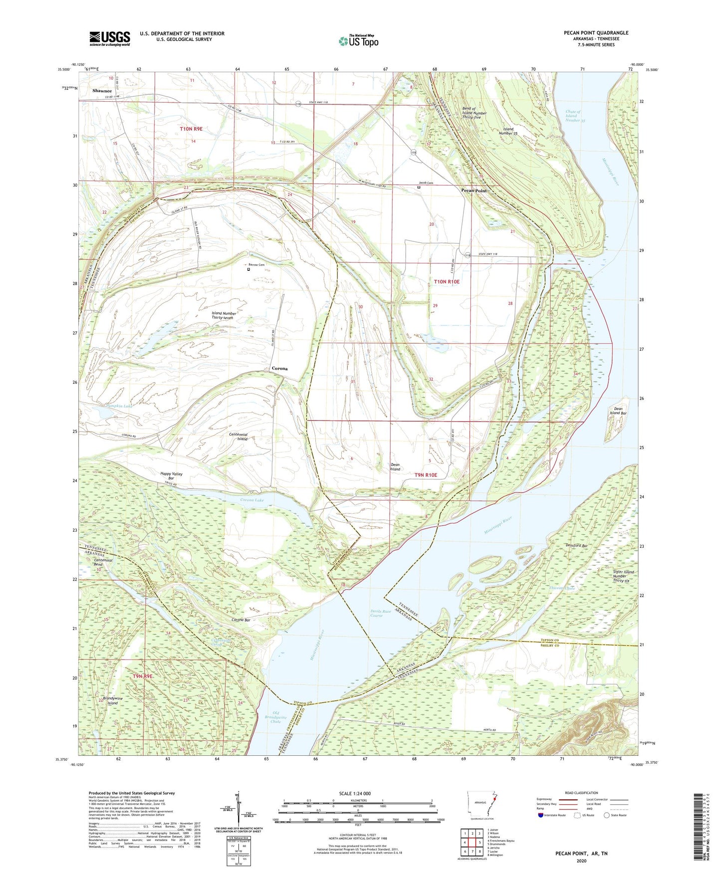
Pecan Point Arkansas US Topo Map
Couldn't load pickup availability
2024 topographic map quadrangle Pecan Point in the states of Tennessee, Arkansas. Scale: 1:24000. Based on the newly updated USGS 7.5' US Topo map series, this map is in the following counties: Mississippi, Tipton, Shelby, Crittenden. The map contains contour data, water features, and other items you are used to seeing on USGS maps, but also has updated roads and other features. This is the next generation of topographic maps. Printed on high-quality waterproof paper with UV fade-resistant inks.
Quads adjacent to this one:
West: Frenchmans Bayou
Northwest: Joiner
North: Wilson
Northeast: Nodena
East: Drummonds
Southeast: Millington
South: Locke
Southwest: Jericho
Contains the following named places: Andrews Landing, Barrow Cemetery, Bateman Landing, Bend of Island Number Thirty-five, Black Cat, Black Cat Landing, Brandywine Island, Centennial Cutoff, Chute of Island Number Thirty-five Revetment, Corona, Corona Bar, Corona Bar Dikes, Corona Lake, Dean Island, Dean Island Bar, Dean Island Landing, Dean Island Revetment, Deans Island, Densford Bar, Densford Dikes, Devils Race Course, Ditch Number 18, Ditch Number 19, Happy Valley Bar, Island Number Thirty-seven, Jacob Cemetery, Kingsland Landing, Molasses Point Landing, North Lake, Pecan Point, Pecan Point Landing, Pecan Point-Dean Island Dikes, Pumpkin Lake, Random Shot Landing, Saint Francis Levee, Shawnee, Sunrise Church, Thweatt Chute, Township of Pecan Point, Union Hill Church, Walts Landing