MyTopo
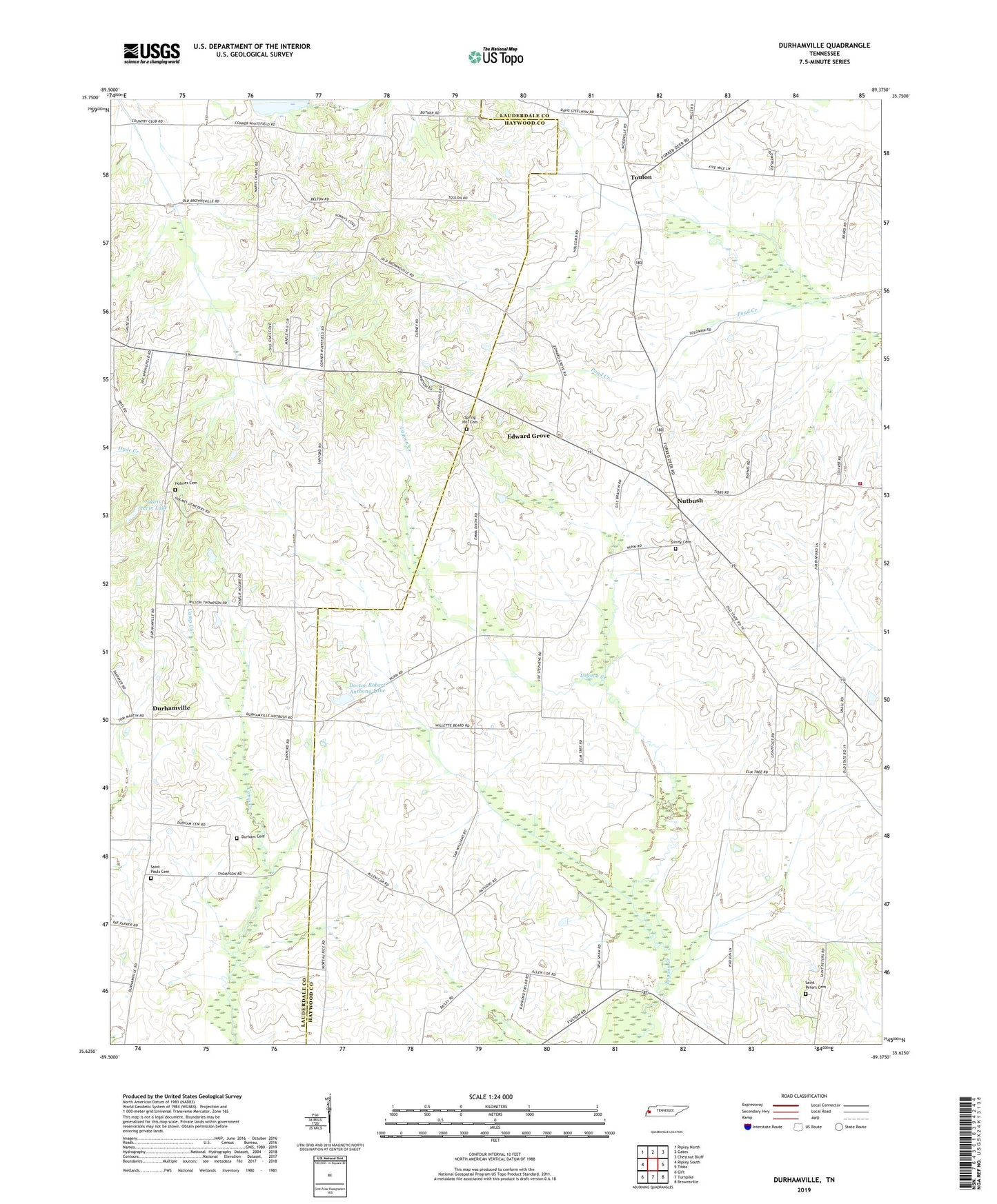
Durhamville Tennessee US Topo Map
Couldn't load pickup availability
2019 topographic map quadrangle Durhamville in the state of Tennessee. Scale: 1:24000. Based on the newly updated USGS 7.5' US Topo map series, this map is in the following counties: Haywood, Lauderdale. The map contains contour data, water features, and other items you are used to seeing on USGS maps, but also has updated roads and other features. This is the next generation of topographic maps. Printed on high-quality waterproof paper with UV fade-resistant inks.
Quads adjacent to this one:
West: Ripley South
Northwest: Ripley North
North: Gates
Northeast: Chestnut Bluff
East: Tibbs
Southeast: Brownsville
South: Turnpike
Southwest: Gift
Contains the following named places: Brownsville - Haywood County Fire Department District 9, Cane Creek Dam Number Fifteen, Cane Creek Lake Number Fifteen, Commissioner District 10, Commissioner District 2, Conner Church, Conners School, Cox Store, Currins School, Doctor Robert Anthony Dam, Doctor Robert Anthony Lake, Doris Irvin Dam, Doris Irvin Lake, Durham Cemetery, Durhamville, Durhamville Baptist Church, Durhamville School, Edward Grove, Edward Grove School, Elam Church, Flag Grove School, Greater Zion Church, Holmes Cemetery, Maranatha Church, Marys Chapel, Neboth Church, Nutbush, Nutbush Division, Nutbush Post Office, Nutbush School, Saint Luke Church, Saint Lukes School, Saint Pauls Cemetery, Saint Pauls Church, Saint Peters Cemetery, Spring Hill Cemetery, Spring Hill Church, Toulon, Toulon Post Office, Trinity Cemetery, Trinity Church