MyTopo
Tibbs Tennessee US Topo Map
Couldn't load pickup availability
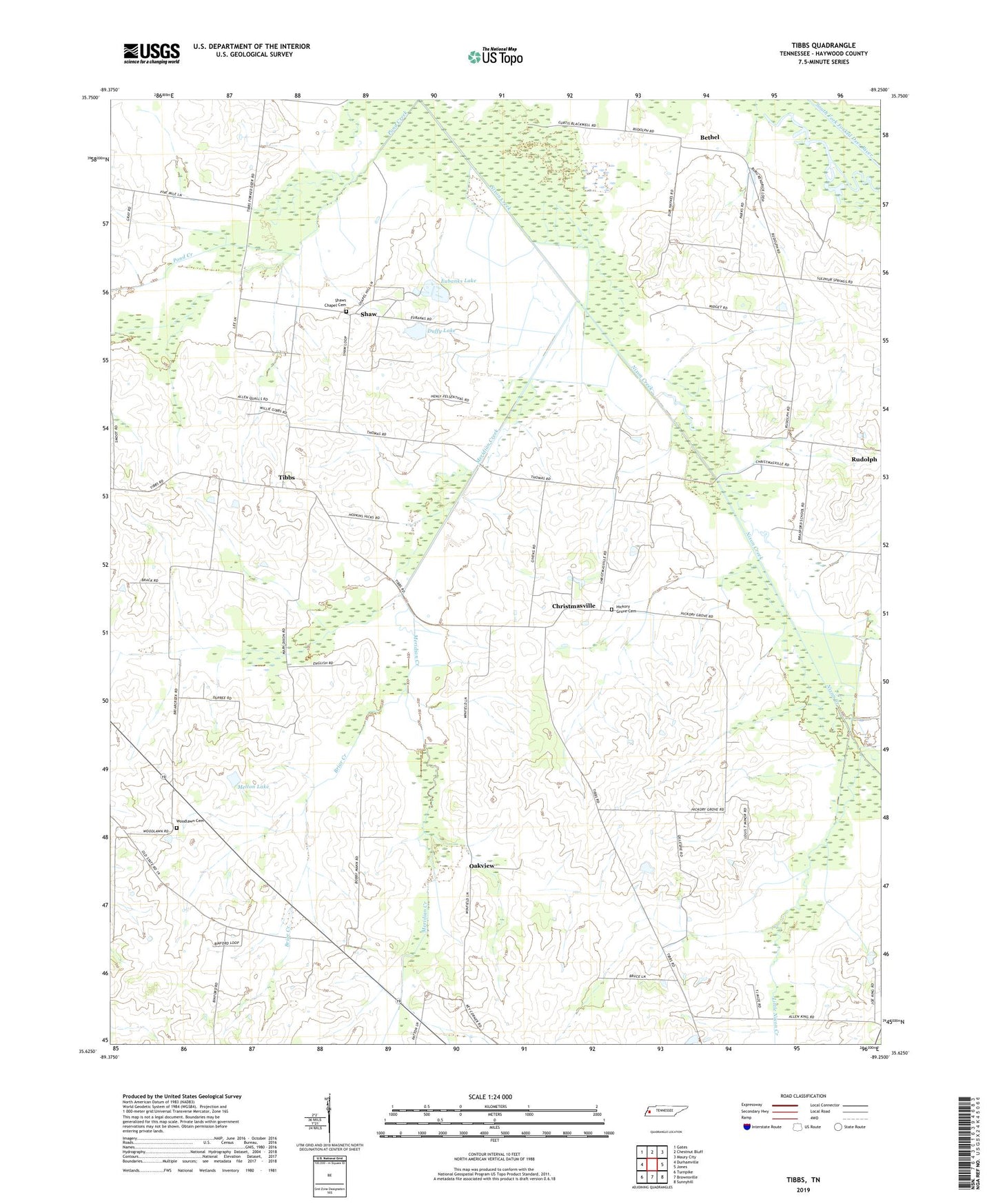
2022 topographic map quadrangle Tibbs in the state of Tennessee. Scale: 1:24000. Based on the newly updated USGS 7.5' US Topo map series, this map is in the following counties: Haywood. The map contains contour data, water features, and other items you are used to seeing on USGS maps, but also has updated roads and other features. This is the next generation of topographic maps. Printed on high-quality waterproof paper with UV fade-resistant inks.
Quads adjacent to this one:
West: Durhamville
Northwest: Gates
North: Chestnut Bluff
Northeast: Maury City
East: Jones
Southeast: Sunnyhill
South: Brownsville
Southwest: Turnpike
This map covers the same area as the classic USGS quad with code o35089f3.
Contains the following named places: Antioch Church, Bethel, Bethel Cemetery, Bethel School, Briar Creek, Cannon Lake, Chapel Hill School, Christmasville, Commissioner District 5, Duffy Lake, Duffy Lake Dam, Eubanks Dam, Eubanks Lake, Hickory Grove Cemetery, Hickory Grove Church, Hickory Grove School, Hughes Mill, Little Nixon Creek, Lone Oak School, Melton Dam, Melton Lake, Meridian Creek, Oakview, Oakview Church, Rudolph, Salem Church, Shaw, Shaws Chapel Baptist Church, Shaws Chapel Cemetery, Tibbs, Tibbs School, Travelers Rest School, Wiggins Dam, Wiggins Lake, Winfield School, Woodlawn Cemetery, Woodlawn Church, Woodlawn School