MyTopo
Ripley North Tennessee US Topo Map
Couldn't load pickup availability
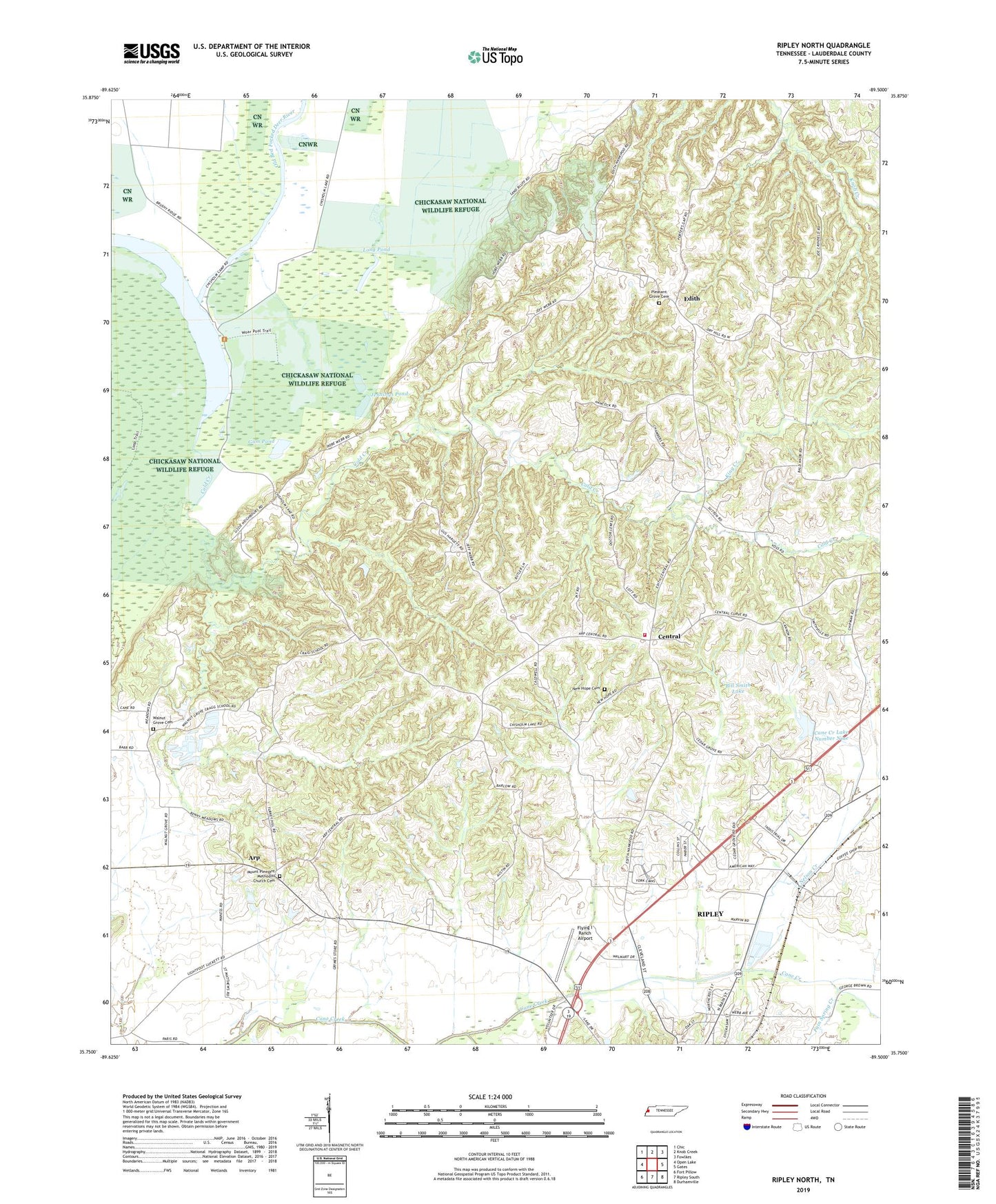
2022 topographic map quadrangle Ripley North in the state of Tennessee. Scale: 1:24000. Based on the newly updated USGS 7.5' US Topo map series, this map is in the following counties: Lauderdale. The map contains contour data, water features, and other items you are used to seeing on USGS maps, but also has updated roads and other features. This is the next generation of topographic maps. Printed on high-quality waterproof paper with UV fade-resistant inks.
Quads adjacent to this one:
West: Open Lake
Northwest: Chic
North: Knob Creek
Northeast: Fowlkes
East: Gates
Southeast: Durhamville
South: Ripley South
Southwest: Fort Pillow
This map covers the same area as the classic USGS quad with code o35089g5.
Contains the following named places: Arp, Arp School, Bill Smith Lake, Bill Smith Lake Dam, Cane Creek Dam Number Nine, Cane Creek Lake Number Nine, Cane Creek Number Five Dam, Cane Creek Number Five Lake, Central, Central Church, Central School, Chisholm Lake, Cold Creek, Edith, Edith School, Fain Spring Creek, Flying I Ranch Airport, Grace Church, Gray School, Gum Pond, Hyde Creek, Jennings Pond, King Creek, Lauderdale County Ambulance Authority, Long Pond, Macedonia Church, Matthews School, Mount Pleasant Church, Mount Pleasant Methodist Church Cemetery, Nelson Creek, New Hope Cemetery, New Hope Church, Northwest Lauderdale County Fire Department, Old Bed Forked Deer River, Pleasant Grove Cemetery, Ripley Church, Ripley Division, Saint Matthew Church, Separate Pond, Tennessee Department of Agriculture Division of Forestry Ripley Fire Tower, Walnut Grove Cemetery, Walnut Grove Church