MyTopo
Enville Tennessee US Topo Map
Couldn't load pickup availability
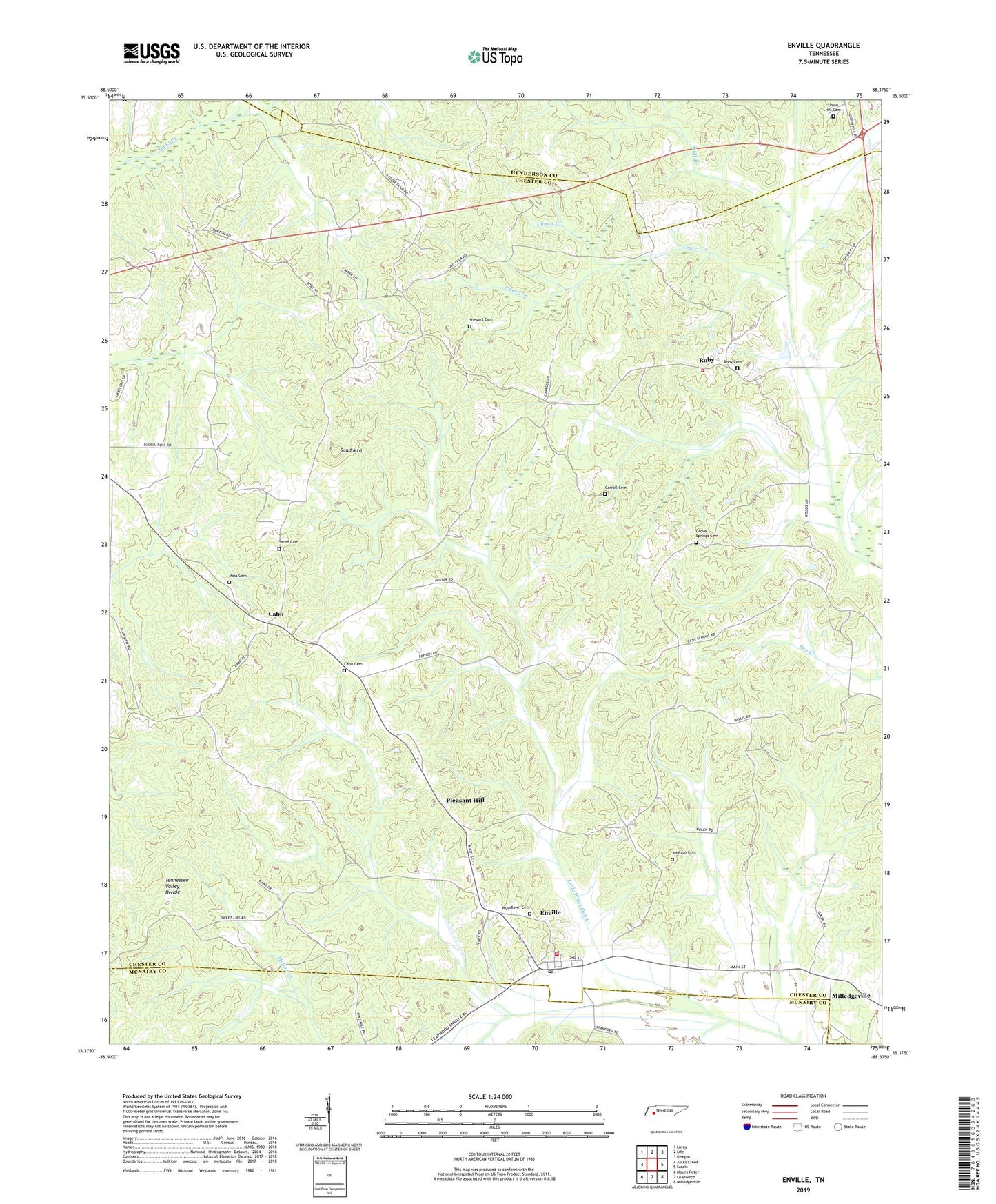
2022 topographic map quadrangle Enville in the state of Tennessee. Scale: 1:24000. Based on the newly updated USGS 7.5' US Topo map series, this map is in the following counties: Chester, Henderson, McNairy. The map contains contour data, water features, and other items you are used to seeing on USGS maps, but also has updated roads and other features. This is the next generation of topographic maps. Printed on high-quality waterproof paper with UV fade-resistant inks.
Quads adjacent to this one:
West: Jacks Creek
Northwest: Luray
North: Life
Northeast: Reagan
East: Sardis
Southeast: Milledgeville
South: Leapwood
Southwest: Mount Peter
This map covers the same area as the classic USGS quad with code o35088d4.
Contains the following named places: Bailey Chapel, Bishop School, Cabo, Cabo Cemetery, Cabo School, Carroll Cemetery, Cash School, Climer Creek, Commissioner District 1, Coon Creek, Criner Creek, Crossroads Church, Enville, Enville Church, Enville Post Office, Enville School, Enville Volunteer Fire Department, Goff Branch, Grove Springs Cemetery, Grove Springs Church, Jerusalem Church, Johnson Cemetery, Johnson Church, Little White Oak Creek, Lula, Moss Cemetery, OFDBA Spring Creek Site Number 105a-1 Dam, Pike School, Pine Springs School, Pleasant Hill, Pleasant Ridge Church, Roby, Roby Cemetery, Roby Church, Roby Community Volunteer Fire Department, Roby School, Sand Mountain, Shady Grove School, Shiloh Church, Smith Cemetery, Spring Creek Lake, Stewart Cemetery, Threemile Creek, Town of Enville, Union Hill Cemetery, Union Hill Church, Vernon Chapel, Woodlawn Cemetery, ZIP Codes: 38332, 38347