MyTopo
Life Tennessee US Topo Map
Couldn't load pickup availability
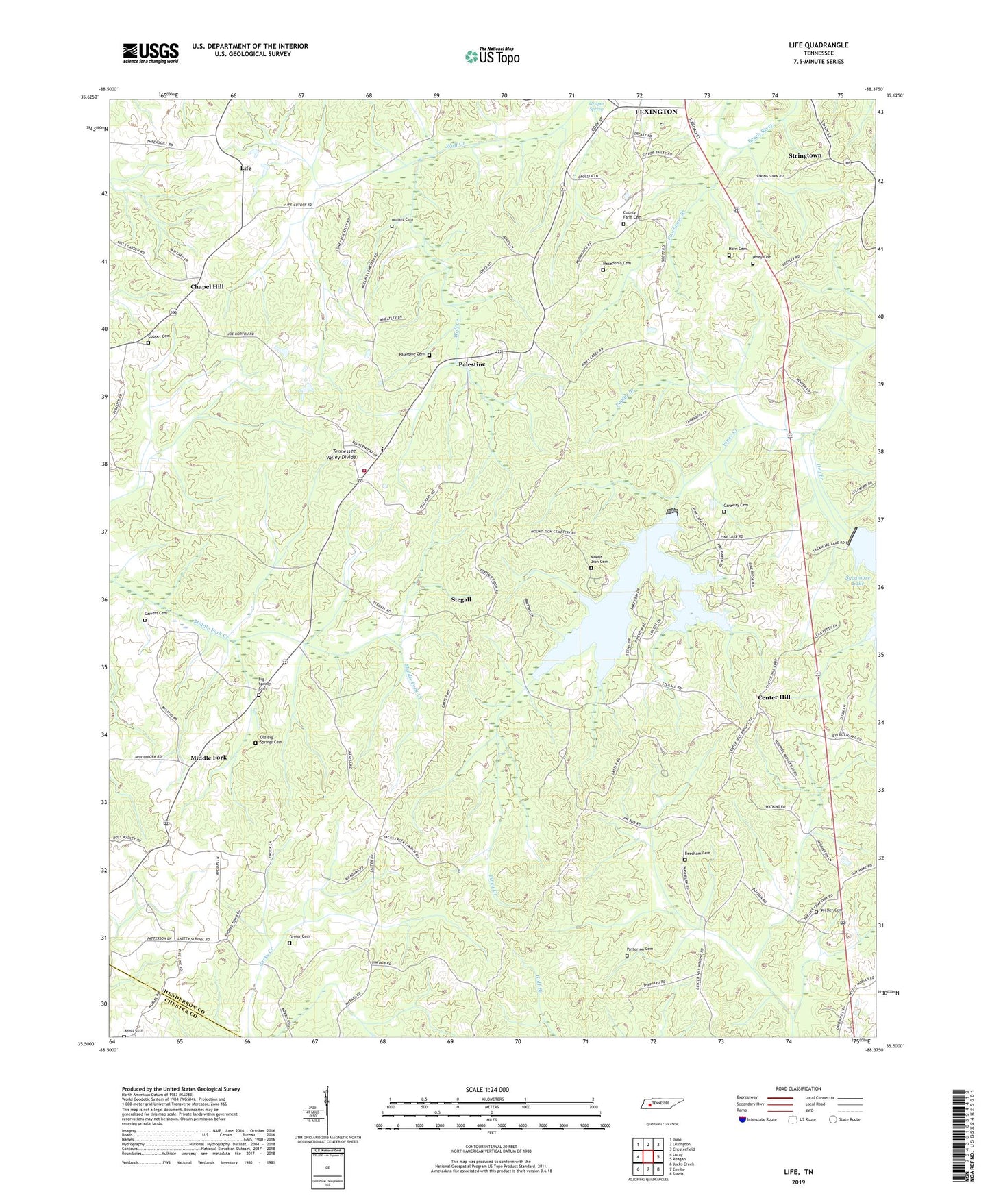
2022 topographic map quadrangle Life in the state of Tennessee. Scale: 1:24000. Based on the newly updated USGS 7.5' US Topo map series, this map is in the following counties: Henderson, Chester. The map contains contour data, water features, and other items you are used to seeing on USGS maps, but also has updated roads and other features. This is the next generation of topographic maps. Printed on high-quality waterproof paper with UV fade-resistant inks.
Quads adjacent to this one:
West: Luray
Northwest: Juno
North: Lexington
Northeast: Chesterfield
East: Reagan
Southeast: Sardis
South: Enville
Southwest: Jacks Creek
This map covers the same area as the classic USGS quad with code o35088e4.
Contains the following named places: Beecham Cemetery, Big Springs Cemetery, Big Springs Cumberland Presbyterian Church, Caraway Cemetery, Center Hill, Center Hill Baptist Church, Center Hill School, Chapel Hill, Chapel Hill Baptist Church, Chapel Hill School, Commissioner District 5, Cooper Cemetery, County Farm Cemetery, Dry Branch, Garrett Cemetery, Grider Cemetery, Henderson County Farm, Henderson County Fire Department Station 6, Horn Cemetery, Jacks Creek Church, Jones Cemetery, Laster School, Life, Life School, Macedonia Cemetery, Maple Grove Baptist Church, Maple Grove School, Middle Fork, Middlefork School, Mount Zion Cemetery, Mullins Cemetery, New Bethel Church, Old Big Springs Cemetery, Palestine, Palestine Cemetery, Palestine Cumberland Presbyterian Church, Palestine School, Patterson Cemetery, Pine Dam, Pine Lake, Piney Cemetery, Poorhouse Branch, Poplar Branch, Presler Cemetery, Presley School, Rhodes Town, Saints Chapel, Sheppard School, Sheppards Store, South Haven Elementary School, Stegall, Stringtown, Stringtown Church, Sycamore Dam, Thomas School