MyTopo
Milledgeville Tennessee US Topo Map
Couldn't load pickup availability
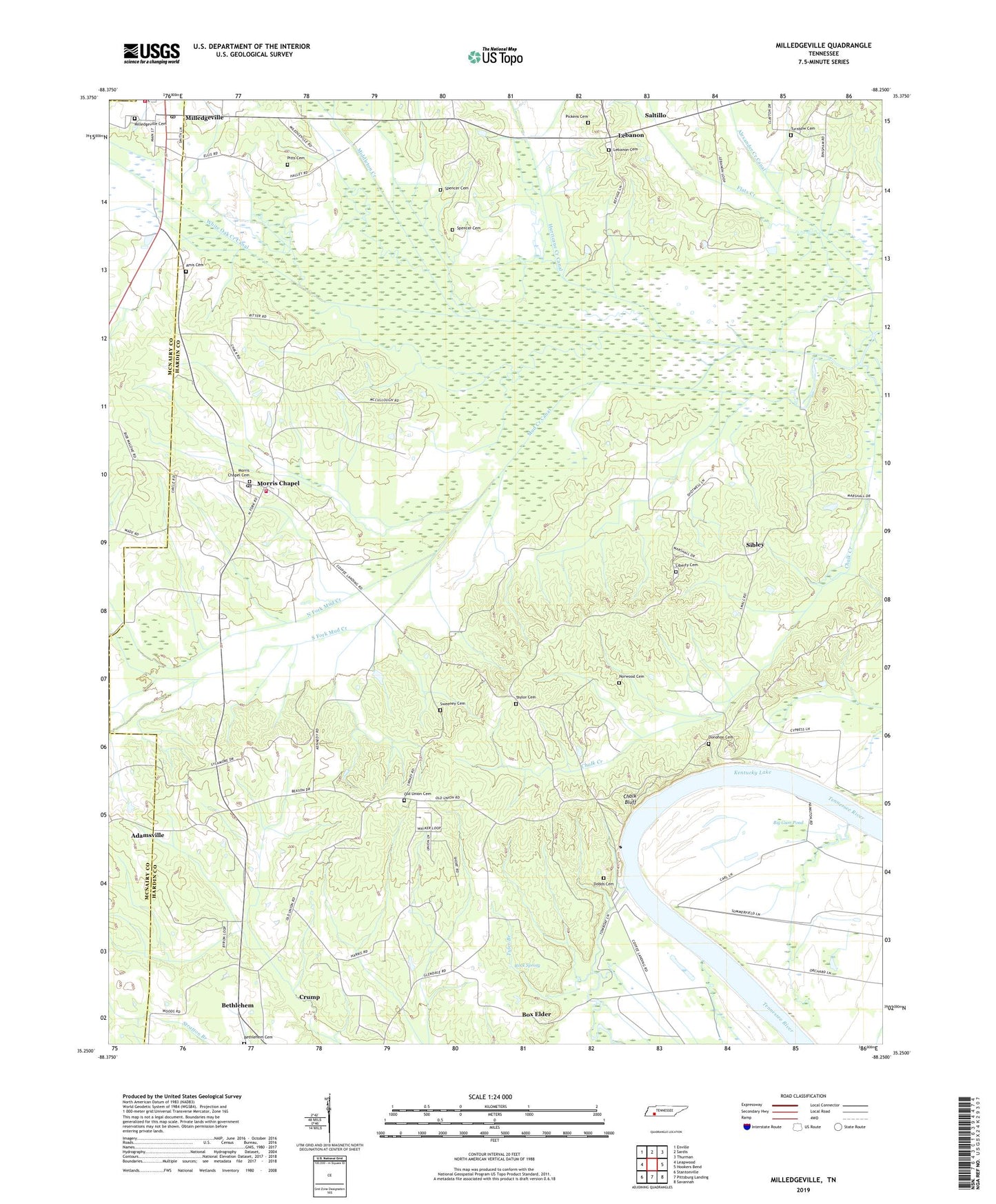
2022 topographic map quadrangle Milledgeville in the state of Tennessee. Scale: 1:24000. Based on the newly updated USGS 7.5' US Topo map series, this map is in the following counties: Hardin, McNairy, Chester. The map contains contour data, water features, and other items you are used to seeing on USGS maps, but also has updated roads and other features. This is the next generation of topographic maps. Printed on high-quality waterproof paper with UV fade-resistant inks.
Quads adjacent to this one:
West: Leapwood
Northwest: Enville
North: Sardis
Northeast: Thurman
East: Hookers Bend
Southeast: Savannah
South: Pittsburg Landing
Southwest: Stantonville
This map covers the same area as the classic USGS quad with code o35088c3.
Contains the following named places: Amis Cemetery, Armstrong Landing, Bailey Branch, Beason Creek, Bethlehem, Bethlehem Cemetery, Bethlehem School, Big Gum Pond, Bingham Creek, Bluff Landing, Box Elder, Chalk Bluff, Chalk Creek, Clayton Branch, Coffee Landing, Commissioner District 5, Crooked Creek, Davy Branch, District 12, District 16, Dodds Cemetery, Donohoo Cemetery, Edmonds Branch, Flats Creek, Hardin County Fire Department / Emergency Management District 2 North Station, Hardin Slough, Holley Creek, Hurricane Creek, Hurricane School, Lebanon, Lebanon Cemetery, Lebanon Methodist Church, Liberty Cemetery, Liberty Church, Liberty School, Middleton Creek, Milledgeville, Milledgeville Baptist Church, Milledgeville Cemetery, Milledgeville Post Office, Milledgeville Volunteer Fire Department, Morris Chapel, Morris Chapel Baptist Church, Morris Chapel Cemetery, Morris Chapel Census Designated Place, Morris Chapel Division, Morris Chapel Post Office, Morris Chapel School, Morris Chapel United Methodist Church, Mud Creek, Mud Creek Canal, Nelsons Ferry, New Zeal Church, North Fork Mud Creek, Norwood Cemetery, Old Union Cemetery, Old Union Church, Pickens Cemetery, Pisgah Church, Pitts Cemetery, Right, Rock Spring, Rock Spring School, Salt River, Short Branch, Sibley, South Fork Mud Creek, Spencer Cemetery, Sweeney Cemetery, Sycamore School, Taylor Cemetery, Turnbow Cemetery, Tyler Branch, White Oak Creek Canal, ZIP Codes: 38359, 38361