MyTopo
Gardner Tennessee US Topo Map
Couldn't load pickup availability
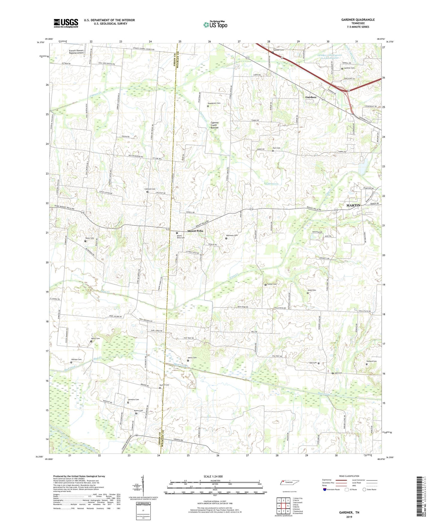
2022 topographic map quadrangle Gardner in the state of Tennessee. Scale: 1:24000. Based on the newly updated USGS 7.5' US Topo map series, this map is in the following counties: Weakley, Obion. The map contains contour data, water features, and other items you are used to seeing on USGS maps, but also has updated roads and other features. This is the next generation of topographic maps. Printed on high-quality waterproof paper with UV fade-resistant inks.
Quads adjacent to this one:
West: Rives
Northwest: Union City
North: Harris
Northeast: McConnell
East: Martin
Southeast: Greenfield
South: Rutherford
Southwest: Kenton
This map covers the same area as the classic USGS quad with code o36088c8.
Contains the following named places: Alamo Cemetery, Alamo Church, Alamo School, Beech Grove Church, Bethel Baptist Church, Callicott Cemetery, Cane Creek Church, Central, Collier Cemetery, Commissioner District 7, Cypress Creek Bottom, Cypress Creek Church, Dortch Cemetery, Gardner, Gardner Cemetery, Gardner School, Hall Cemetery, Harmony Church, Hazelwood School, Henry Cemetery, Holland Cemetery, Hurt Cemetery, Johnson Cemetery, Jones Cemetery, Limbs Store, McKinney Cemetery, Mount Pelia, Mount Pelia Cemetery, Mount Pelia High School, New Home Church, Northwestern Church, OFDBA Little Cypress Creek Lake Number, Shaddtown Cemetery, Simmons Cemetery, Stanleys Chapel, Stella Ruth Community Center, Stella Ruth School, Sunnyside School, Taylor Cemetery, ZIP Code: 38253