MyTopo
Kenton Tennessee US Topo Map
Couldn't load pickup availability
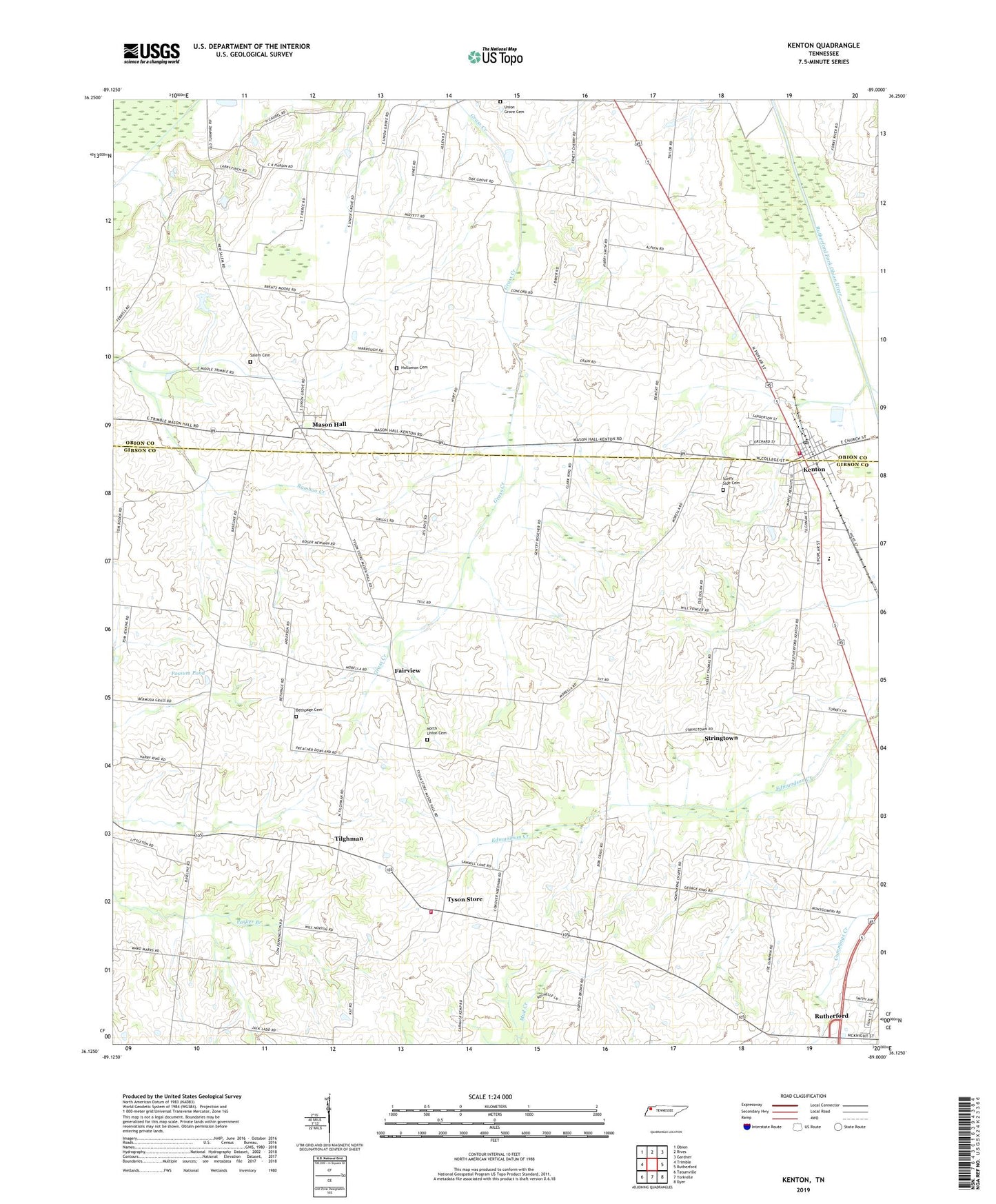
2022 topographic map quadrangle Kenton in the state of Tennessee. Scale: 1:24000. Based on the newly updated USGS 7.5' US Topo map series, this map is in the following counties: Gibson, Obion. The map contains contour data, water features, and other items you are used to seeing on USGS maps, but also has updated roads and other features. This is the next generation of topographic maps. Printed on high-quality waterproof paper with UV fade-resistant inks.
Quads adjacent to this one:
West: Trimble
Northwest: Obion
North: Rives
Northeast: Gardner
East: Rutherford
Southeast: Dyer
South: Yorkville
Southwest: Tatumville
This map covers the same area as the classic USGS quad with code o36089b1.
Contains the following named places: Bamboo Creek, Bear Creek, Bethpage Cemetery, Bethpage Church, Boyett School, Christian Chapel, District 10, District 24, District 9, Fairview, Fairview School, First Baptist Church of Kenton, Gibson County Fire and Rescue Tyson Community, Hollomon Cemetery, Kenton, Kenton City Hall, Kenton City Park, Kenton Elementary School, Kenton Fire Department, Kenton High School, Kenton Police Department, Kenton Post Office, Kenton-Mason Hall Division, Laneview Church, Mason Hall, Mason Hall School, Morella Church, Morella School, New Concord Church, New Salem Church, North Union Cemetery, North Union Church, Northern Church, Possum Pond, Rutherford Division, Salem Cemetery, Stringtown, Sunny Side Cemetery, Tilghman, Tilghmans School, Town of Kenton, Tyson Store, Tysonville, Union Grove Cemetery, Union Grove Church, ZIP Code: 38233