MyTopo
Gladeville Tennessee US Topo Map
Couldn't load pickup availability
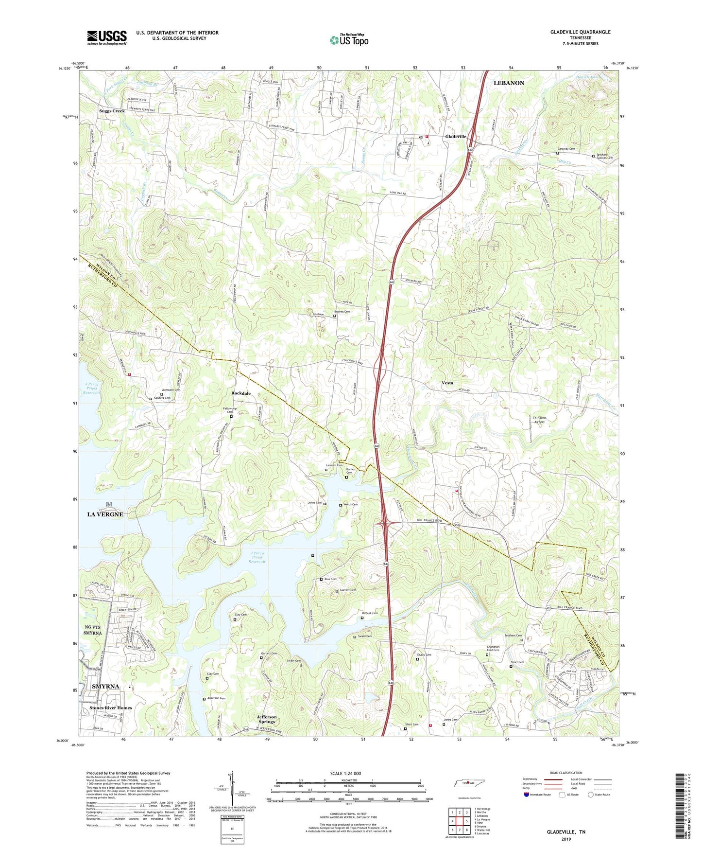
2022 topographic map quadrangle Gladeville in the state of Tennessee. Scale: 1:24000. Based on the newly updated USGS 7.5' US Topo map series, this map is in the following counties: Wilson, Rutherford. The map contains contour data, water features, and other items you are used to seeing on USGS maps, but also has updated roads and other features. This is the next generation of topographic maps. Printed on high-quality waterproof paper with UV fade-resistant inks.
Quads adjacent to this one:
West: La Vergne
Northwest: Hermitage
North: Martha
Northeast: Lebanon
East: Vine
Southeast: Lascassas
South: Walterhill
Southwest: Smyrna
This map covers the same area as the classic USGS quad with code o36086a4.
Contains the following named places: Adkerson Cemetery, Almaville Fire Department Station 3, Anthony Branch, Ashwood, Barber Cemetery, Brothers Cemetery, Browns Cemetery, Caraway Cemetery, Cedars Division, Cedars of Lebanon State Park, Charleton Ford Cemetery, Clay Cemetery, Coleman Elementary School, Commissioner District 13, Corinth Branch, Daniels Lake, Dry Creek, EAdes Cemetery, Fall Creek, Fall Creek Recreation Area, Fate Sanders Boat Dock, Fate Sanders Recreation Area, Fellowship Cemetery, Fellowship Church, Garrett Cemetery, Gladeville, Gladeville Census Designated Place, Gladeville Elementary School, Gladeville Post Office, Hamilton Chapel, Harbor Isles, Hurricane Creek, Jefferson Springs, Jefferson Springs Recreation Area, Johns Cemetery, Jones Cemetery, Lamar Hill Access Area, Lannom Cemetery, Livenston Cemetery, McPeak Cemetery, Murphree, Nashs Ford, Nashville Superspeedway Fire Station, North Fork Suggs Creek, Patterson Cemetery, Powells Chapel, Rockdale, Rockdale School, Ross Cemetery, Rural Hill, Russell Cemetery, Sanders Cemetery, Short Cemetery, Sinking Creek, Smyrna Vocational Rehabilitation Center, Sneed Cemetery, Spickard - Sullivan Cemetery, Spring Creek, Spring Creek School, Stewart Creek, Stewart Creek Boat Ramp, Stones River Homes, Suggs Creek, Suggs Creek Presbyterian Church, Swain Cemetery, TK Farms Airport, Tucker Cemetery, Vesta, Walter Hill Volunteer Fire Department Station 3, Weakley Hills, Welch Cemetery, Wesley Chapel, Wilson Emergency Management Agency Station 5 Gladeville, Wilson Line Church, WKOS-FM (Murfreesboro), WYHY-FM (Lebanon)