MyTopo
Richardson Cove Tennessee US Topo Map
Couldn't load pickup availability
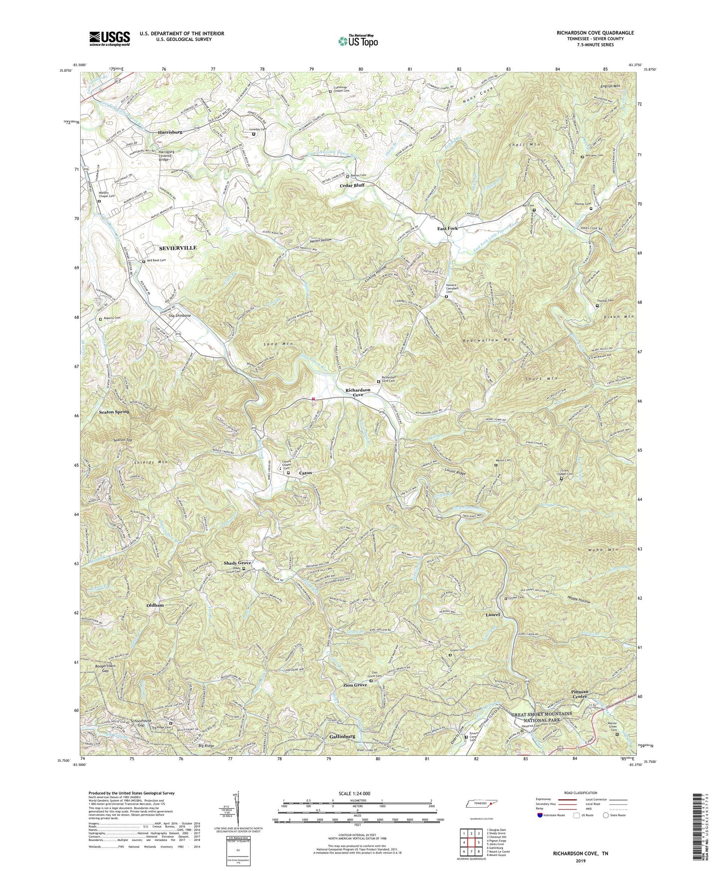
2022 topographic map quadrangle Richardson Cove in the state of Tennessee. Scale: 1:24000. Based on the newly updated USGS 7.5' US Topo map series, this map is in the following counties: Sevier. The map contains contour data, water features, and other items you are used to seeing on USGS maps, but also has updated roads and other features. This is the next generation of topographic maps. Printed on high-quality waterproof paper with UV fade-resistant inks.
Quads adjacent to this one:
West: Pigeon Forge
Northwest: Douglas Dam
North: Shady Grove
Northeast: Chestnut Hill
East: Jones Cove
Southeast: Mount Guyot
South: Mount Le Conte
Southwest: Gatlinburg
This map covers the same area as the classic USGS quad with code o35083g4.
Contains the following named places: Atchley Branch, Ball Cemetery, Bearwallow Mountain, Bethany Church, Bethel Baptist Church, Bethel Cemetery, Big Ridge Cemetery, Big Ridge School, Bird Creek, Boogertown Gap, Breeden Branch, Brown Mare Branch, Campbell Branch, Canupp Branch, Caton, Caton Church, Catons Chapel - Richardson Cove Volunteer Fire Department, Catons Chapel Cemetery, Catons Chapel Elementary School, Cedar Bluff, Cedar Bluff School, Cedar Bluff United Methodist Church, Clark Branch, Cloverfield Branch, Commissioner District 1, Copeland Creek, Cowden Hollow, Crockettsville, Crockettsville School, Cummings Chapel Cemetery, Cummings Church, Dixon Branch, Dugan Branch, Dunn Creek, Dunn Creek Division, East Fork, East Fork Mine, East Prong Bird Creek, Emerts Cove, Emerts Cove Cemetery, Evans Chapel, Evans Chapel Cemetery, Evans Chapel School, Fern Branch, Flat Branch, Grassy Branch, Grassy Branch Cemetery, Green Cemetery, Griffin Branch, Happy Hollow, Harbin Hollow, Harrisburg, Harrisburg Covered Bridge, Harrisburg School, Headrick Cemetery, Henry Branch, Howard - Campbell Cemetery, Johnson Branch, Kear - Loveday Cemetery, Lane Hollow Branch, Laurel, Laurel Branch, Laurel Branch Baptist Church, Laurel School, Licklog Hollow, Lindsey Creek, Locust Ridge, Lone Branch, Long Branch, Long Ford, Maple Branch, Maple Branch School, Maples Branch Baptist Church, Marion Green Cemetery, Martin Justus Cemetery, Mill Branch, Mize Branch, Murphy Chapel, Murphy Chapel Cemetery, Nuns Cove, Obes Branch, Oldham, Oldham Creek, Oldhams Creek Baptist Church, Oldhams Creek School, Pittman Center, Pittman Center Elementary School, Powdermill Creek, Red Bank Cemetery, Red Bank Church, Richardson Cove, Richardson Cove Cemetery, Richardsons Cove Baptist Church, Richardsons Cove School, Roberts Cemetery, Roberts School, Roberts United Methodist Church, Sand Mountain, Schoolhouse Gap, Seaton Spring, Seaton Top, Sevier County Highway Department Quarry, Shady Baptist Church, Shady Grove, Shady Grove Cemetery, Shady School, Sharp Branch, Shell Mountain, Shields Mountain, Short Mountain, Sloan Branch, Smoky Mountain Academy, Soak Ash Creek, Splitwood Branch, Swader Hollow, Tattle Branch, The Shinbone, Thomas Cemetery, Town of Pittman Center, Turkeypen Branch, Tyrant Branch, Webb Creek, West Prong Bird Creek, Wilhite Creek, Williams Cemetery, Williams Fall Church, Wilson Branch, WMYU-FM (Sevierville), Zion Grove, Zion Grove Cemetery, Zion Grove Church, ZIP Code: 37876


