MyTopo
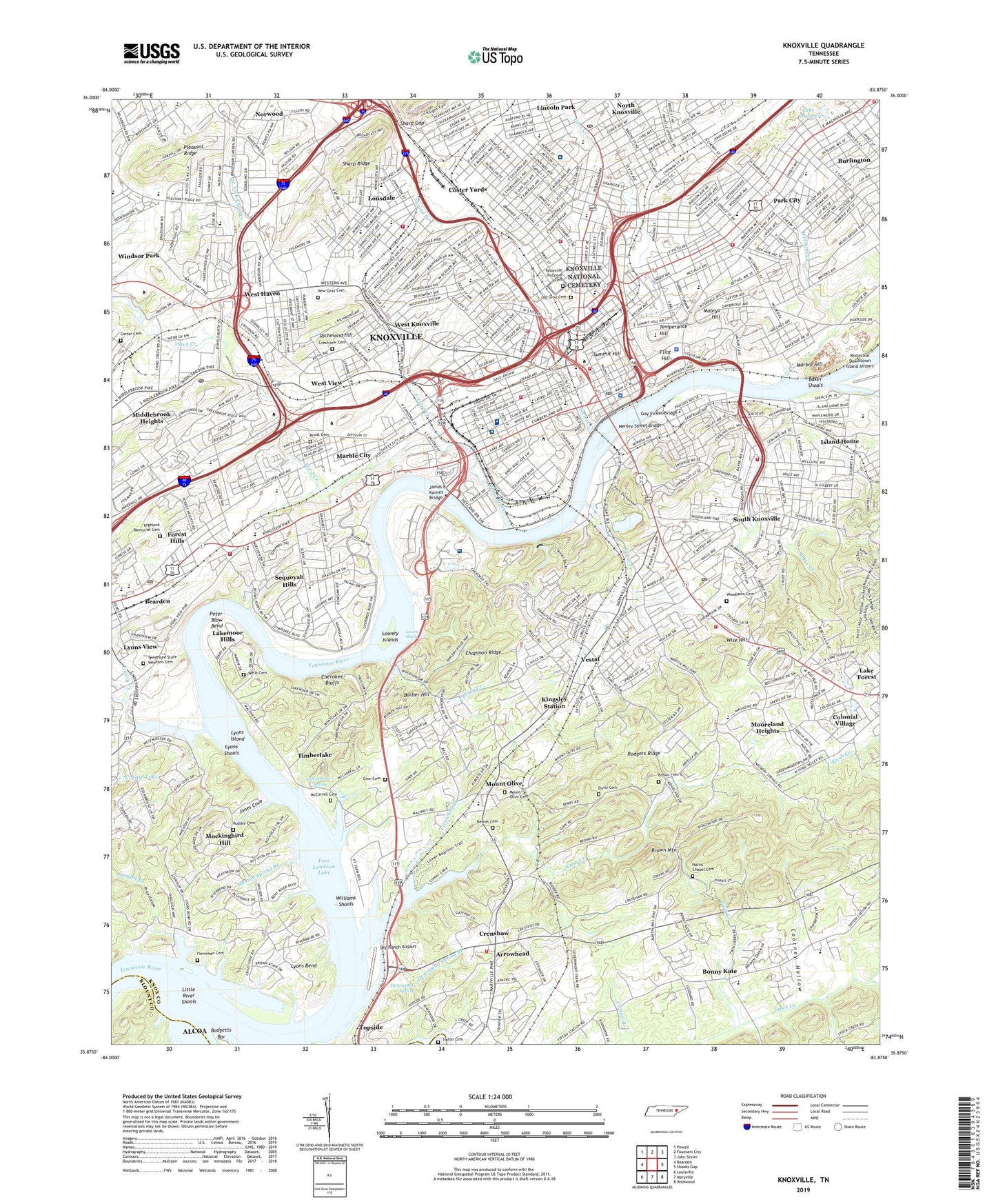
Knoxville Tennessee US Topo Map
Couldn't load pickup availability
2022 topographic map quadrangle Knoxville in the state of Tennessee. Scale: 1:24000. Based on the newly updated USGS 7.5' US Topo map series, this map is in the following counties: Knox, Blount. The map contains contour data, water features, and other items you are used to seeing on USGS maps, but also has updated roads and other features. This is the next generation of topographic maps. Printed on high-quality waterproof paper with UV fade-resistant inks.
Quads adjacent to this one:
West: Bearden
Northwest: Powell
North: Fountain City
Northeast: John Sevier
East: Shooks Gap
Southeast: Wildwood
South: Maryville
Southwest: Louisville
This map covers the same area as the classic USGS quad with code o35083h8.
Contains the following named places: Arrowhead, Austin - East Magnet High School, Austin High School, Badger Field, Badgetts Bar, Baker Creek, Baker Shoals, Baptist Hospital of East Tennessee, Barber Hill, Bartletts Fort, Battery Billingsley, Battery Clifton Lee, Battery Fearns, Battery Galpin, Battery Noble, Battery Stearman, Battery Wiltsie, Battery Zoellner, Bearden Elementary School, Bearden Middle School, Bethel Cemetery, Bicentennial Park, Bonny Kate, Brown Cemetery V, Burlington, Cal Johnson Park, Carter Cemetery, Caswell Park, Causier School, Chapman Highway Shopping Center, Chapman Ridge, Cherokee Bluffs, Cherokee Golf and Country Club, Chilhowee Park, Christenberry Junior High School, City of Knoxville, Clinch Avenue Park, Coatney Hollow, Colonial Village, Colony Park Airport, Commissioner District 1, Coster Yards, Crenshaw, Crestview Cemetery, Crystal Lake, Davis Cemetery, DeArmond Spring, DeArmond Spring Branch, Deep Creek, Doyle Middle School, Duncan Branch, Duncan Dock, East Tennessee Childrens Hospital, East Third Creek, First Creek, First Lutheran School, Flenniken Branch, Flenniken Cemetery, Flenniken Elementary School, Flint Hill, Forest Hills, Fort Byington, Fort Comstock, Fort Dickerson, Fort Dickerson Park, Fort Higley, Fort Hill, Fort Huntington Smith, Fort Sanders, Fort Sanders Regional Medical Center, Fort Stanley, Fourth Creek, Fulton High School, Galbraith School, Gay Street Bridge, Ginn Cemetery, Goose Creek, Hampden Sidney Academy, Harris Chapel Cemetery, Henley Street Bridge, Henson Spring Branch, Highland Memorial Cemetery, Hillvale Country Club, I.C. King Park, Island Home, James E Karnes Bridge, John Tarleton Institute, Jones Cove, Kerns Quarry, Kingsley Station, Kingston Pike Shopping Center, Knob Creek, Knott Cemetery, Knox County, Knox County Health Center, Knox Plaza Shopping Center, Knoxville, Knoxville - Kuwahee Sewage Treatment Plant, Knoxville Catholic High School, Knoxville College, Knoxville Division, Knoxville Municipal Stadium, Knoxville National Cemetery, Knoxville News-Sentinel Airport, Knoxville Zoological Park, L N Station, Lake Ottosee, Lakemoor Hills, Lakeshore Mental Health Institute, Leslie Street Park, Lincoln Park, Lindsey Nelson Stadium, Little River, Little River Islands, Little River Shoals, Lonsdale, Lonsdale Elementary School, Lonsdale Park, Looney Islands, Looney Shoals, Lyons Bend, Lyons Island, Lyons Mill, Lyons Shoals, Lyons View, Lyons View School, Mabrys Hill, Malcom Martin Park, Marble City, Marble Hill, Marble Springs, Mark James Park, Market Square, Mary Vestal Park, Maxey Dock, Maynard Glen Park, McCarrell Cemetery, McCarrell Spring, McMillan School, McMullen Quarry, Middlebrook Heights, Mockingbird Hill, Mooreland Heights, Morningside Park, Mount Olive, Mount Olive Cemetery, Mount Olive Elementary School, Mountain View School, New Gray Cemetery, Neyland Stadium, Northwest Junior High School, Old Gray Cemetery, Old Water Mill, Park City, Park City Lowry School, Park Junior High School, Parkway Shopping Center, Peter Blow Bend, Physicians Regional Medical Center, Pleasant Ridge, Price Hollow, Richmond Hill, Riverbend, Rock City Park, Rodgers Ridge, Rudder Cemetery, Rule High School, Sam E Hill School, Second Creek, Select Specialty Hospital - Knoxville, Sequoyah Hills, Sequoyah Park, Sharp Gap, Shields-Watkins Field, Sky Ranch Airport, South Doyle High School, South Doyle Middle School, South Junior High School, South Knoxville, South Knoxville Optimist Park, South Knoxville Quarry, Southbrook, Southern Station, Spring Creek, Spur Trailer Park, Stock Creek, Summit Hill, Temperance Hill, Tennessee Amphitheater, Tennessee School for the Deaf, Tennessee State Veterans Cemetery, The University of Tennessee Medical Center, Third Creek, Timberlake, Tipton Cemetery, Topside, Twin Creek, Tyson Junior High School, Tyson Park, U T Department of Agriculture, University of Tennessee, University of Tennessee Experimental Farm, University of Tennessee Hospital Airport, Vestal, Vestal School, Village Square Shopping Center, Vine Junior High School, Wells Cemetery, Welwyn, West Fork Third Creek, West Haven, West Haven Shopping Center, West High School, West Knoxville, West View, Western Plaza Shopping Center, Westminister Ridge, Williams Creek, Williams Island, Williams Shoals, Wilson Castle Park, WIMZ-AM (Knoxville), Wise Hill, WITA-AM (Knoxville), WKCS-FM (Knoxville), WKGN-AM (Knoxville), WKXV-AM (Knoxville), Woodlawn Cemetery, WSKT-AM (Knoxville), WUOT-FM (Knoxville), WUTK-FM (Knoxville), Young High School, ZIP Codes: 37902, 37915, 37916


