MyTopo
Lowryville Tennessee US Topo Map
Couldn't load pickup availability
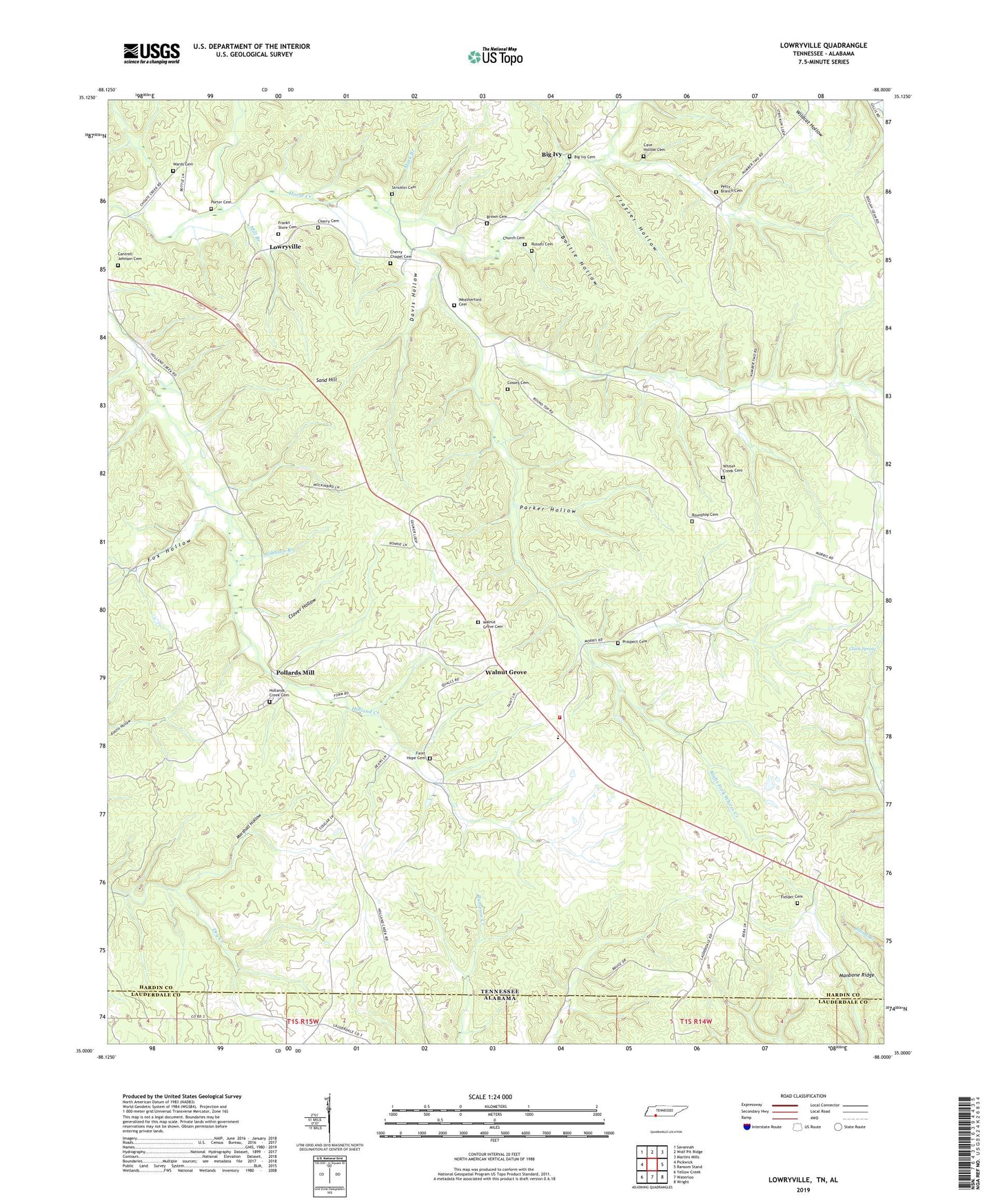
2022 topographic map quadrangle Lowryville in the states of Tennessee, Alabama. Scale: 1:24000. Based on the newly updated USGS 7.5' US Topo map series, this map is in the following counties: Hardin, Lauderdale. The map contains contour data, water features, and other items you are used to seeing on USGS maps, but also has updated roads and other features. This is the next generation of topographic maps. Printed on high-quality waterproof paper with UV fade-resistant inks.
Quads adjacent to this one:
West: Pickwick
Northwest: Savannah
North: Wolf Pit Ridge
Northeast: Martins Mills
East: Ransom Stand
Southeast: Wright
South: Waterloo
Southwest: Yellow Creek
This map covers the same area as the classic USGS quad with code o35088a1.
Contains the following named places: Barrier School, Big Ivy, Big Ivy Cemetery, Boltie Hollow, Brown Cemetery, Cantrell-Johnson Cemetery, Cave Hollow Cemetery, Cherry Cemetery, Cherry Chapel, Cherry Chapel Cemetery, Cherry School, Church Cemetery, Clack Spring, Clay Branch, Clover Hollow, Commissioner District 7, Cossey Cemetery, Davis Hollow, Dean Branch, District 7, Duke School, Duncan Chapel, Duncans Chapel School, Faint Hope Cemetery, Fielder Cemetery, Forest Ridge Union Church, Fox Hollow, Franks Store Cemetery, Frazier Hollow, Hardin County Fire Department / Emergency Management District 11 Station 1, Harrison Branch, Holland Creek School, Hollands Creek Cemetery, Holly Branch, Johnson Branch, Jones Store, Left Fork Whites Creek, Lower Church, Lowryville, Marshall Hollow, Math Branch, Meetinghouse Branch, Mill Branch, Parker Hollow, Petty Branch, Petty Branch Cemetery, Pollards Mill, Porter Cemetery, Prospect Cemetery, Right Fork Whites Creek, Rogers Creek, Roundtop Cemetery, Roundtop Church, Russell Cemetery, Sand Hill, Still Branch, Stricklin Cemetery, Upper Holland Creek Church, Walnut Grove, Walnut Grove Cemetery, Walnut Grove Census Designated Place, Walnut Grove Church, Walnut Grove Elementary School, Wards Cemetery, Wards Church, Wards School, Weatherford Cemetery, Whites Creek, Whites Creek Cemetery, Whites Creek Church, Whites Creek School