MyTopo
Hornbeak Tennessee US Topo Map
Couldn't load pickup availability
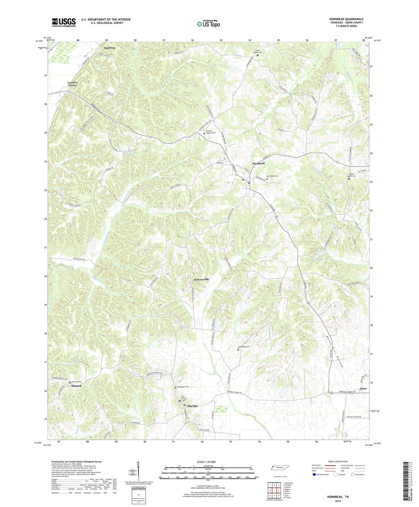
2022 topographic map quadrangle Hornbeak in the state of Tennessee. Scale: 1:24000. Based on the newly updated USGS 7.5' US Topo map series, this map is in the following counties: Obion. The map contains contour data, water features, and other items you are used to seeing on USGS maps, but also has updated roads and other features. This is the next generation of topographic maps. Printed on high-quality waterproof paper with UV fade-resistant inks.
Quads adjacent to this one:
West: Ridgely
Northwest: Tiptonville
North: Samburg
Northeast: Clayton
East: Obion
Southeast: Trimble
South: Lane
Southwest: Miston
This map covers the same area as the classic USGS quad with code o36089c3.
Contains the following named places: Antioch Baptist Cemetery, Antioch Baptist Church, Atkins Creek, Bethel, Bethel Church, Burnt Mill Hollow, Cobbs Chapel, Cobbs Chapel Cemetery, Commissioner District 5, Elbridge, Elbridge Post Office, Elbridge-Cloverdale Division, Glady Hollow, Glady Hollow 41-1 Dam, Glady Hollow 41-1 Lake, Glady School, Glass, Glass Church of Christ, Graves Chapel, Hornbeak, Hornbeak Cemetery, Hornbeak Post Office, Hornbeak School, Hornbeak Volunteer Fire Department, Jacksonville, Jones Branch, Kendall Creek, L E Dellinger Dam, L E Dellinger Lake, Lassiter Corner, Luker Dam, Luker Lake, Minnick, Minnick Cemetery, New Chapel, New Chapel Cemetery, North Branch Pawpaw Creek, Oak Ridge Cemetery, Oak Ridge Church, Oakridge School, Obion Chapel, Obion Chapel Cemetery, Obion Chapel School, Robinson Creek, South Branch Pawpaw Creek, Thompson Cemetery, Town of Hornbeak, Turnage School, ZIP Codes: 38232, 38254