MyTopo
Monterey Lake Tennessee US Topo Map
Couldn't load pickup availability
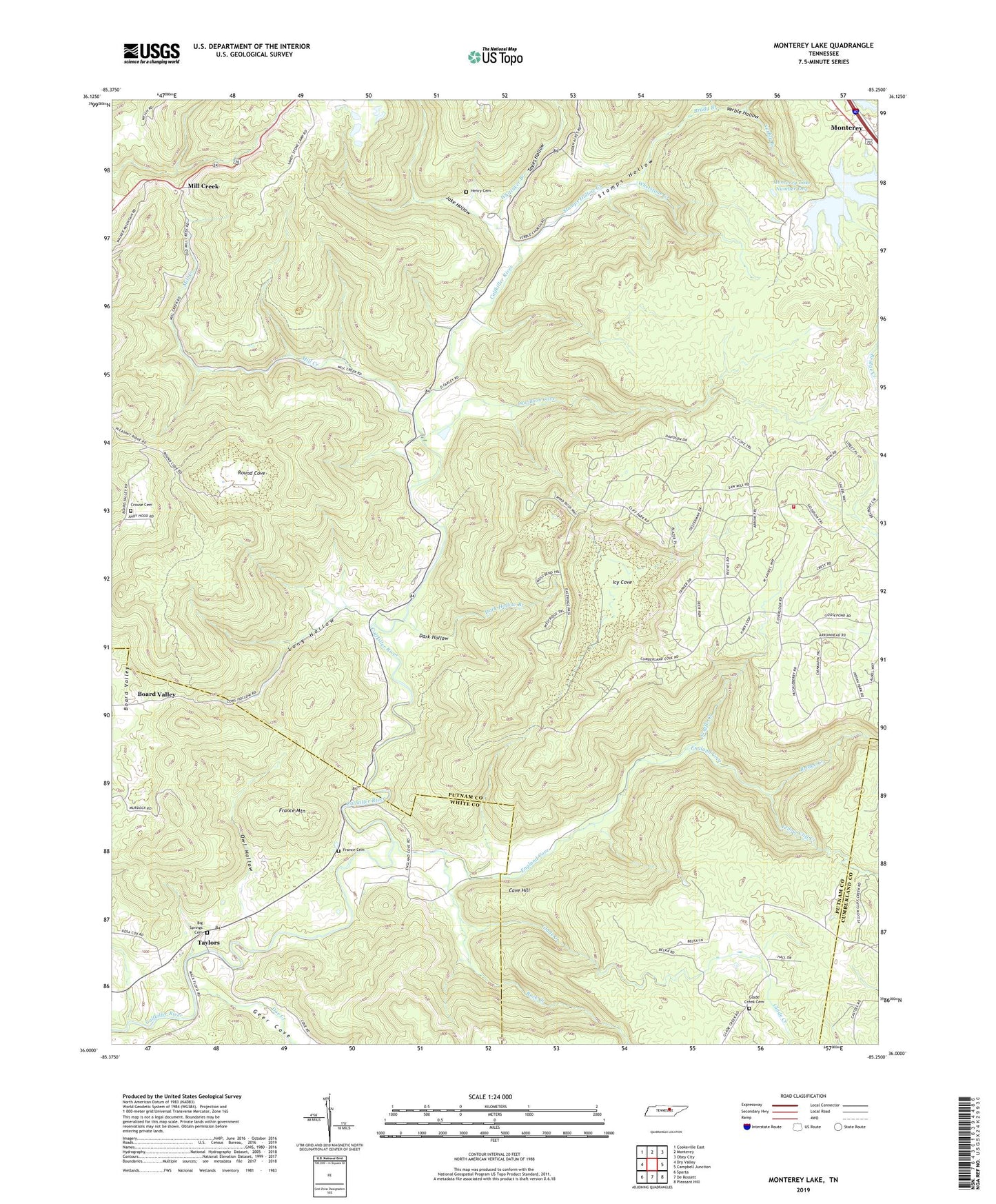
2019 topographic map quadrangle Monterey Lake in the state of Tennessee. Scale: 1:24000. Based on the newly updated USGS 7.5' US Topo map series, this map is in the following counties: Putnam, White, Cumberland. The map contains contour data, water features, and other items you are used to seeing on USGS maps, but also has updated roads and other features. This is the next generation of topographic maps. Printed on high-quality waterproof paper with UV fade-resistant inks.
Quads adjacent to this one:
West: Dry Valley
Northwest: Cookeville East
North: Monterey
Northeast: Obey City
East: Campbell Junction
Southeast: Pleasant Hill
South: De Rossett
Southwest: Sparta
Contains the following named places: Big Spring Church, Big Spring School, Big Springs Cemetery, Board Valley, Brady Branch, Bridge Creek, Buck Creek, Calfkiller, Calfkiller School, Camp Monterey, Cave Hill, Commissioner District 4, Crouse Cemetery, Dark Hollow, Dark Hollow Branch, Davidson Cove, Davidson Cove Branch, Doe Creek, Dug Hill, England Cove, Farley Seminary, Foot, France Cemetery, France Mountain, Geer Cove, Glade Creek, Glade Creek Cemetery, Glade Creek School, Henry Cemetery, Icy Cove, Jake Hollow, Johnson Church, Long Hollow, Mill Creek, Mill Creek Church, Monterey Lake, Monterey Lake Dam Number One, Monterey Lake Dam Number Two, Monterey Lake Number One, Monterey Lake Number Two, Owl Hollow, Putnam County Fire Department Station 23, Robinson School, Round Cove, Scuffle Creek, Stamps Hollow, Stamps Hollow Creek, Tayes Hollow, Taylors, Verble, Verble Branch, Verble Church, Verble Hollow, Whetstone Creek, Whittaker Branch, Yellow Cliff Creek