MyTopo
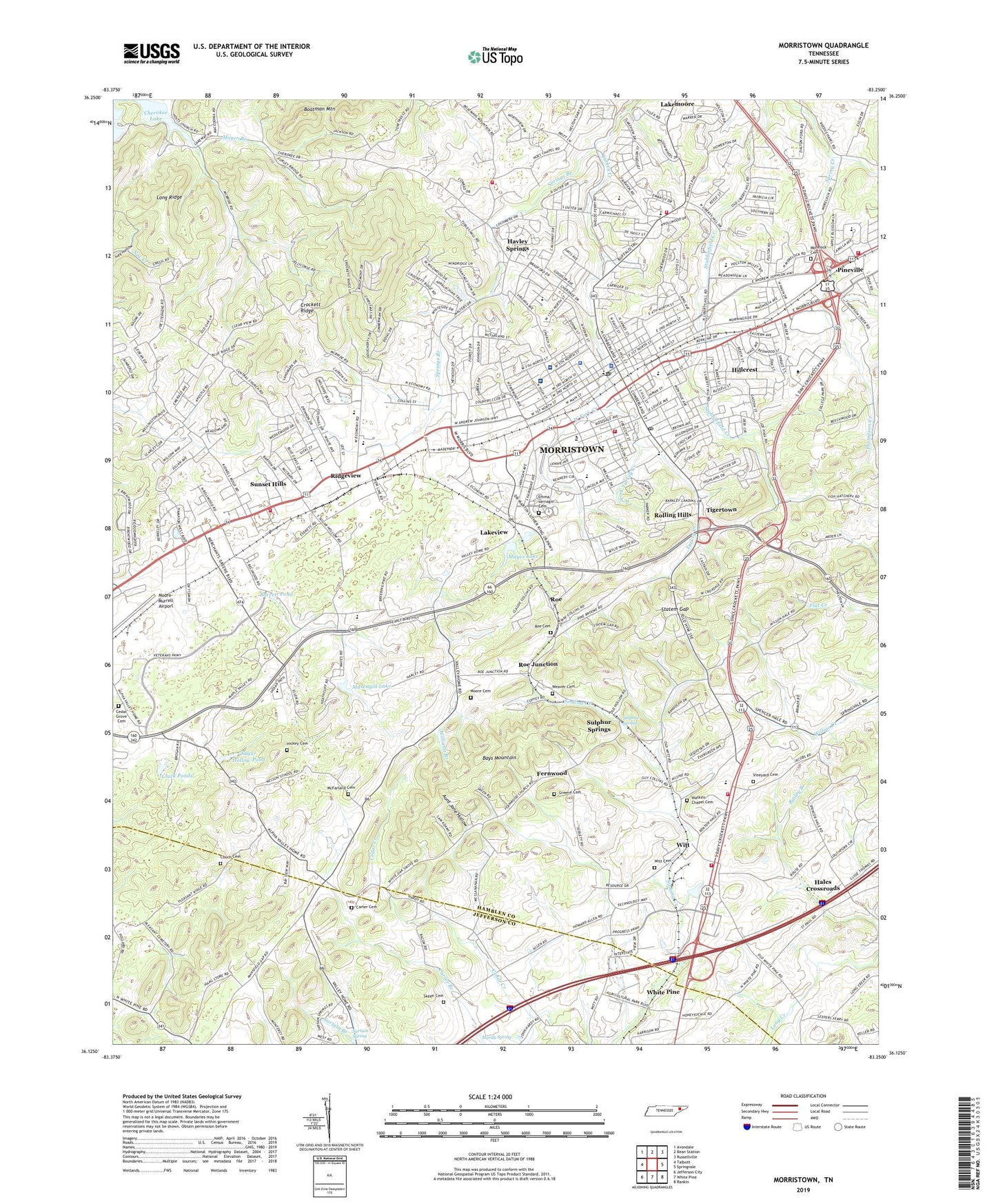
Morristown Tennessee US Topo Map
Couldn't load pickup availability
2022 topographic map quadrangle Morristown in the state of Tennessee. Scale: 1:24000. Based on the newly updated USGS 7.5' US Topo map series, this map is in the following counties: Hamblen, Jefferson. The map contains contour data, water features, and other items you are used to seeing on USGS maps, but also has updated roads and other features. This is the next generation of topographic maps. Printed on high-quality waterproof paper with UV fade-resistant inks.
Quads adjacent to this one:
West: Talbott
Northwest: Avondale
North: Bean Station
Northeast: Russellville
East: Springvale
Southeast: Rankin
South: White Pine
Southwest: Jefferson City
This map covers the same area as the classic USGS quad with code o36083b3.
Contains the following named places: All Saints Episcopal Church, Aunt Jane Hollow, Barrett Pond, Barron Park, Bell Quarry, Bethel United Methodist Church, Brentwood, Bridle Path Farms, Buffalo Trail, Buffalo Trail Church, Buffalo Trail Shopping Center, Calvary Baptist Church, Campbell Acres, Carter Acres, Carter Cemetery, Casablanca, Cedar Grove Cemetery, Centenary United Methodist Church, Central Church, Cherokee Hills Baptist Church, Church of God, City of Morristown, Civilian Conservation Corps Camp Number 1467, Cluck Ponds, Commissioner District 1, Commissioner District 11, Commissioner District 2, Commissioner District 3, Commissioner District 4, Commissioner District 5, Corpening HIlls, Couch Cemetery, Coulter, Cresent Plaza Shopping Center, Crockett Ridge, Cumberland Shopping Center, Dalton Heights, Depew Addition, Dogwood Hills, Downtown Mall Shopping Center, Drinnon Heights, East High School, Echo Hills, Economy Church, Edgewood, Emerald Acres, Emma Jarnagin Cemetery, Eureka Hills, Fairview Bible Baptist Church, Fairview Marguerite Elementary School, Faith Baptist Church, Faith Temple Church of God in Christ, Fernwood, Fernwood Church, Fernwood Heights, First Baptist Church, First Christian Church, First Church of the Nazarene, First Presbyterian Church, First United Methodist Church, Fry Church, Grace Baptist Church, Greene Cemetery, Greenwood Acres, Greenwood School, Hales Crossroads, Hallmark Estates, Hamblen County, Hamblen County Courthouse, Hamblen County Sheriff's Department, Hardy Spring, Havley Springs, Havley Springs Branch, Henry Street Post Office, Henry Street Station Morristown Post Office, Hickey Cemetery, Hidden Acres, Hill School, Hillcrest, Hillcrest Baptist Church, Hillcrest Elementary School, Holly Hills, Holston Mill, Holt Church, James A Carriger School, Jaycee Park, John Hay Elementary School, Kingdom Hall of Jehovahs Witnesses, Lakeview, Lakeway Regional Hospital, Landmark Estates, Liberty Heights, Liberty Hill Church, Liberty Plaza Shopping Center, Lincoln Heights School, Lon Price Park, Long Ridge, Lutheran Church of the Good Shepherd, Lynndale, Manley Elementary School, Manley Village Shopping Center, Maple Hill Church, Mapleview Acres, Masengill Lake, Mayes Lake, McBride School, McFarland Cemetery, Meadow View Midddle School, Monte Vista Estates, Montvue Baptist Church, Moore Cemetery, Morelock Cemetery, Morningside Baptist Church, Morris Town College, Morristown, Morristown - Hamblen Healthcare System Hospital, Morristown City Hall, Morristown College, Morristown College Historic District, Morristown Division, Morristown Fire Department Station 1, Morristown Fire Department Station 2, Morristown Fire Department Station 3, Morristown Fire Department Station 4, Morristown Fire Department Station 6, Morristown Golf and Country Club, Morristown Hamblen Emergency Medical Services, Morristown Mall Shopping Center, Morristown Plaza Shopping Center, Morristown Police Department, Morristown Post Office, Morristown Seventh Day Adventist Church, Mount Carmel Church, Mount Olive Baptist Church, Moyer Branch, Mulberry Acres, Nelson School, New Line, Noe Chapel, Noe Mill, North Brook, North Hamblen County Volunteer Fire Department, Northfield Court Shopping Center, Northgate Shopping Center, Oakwood, Open Door Baptist Church, Panther Springs Church, Park Terrace Shopping Center, Pleasant Ridge Church, Pleasant Ridge School, Radio Center Shopping Center, Reed Chapel, Ridgeview, Roberts School, Rock of Ages Church, Roe, Roe Cemetery, Roe Junction, Roe Junction Baptist Church, Roe Junction School, Rolling Hills, Rose Center Historical Museum, Rose School, Saint Patrick Church, Sartain Spring, Sartain Springs Church, Sequooyah Estates, Sherwood School, Skeen Cemetery, Skeens School, Sky City Shopping Center, Solid Rock Church, South Hamblen County Volunteer Fire Department, Southern Heights, Southern Heights Elementary School, Springs Branch, Statem Gap, Statem Gap Church, Sugar Hollow Pond, Sulphur Spring, Sulphur Springs, Sunset Hills, Taylor Estates, Thankful Church, The Colonies, The Country Club, The Meadows, Thompson Creek, Tigertown, Trinity United Methodist Church, Valley Home, Vantage View, Vineyard Cemetery, Walters State Community College, Watkins Chapel, Watkins Chapel Cemetery, WAZI-FM (Morristown), WCRK-AM (Morristown), Weaver Cemetery, West Elementary School, West Fork Creek, West Fork Turkey Creek, West High School, West Hills, Western Willow Shopping Center, Westivew Woods, Westside Christian Church, Westview, Westview Church, Westview School, White Oak Grove Baptist Church, Wildwood, Williams Branch, Witt, Witt Acres, Witt Baptist Church, Witt Cemetery, Witt Elementary School, WMTN-AM (Morristown), ZIP Codes: 37813, 37814


