MyTopo
Pleasant Hill Tennessee US Topo Map
Couldn't load pickup availability
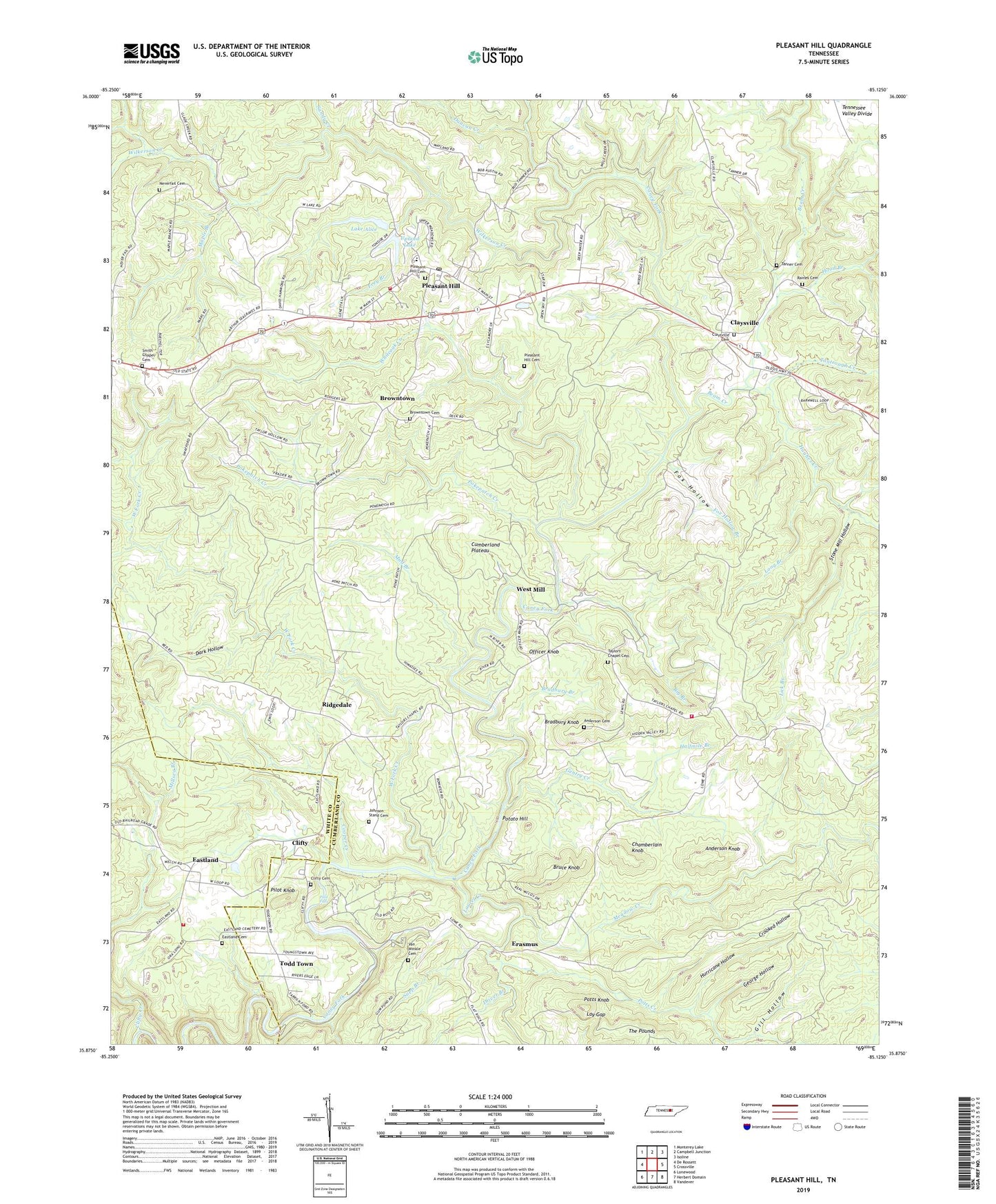
2019 topographic map quadrangle Pleasant Hill in the state of Tennessee. Scale: 1:24000. Based on the newly updated USGS 7.5' US Topo map series, this map is in the following counties: Cumberland, White. The map contains contour data, water features, and other items you are used to seeing on USGS maps, but also has updated roads and other features. This is the next generation of topographic maps. Printed on high-quality waterproof paper with UV fade-resistant inks.
Quads adjacent to this one:
West: De Rossett
Northwest: Monterey Lake
North: Campbell Junction
Northeast: Isoline
East: Crossville
Southeast: Vandever
South: Herbert Domain
Southwest: Lonewood
Contains the following named places: Anderson Cemetery, Anderson Knob, Beam Creek, Big Branch, Braceburn Mine, Bradbury Branch, Bradbury Knob, Browntown, Browntown Cemetery, Bruce Knob, Caney Forks, Chamberlain Knob, Claysville, Claysville Cemetery, Claysville Methodist Church, Claysville School, Clifty, Clifty Baptist Church, Clifty Cemetery, Clifty Creek, Clifty Number One Mine, Clifty Number Three Mine, Commissioner District 8, Cooper Creek, Crooked Hollow, Cumberland County Fire Department Station 8, Cumberland County Fire Department Station 8 - 1, Dark Hollow, Driver Branch, Duncan Creek, Eastland, Eastland Cemetery, Eastland Church of Christ, Eastland Volunteer Fire Department, Erasmus, Fox Hollow, Fox Hollow Branch, Frey Branch, Gentry Creek, George Hollow, Gill Hollow, Halfmile Branch, Hickory Hills, Highland Estates, Hood Branch, Hughes Creek, Hurricane Hollow, Johnson Stand Cemetery, Lake Alice, Lake Alice Dam, Lake Laura Dam, Laurel Creek, Lay Gap, Lick Branch, Long Branch, Maple Branch, Meadow Creek, Mud Branch, Neverfail, Neverfail Cemetery, Neverfail Church, Neverfail School, Officer Knob, Pilot Falls, Pilot Knob, Pilot Knob church, Pilot Knob School, Pinedale, Pleasant Hill, Pleasant Hill Academy, Pleasant Hill Cemetery, Pleasant HIll Cemetery, Pleasant Hill Elementary School, Pleasant Hill High School, Pleasant Hill Post Office, Pokepatch Creek, Potato Hill, Potts Creek, Potts Knob, Raines Cemetery, Ridgedale, Ridgedale Church, Ridgedale School, Sandy Creek, Sapp Branch, Smith Chapel, Smith Chapel Cemetery, Stone Mill Hollow, Tanner Cemetery, Tantrough Creek, Tarkiln Ford, Taylor Chapel, Taylor School, Taylors Chapel, Taylors Chapel Cemetery, The Meadows, Todd Town, Town of Pleasant Hill, Upland Lake, Uplands General Hospital, Van Winkle Cemetery, West Fork Creek, West Mill, White Oak Forest, Whiteoak Creek, Wilkerson Creek, ZIP Code: 38578