MyTopo
Reagan Tennessee US Topo Map
Couldn't load pickup availability
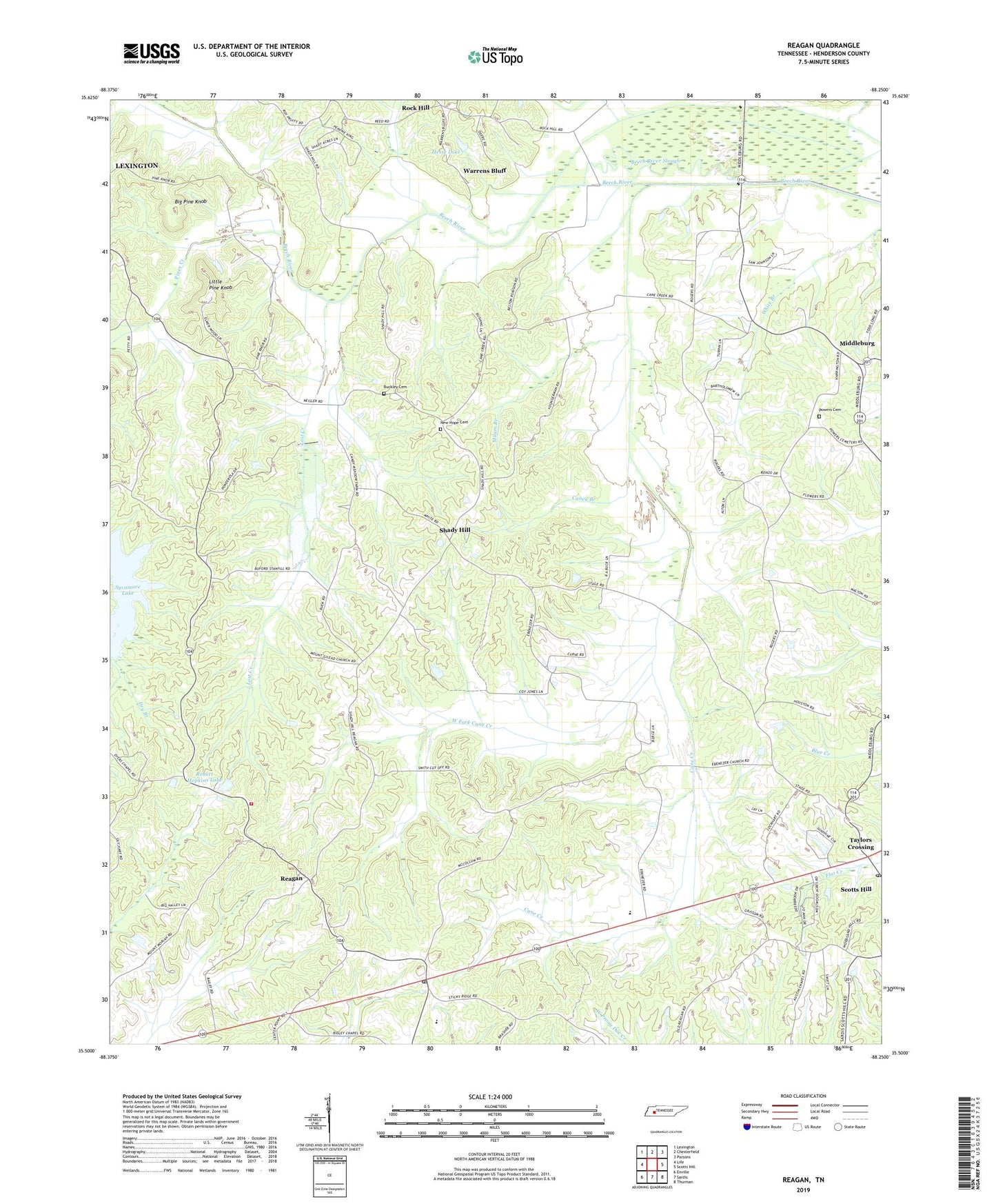
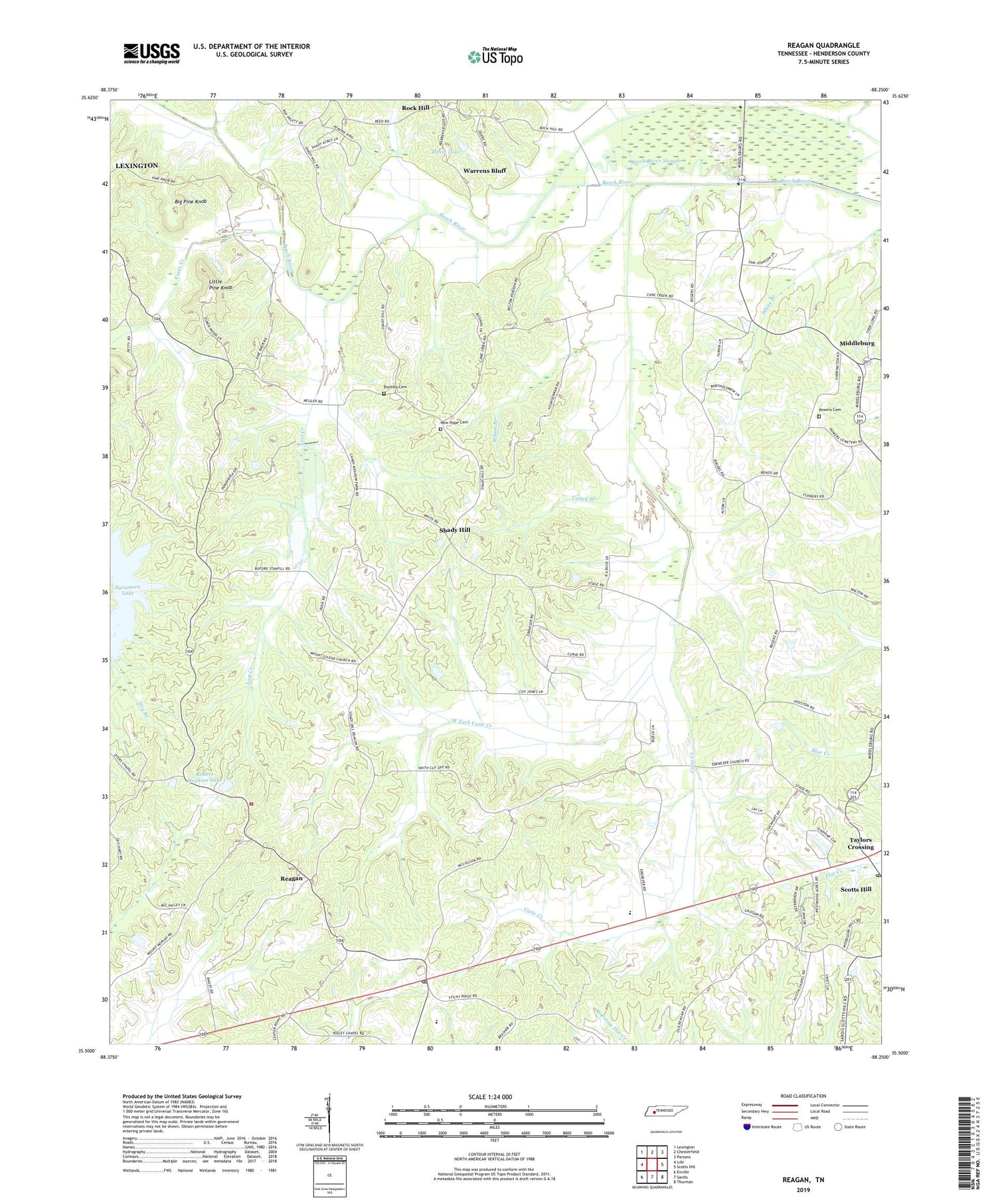
2019 topographic map quadrangle Reagan in the state of Tennessee. Scale: 1:24000. Based on the newly updated USGS 7.5' US Topo map series, this map is in the following counties: Henderson. The map contains contour data, water features, and other items you are used to seeing on USGS maps, but also has updated roads and other features. This is the next generation of topographic maps. Printed on high-quality waterproof paper with UV fade-resistant inks.
Quads adjacent to this one:
West: Life
Northwest: Lexington
North: Chesterfield
Northeast: Parsons
East: Scotts Hill
Southeast: Thurman
South: Sardis
Southwest: Enville
Contains the following named places: Austin Chapel, Barnes Spring Church, Big Pine Knob, Bluff Station, Brown School, Browns Creek, Buckley Cemetery, Caney Branch, City of Lexington, Commissioner District 7, Deers School, Dyer Chapel, East Fork Cane Creek, Ebenezer Church, Haley Creek, Harmon Creek, Henderson County Fire Department Station 9, Hesse Lake, Hesse Lake Dam, Judson Church, Judson School, Lick Creek, Little Pine Knob, Lost Creek, Lost Creek Dam, Middleburg, Milam Branch, Mount Gilead Church, Mount Moriah Church, New Hope Cemetery, New Hope Church, Oak Grove Church, Piney Church, Piney Creek, Piney School, Powers Cemetery, Reagan, Reagan Post Office, Reagan School, Ridley Chapel, Robert Hopkins Lake, Robert L Hopkins Dam, Rock Hill, Rock Hill Missionary Baptist Church, Rock Hill School, Sardis Division, Scotts Hill Post Office, Shady Hill, Shady Hill School, Stubblefields, Sycamore Lake, Taylors Crossing, Town of Scotts Hill, Tucker School, Warrens Bluff, Warrens Bluff Post Office, West Fork Cane Creek, White Branch, ZIP Code: 38368