MyTopo
Rives Tennessee US Topo Map
Couldn't load pickup availability
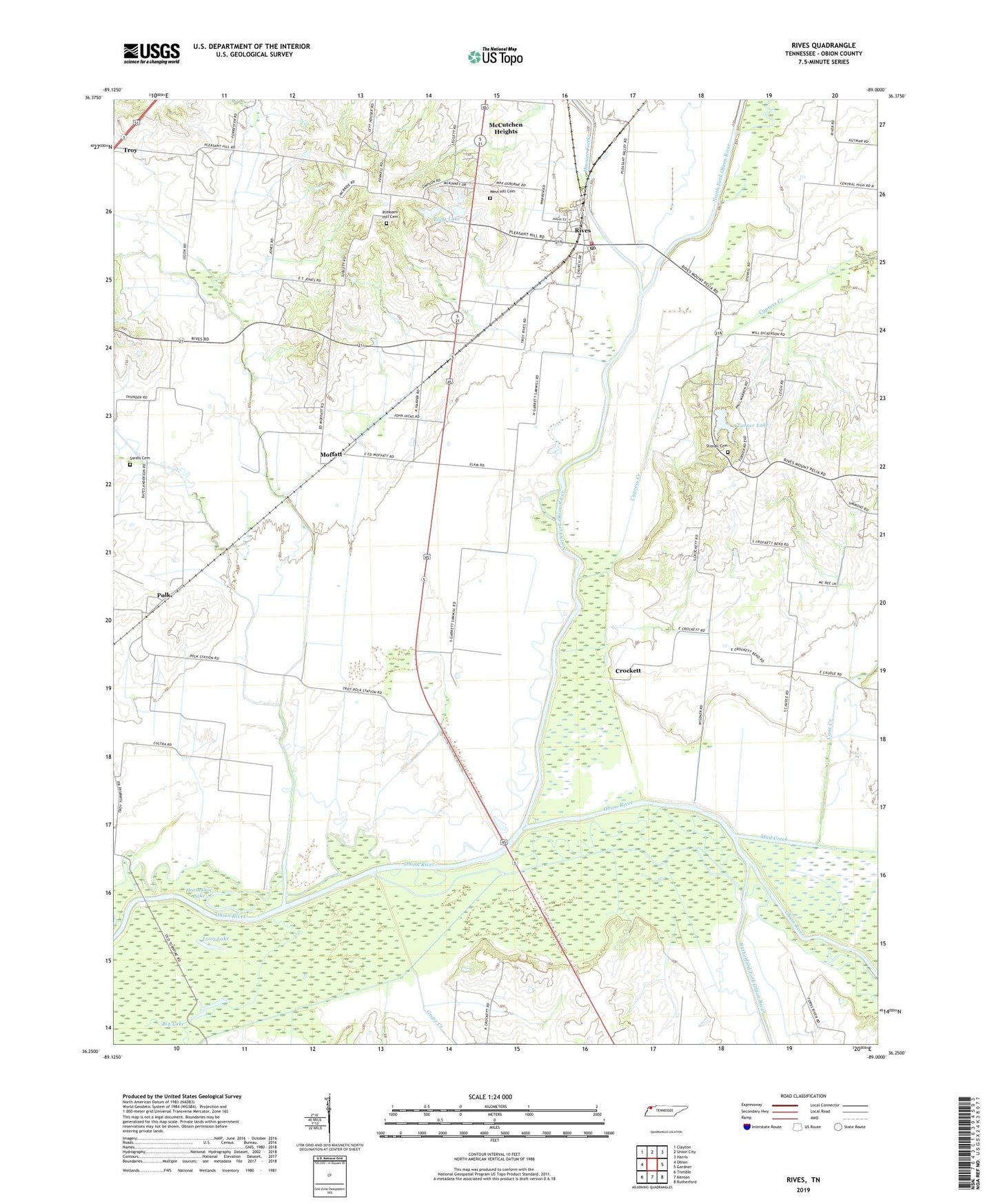
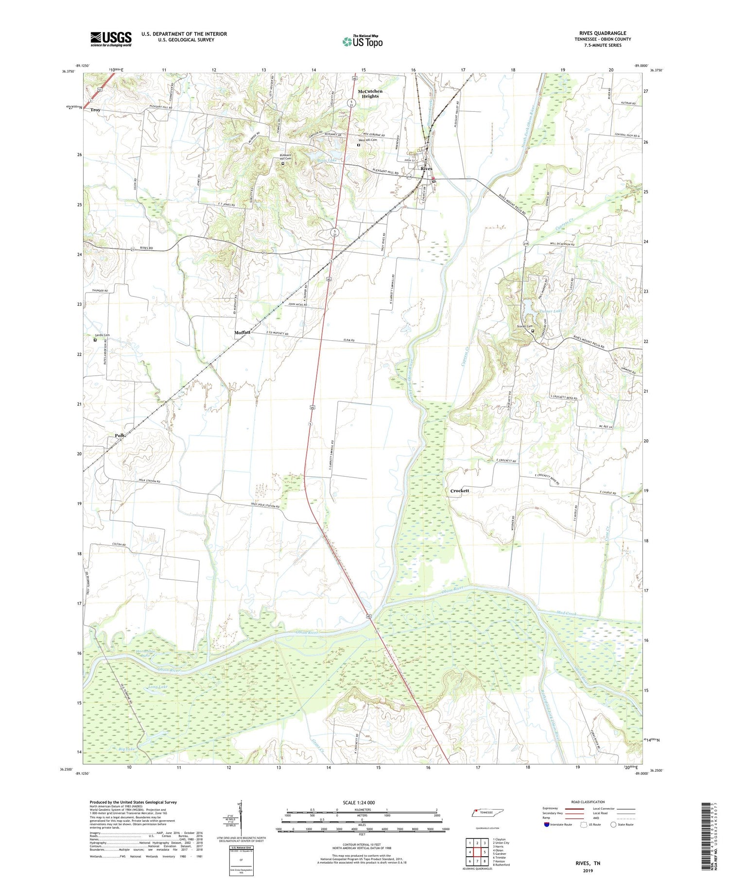
2019 topographic map quadrangle Rives in the state of Tennessee. Scale: 1:24000. Based on the newly updated USGS 7.5' US Topo map series, this map is in the following counties: Obion. The map contains contour data, water features, and other items you are used to seeing on USGS maps, but also has updated roads and other features. This is the next generation of topographic maps. Printed on high-quality waterproof paper with UV fade-resistant inks.
Quads adjacent to this one:
West: Obion
Northwest: Clayton
North: Union City
Northeast: Harris
East: Gardner
Southeast: Rutherford
South: Kenton
Southwest: Trimble
Contains the following named places: Big Lake, Botts Dam, Botts Lake, Cane Creek, Central Church, Commissioner District 3, Crockett, Cypress Creek, Davidson Creek, Gooch Wildlife Management Area, Grass Creek, Hoosier Creek, Horseshoe Lake, Long Lake, McCutchen Heights, Moffatt, Mud Creek, North Fork Obion River, Pleasant Hill, Pleasant Hill Cemetery, Pleasant Hill Church, Polk, Rives, Rives Elementary School, Rives Post Office, Rives Volunteer Fire Department, Rutherford Fork Obion River, Sardis Cemetery, Stovall Cemetery, Town of Rives, Troy Creek, Turner Lake, Turner Lake Dam, West Hill Cemetery