MyTopo
Obion Tennessee US Topo Map
Couldn't load pickup availability
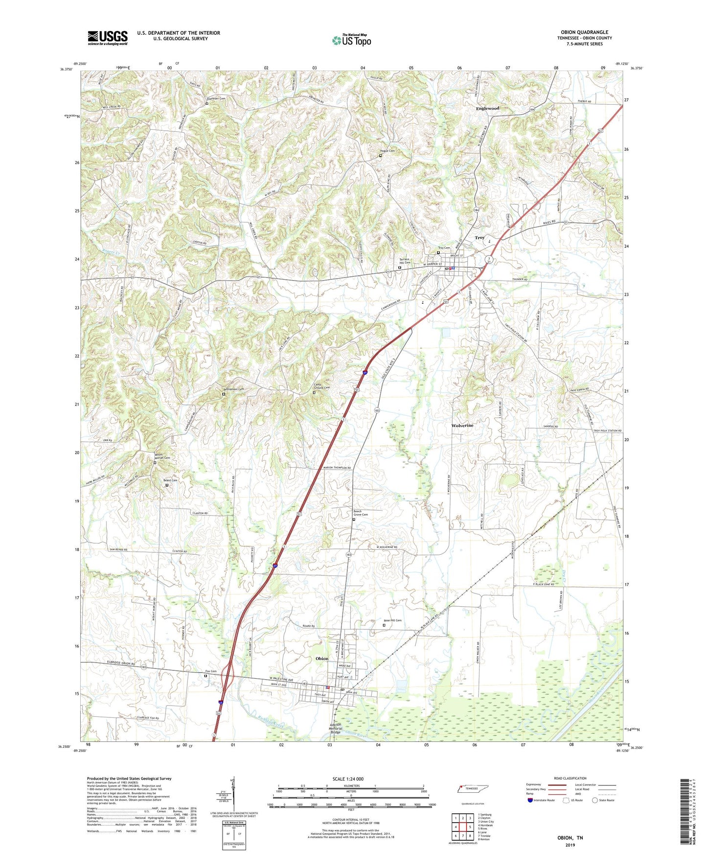
2022 topographic map quadrangle Obion in the state of Tennessee. Scale: 1:24000. Based on the newly updated USGS 7.5' US Topo map series, this map is in the following counties: Obion. The map contains contour data, water features, and other items you are used to seeing on USGS maps, but also has updated roads and other features. This is the next generation of topographic maps. Printed on high-quality waterproof paper with UV fade-resistant inks.
Quads adjacent to this one:
West: Hornbeak
Northwest: Samburg
North: Clayton
Northeast: Union City
East: Rives
Southeast: Kenton
South: Trimble
Southwest: Lane
This map covers the same area as the classic USGS quad with code o36089c2.
Contains the following named places: Adkison Memorial Bridge, Beard Cemetery, Beech Grove Cemetery, Bethlehem Cemetery, Camp Ground Cemetery, Commissioner District 6, Dry Creek, Ebenezer Cemetery, Ebenezer Church, Englewood, Englewood Church, Fox Cemetery, Hogue Cemetery, Hornbeak-Samburg Division, Little Richland Creek, Mount Moriah, Mount Moriah Cemetery, Mount Moriah Church, Obion, Obion County, Obion County Central School, Obion Fire Department, Obion Police Department, Obion Post Office, Obion School, Obion-Troy Division, Richland Creek, Rose Hill Cemetery, Simpson Cemetery, Terrace Hill Cemetery, Town of Obion, Town of Troy, Troy, Troy Cemetery, Troy Fire Department, Troy Police Department, Troy Post Office, Troy School, Wolverine, ZIP Code: 38260