MyTopo
Clayton Tennessee US Topo Map
Couldn't load pickup availability
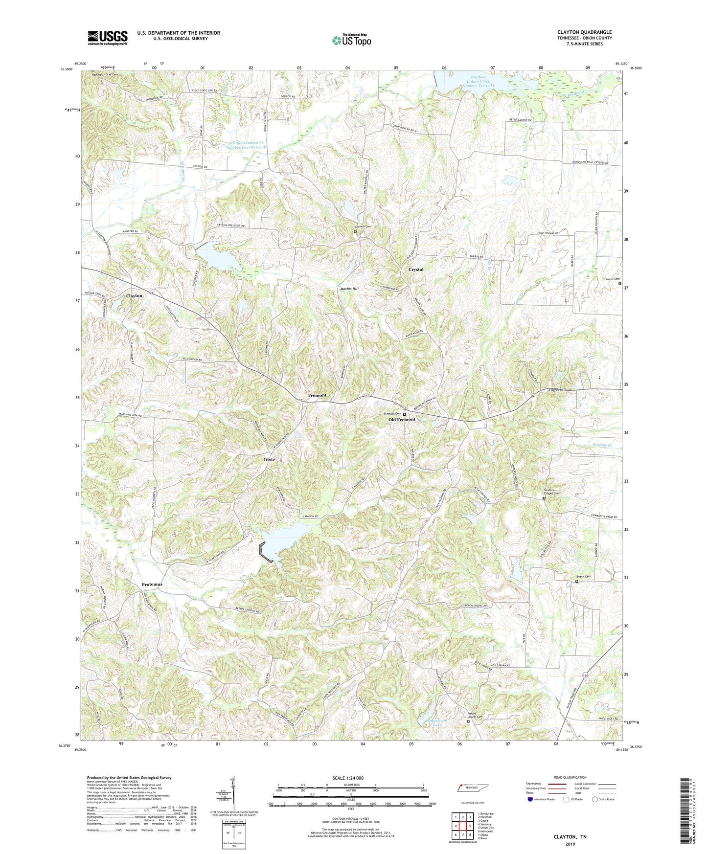
2022 topographic map quadrangle Clayton in the state of Tennessee. Scale: 1:24000. Based on the newly updated USGS 7.5' US Topo map series, this map is in the following counties: Obion. The map contains contour data, water features, and other items you are used to seeing on USGS maps, but also has updated roads and other features. This is the next generation of topographic maps. Printed on high-quality waterproof paper with UV fade-resistant inks.
Quads adjacent to this one:
West: Samburg
Northwest: Bondurant
North: Hickman
Northeast: Cayce
East: Union City
Southeast: Rives
South: Obion
Southwest: Hornbeak
This map covers the same area as the classic USGS quad with code o36089d2.
Contains the following named places: Antioch Cemetery, Antioch Church, Beech, Beech Chapel, Beech Church Cemetery, Bethel Baptist Church, Cane Creek, Clayton, Crystal, Cub Branch, Dixie, Dixie Division, Dixie School, Englewood Lake, Englewood Lake Dam, Fremont, Fremont Cemetery, Fremont Church of Christ, Garrison's Poultry Farm, Hamblin Branch, Logan Hill, Mathis Hill, Mount Ararat Cemetery, Mount Ararat Church, Mount Olive Church, Obion County Home, Old Fremont, Old Republican Church, Protemus, Protemus Cumberland Presbyterian Church, Reelfoot Church, Reelfoot Indian Creek Dam Number Fifteen, Reelfoot Indian Creek Dam Number Fourteen, Reelfoot Indian Creek Dam Number Ten, Reelfoot Indian Creek Number Fifteen Lake, Reelfoot Indian Creek Number Fourteen Lake, Reelfoot Indian Creek Number Ten Lake, Reelfoot Indian Creek Watershed Number Seven Reservoir, Rockspring Branch, Salem Cemetery, Sanders Chapel, Sanders Chapel Church Cemetery, Scawley Creek, Snow Branch, Taylor Creek, Tull Creek