MyTopo
Franklin Tennessee US Topo Map
Couldn't load pickup availability
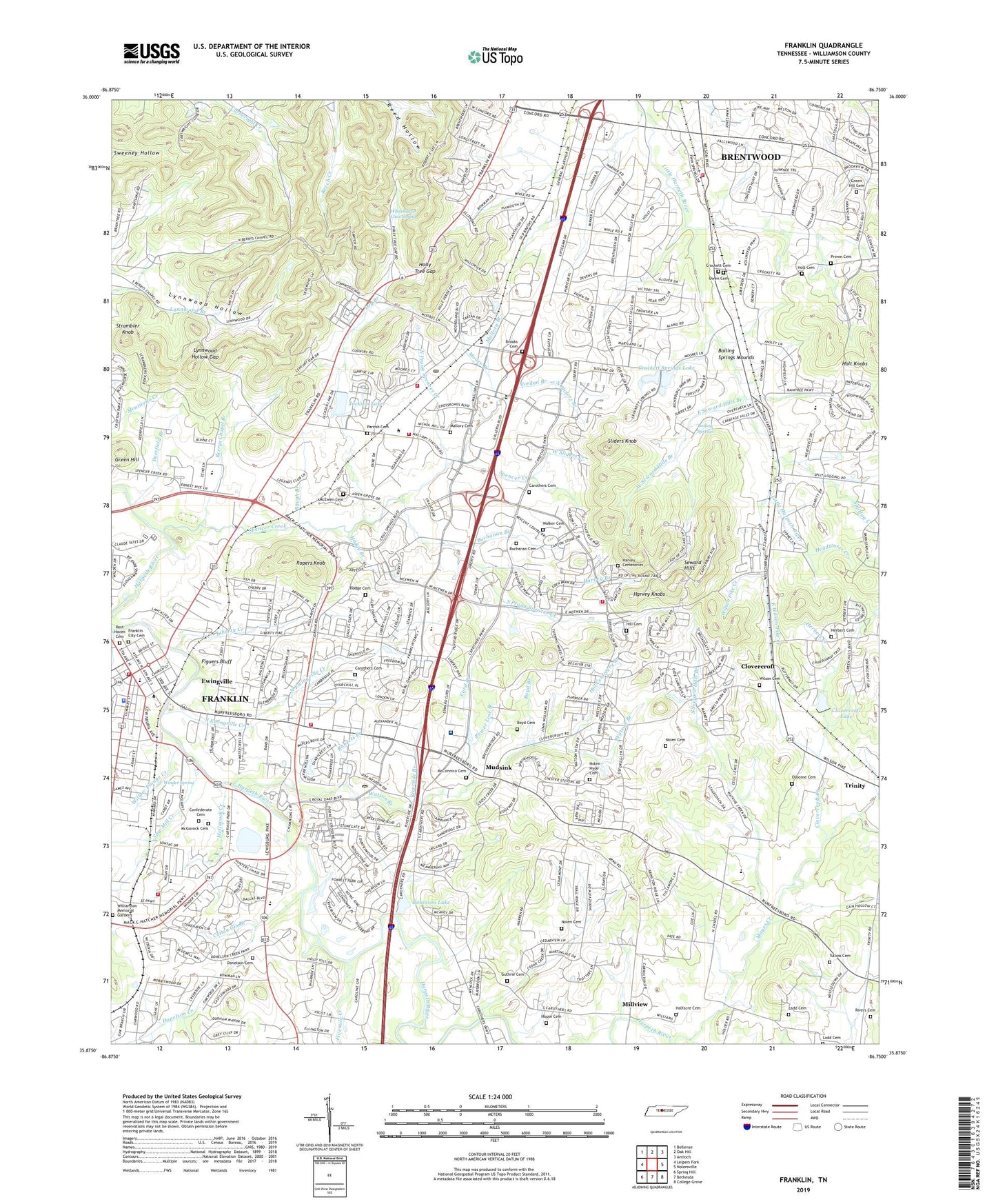
2022 topographic map quadrangle Franklin in the state of Tennessee. Scale: 1:24000. Based on the newly updated USGS 7.5' US Topo map series, this map is in the following counties: Williamson. The map contains contour data, water features, and other items you are used to seeing on USGS maps, but also has updated roads and other features. This is the next generation of topographic maps. Printed on high-quality waterproof paper with UV fade-resistant inks.
Quads adjacent to this one:
West: Leipers Fork
Northwest: Bellevue
North: Oak Hill
Northeast: Antioch
East: Nolensville
Southeast: College Grove
South: Bethesda
Southwest: Spring Hill
This map covers the same area as the classic USGS quad with code o36086f5.
Contains the following named places: Alexander Plaza Shopping Center, Aspen Grove Plantation, Barrett Mine, Baugh Branch, Berrys Chapel Branch, Boiling Spring Academy, Boiling Springs, Boiling Springs Mounds, Boxwood Hall, Boyd Branch, Boyd Cemetery, Breckenridge South, Brenthaven East, Brenthaven North, Brenthaven South, Brentwood Hills, Brentwood Pointe, Brentwood South, Brooks Cemetery, Buchanan Branch, Buchanan Cemetery, Buckingham Park, Burke Branch, Cadet, Callender, Cameron Spring Branch, Carnton Plantation, Carothers Branch, Carothers Cemetery, Carpenters, Carriage Hills, Carters Court Shopping Center, Charleton Green, Chestnut Hill, City of Brentwood, City of Franklin, Clovercroft, Clovercroft Creek, Clovercroft Lake, Clovercroft Lake Dam, Commissioner District 4, Commissioner District 6, Commissioner District 8, Concord Country Estates, Confederate Cemetery, Cool Springs Galleria Mall, Cool Springs Pointe Shopping Center, Cotton Gin Branch, Country Roads, Country Wood Estates, Creekside Plantation, Crockett Cemetery, Crockett Cove, Crockett Hills, Crockett Springs, Crockett Springs Lake, Crockett Springs Lake Dam, Crockett Springs National Golf and Country Club, Cross Creek, Curd Branch, Deerfield, Deerfield Branch, Donelson Cemetery, Donelson Creek, Dry Branch, East Seward Hills Branch, East Wilson Pike Creek, Eldorado Acres, Ewingville, Figuers Bluff, Fivemile Creek, Florenceville School, Forge Seat Plantation, Fort Granger, Foxboro Estates, Frankin Mall Shopping Center, Franklin, Franklin City Cemetery, Franklin Division, Franklin East, Franklin Industrial Park, Franklin Plaza Shopping Center, Gardner Estates, German Branch, Glen Echo Branch, Green Branch, Green Hill, Green Hill Cemetery, Guthrie Cemetery, Halfacre Cemetery, Hallbrook, Harlinsdale Spring Branch, Harpeth Valley Industrial Park, Harvey Branch, Harvey Cemeteries, Harvey Knobs, Harvey Spring Branch, Headwater Creek, Herbert Branch, Herbert Cemetery, Herbert Creek, Highgate, Hill Cemetery, Hill Cemetery Branch, Hill Estates, Hodge Branch, Hodge Cemetery, Holly Tree Gap, Holt Cemetery, Holt Knobs, Holtland Plantation, Horton Mine, House Cemetery, Huffine Branch, Indian Point, Indian Springs, Inglehame Plantation, Jackson Lake, Jackson Lake Dam, Jamestown, Jordan Branch, Ladd Cemetery, Landings, Langford School, Leeland, Liberty Creek, Liberty Hills, Liberty Place Mall, Liberty Place Shopping Center, Lipscomb School, Little Harpeth West Branch, Lynnwood Downs, Lynnwood Hollow, Lynnwood Hollow Gap, Mallory, Mallory Branch, Mallory Cemetery, Mallory School, Maple Lawn Plantation, Maplewood, Mayes Creek, McConnico Cemetery, McEwen, McEwen Cemetery, McGavock, McGavock Cemetery, McGavock Creek, McKays Branch, Millview, Moore Branch, Mooreland Estates, Moores, Mudsink, Myes Manor Plantation, Nolan Branch, Nolen - Hyde Cemetery, Nolen Cemetery, North Ewingville Creek, North Prong Spencer Creek, North Sliders Branch, Oak Hall, Oakleaf Estates, Oakwood Estates, O'More School, Osborne Cemetery, Owen Cemetery, Owens, Parrish Cemetery, Parrish Spring Branch, Pickering Branch, Power Line Branch, Primm Cemetery, Ravenwood Plantation, Redwing Farms, Rest Haven Cemetery, Richardson Mine, River Club Estates, Rivers Cemetery, Riverside Branch, Riverview Park, Roberts Branch, Robinson Lake, Robinson Spring Branch, Robinsons Lake Dam, Rogers Burn, Rolling Rivers, Ropers Knob, Royal Branch, Royal Oaks, Saratoga, Saw Mill Creek, Seward Hills, Sharp Branch, Sliders Knob, South Ewingville Creek, South Prong Spencer Creek, South Seward Hills Branch, Spencer Creek, Spencer Creek Place, Splitlog Creek, Stevens Shop, Stonehenge Estates, Strambler Knob, Sturbridge Pointe, Swanson Branch, Toon Creek, Trinity, Trinity County Park, Truett Place Plantation, Tulloss Cemetery, Twin Springs Estates, Walker Cemetery, Walnut Hills, Watson Branch, Watson Glen Shopping Center, West Seward Hills Branch, West Sliders Creek, Whitehearst Cave Spring, Wikles, Williams Branch, Williamson Medical Center, Williamson Memorial Gardens, Willow Plunge Creek, Wilson Cemetery, Wilson Pike Creek, Wilson Spring Branch, Winder Spring, WIZO-AM (Franklin), WSM-AM (Nashville), WTBN-AM (Brentwood), WTJT-AM (Franklin), Wyatt Hall Plantation, Yorktown, ZIP Codes: 37027, 37067


