MyTopo
Trimble Tennessee US Topo Map
Couldn't load pickup availability
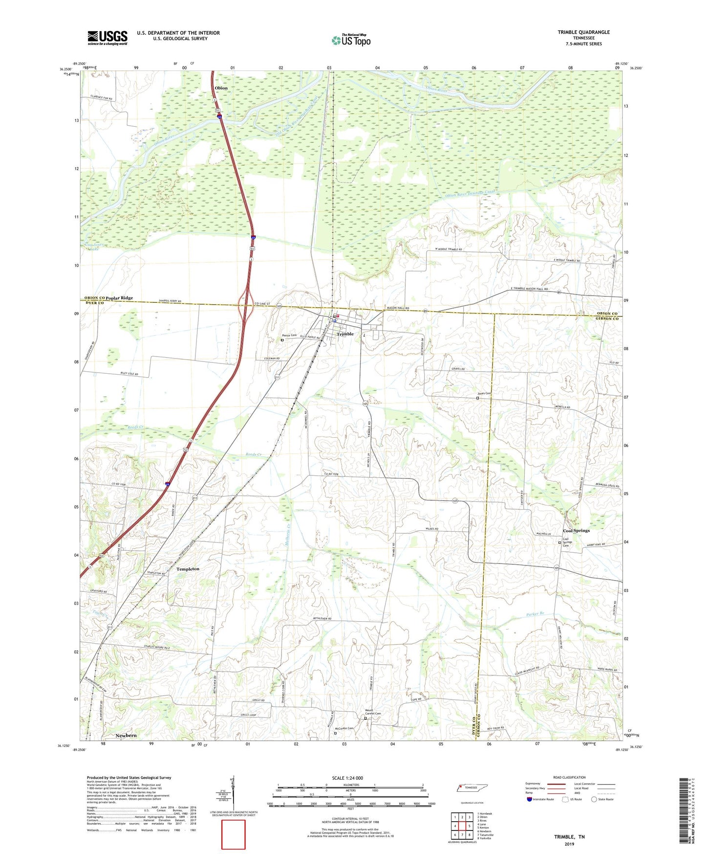
2019 topographic map quadrangle Trimble in the state of Tennessee. Scale: 1:24000. Based on the newly updated USGS 7.5' US Topo map series, this map is in the following counties: Dyer, Obion, Gibson. The map contains contour data, water features, and other items you are used to seeing on USGS maps, but also has updated roads and other features. This is the next generation of topographic maps. Printed on high-quality waterproof paper with UV fade-resistant inks.
Quads adjacent to this one:
West: Lane
Northwest: Hornbeak
North: Obion
Northeast: Rives
East: Kenton
Southeast: Yorkville
South: Tatumville
Southwest: Newbern
Contains the following named places: Bethlehem School, Burnt Mill Hollow Creek, Carmel Church, Cool Springs, Cool Springs Branch, Cool Springs Cemetery, Cool Springs Church, Cool Springs Cumberland Presbyterian Church, Cool Springs School, Dillard Creek, District 15, District 9, Harmony Church, Harmony School, Jones Cemetery, McCorkle Cemetery, Mill Creek, Mount Carmel Cemetery, Mulherin Creek, New Bethlehem Church, Newbern Division, Obion River Drainage Canal, Old Obion River Drainage Canal, Palestine Church, Parker Branch, Pierce Cemetery, Poplar Ridge, Templeton, Town of Trimble, Trimble, Trimble Elementary School, Trimble Fire Department, Trimble First Baptist Church, Trimble Police Department, Trimble Post Office, Union Grove Church, ZIP Code: 38259