MyTopo
Yorkville Tennessee US Topo Map
Couldn't load pickup availability
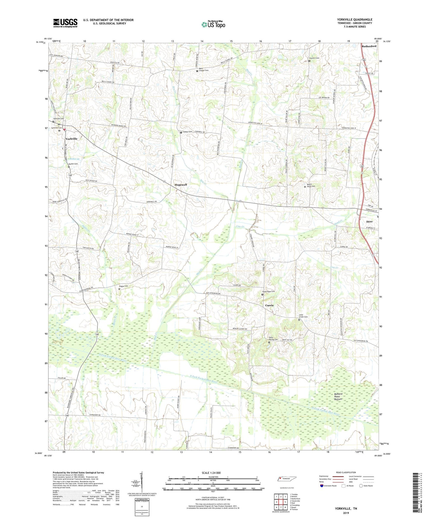
2022 topographic map quadrangle Yorkville in the state of Tennessee. Scale: 1:24000. Based on the newly updated USGS 7.5' US Topo map series, this map is in the following counties: Gibson. The map contains contour data, water features, and other items you are used to seeing on USGS maps, but also has updated roads and other features. This is the next generation of topographic maps. Printed on high-quality waterproof paper with UV fade-resistant inks.
Quads adjacent to this one:
West: Tatumville
Northwest: Trimble
North: Kenton
Northeast: Rutherford
East: Dyer
Southeast: Trenton
South: Brazil
Southwest: Friendship
This map covers the same area as the classic USGS quad with code o36089a1.
Contains the following named places: Bells Chapel, Bells Chapel Cemetery, Bells Chapel School, Bethel Baptist Church, Bethel Cemetery, Buzzard Roost Bottom, City of Yorkville, Clear Creek Cemetery, Clear Creek Church, Commissioner District 16, Cow Creek, Cowan Cemetery, Currie, District 21, District 8, Dry Creek, Duck Hill Church, Dyer Industrial Park, Flowers Cemetery, Flowers Chapel, Good Hope Cemetery, Good Hope Church, Hogue Cemetery, Holly Spring Cemetery, Hooten, Hopewell, Hopewell Methodist Episcopal Church South, Hopewell School, Midway Church, Mount Carmel Cumberland Presbyterian Church, Mount Olive Cemetery, Mount Olive Church, Mud Creek, Newell, Old Bethlehem Church, Riverside, Sand Creek, Union Academy, Yorkville, Yorkville Cemetery, Yorkville Church of Christ, Yorkville Cumberland Presbyterian Church, Yorkville Cumberland Presbyterian Church Cemetery, Yorkville Division, Yorkville Elementary School, Yorkville Fire Department, Yorkville High School, Yorkville Post Office, ZIP Code: 38330