MyTopo
Adell Texas US Topo Map
Couldn't load pickup availability
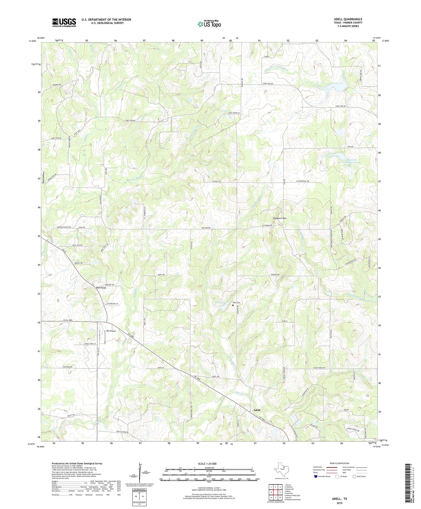
2022 topographic map quadrangle Adell in the state of Texas. Scale: 1:24000. Based on the newly updated USGS 7.5' US Topo map series, this map is in the following counties: Parker. The map contains contour data, water features, and other items you are used to seeing on USGS maps, but also has updated roads and other features. This is the next generation of topographic maps. Printed on high-quality waterproof paper with UV fade-resistant inks.
Quads adjacent to this one:
West: Whitt
Northwest: Perrin
North: Gibtown
Northeast: Boonsville
East: Poolville
Southeast: Weatherford North
South: Garner
Southwest: Mineral Wells East
This map covers the same area as the classic USGS quad with code o32097h8.
Contains the following named places: Adell, Adell Church, Advance, Arnett Landing, Bald Knob, Bethesda Cemetery, Bethesda Church, Blo Airport, Brown Family Cemetery, Cottonwood Creek, Dyer Creek, East Fork Rock Creek, Grub Lake, Grub Lake Dam, Lone Star Cemetery, Lone Star Church, Mader Family Cemetery, Moreland Creek, Reservoir Number One, Reservoir Number Two, Risch Cemetery, Slipdown Mountain, Soil Conservation Service Site 1 Dam, Soil Conservation Service Site 2 Dam, Soil Conservation Service Site 2 Reservoir, Weatherford Northwest Division, ZIP Code: 76487