MyTopo
Garner Texas US Topo Map
Couldn't load pickup availability
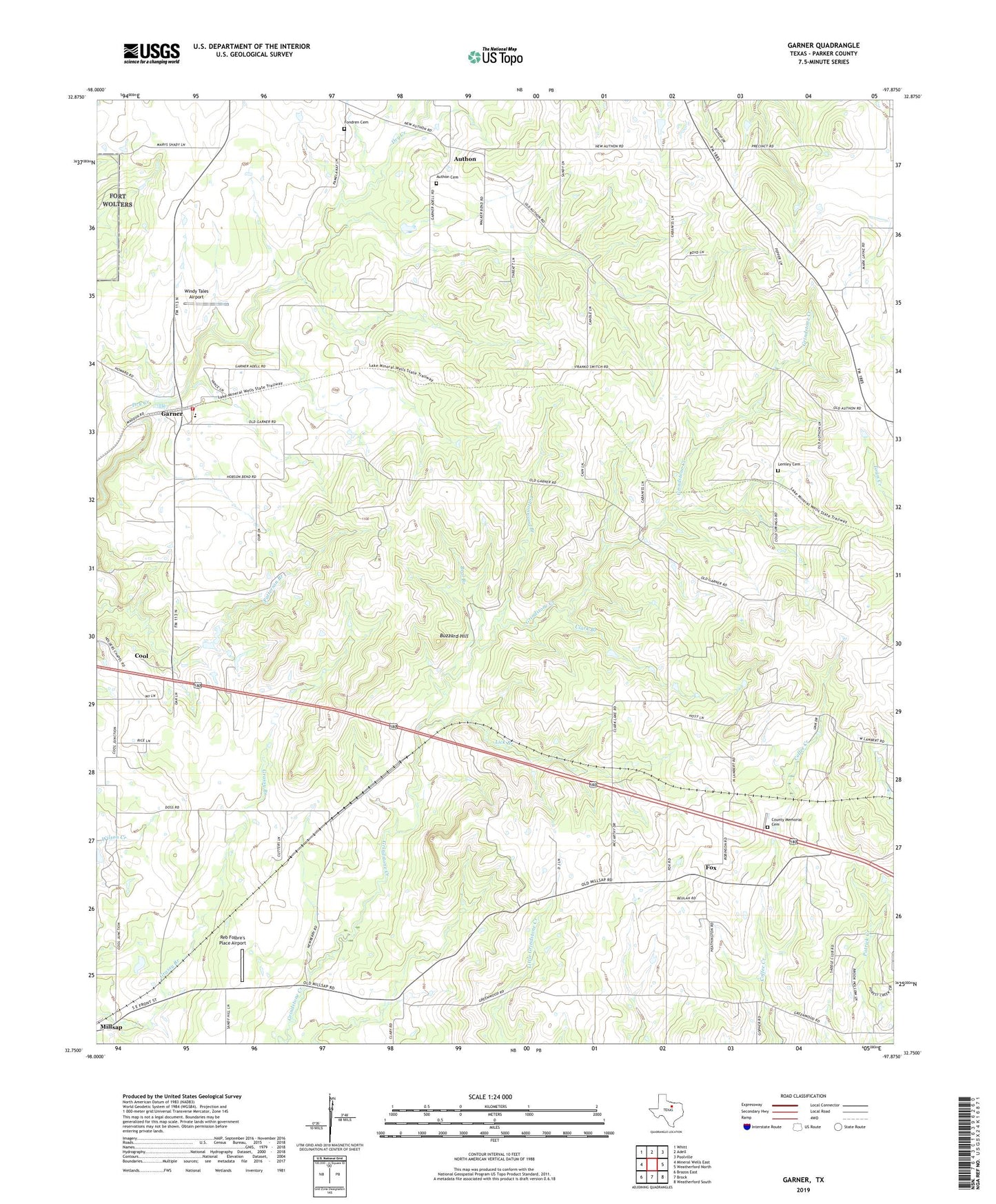
2022 topographic map quadrangle Garner in the state of Texas. Scale: 1:24000. Based on the newly updated USGS 7.5' US Topo map series, this map is in the following counties: Parker. The map contains contour data, water features, and other items you are used to seeing on USGS maps, but also has updated roads and other features. This is the next generation of topographic maps. Printed on high-quality waterproof paper with UV fade-resistant inks.
Quads adjacent to this one:
West: Mineral Wells East
Northwest: Whitt
North: Adell
Northeast: Poolville
East: Weatherford North
Southeast: Weatherford South
South: Brock
Southwest: Brazos East
This map covers the same area as the classic USGS quad with code o32097g8.
Contains the following named places: Authon, Authon Cemetery, Beal Branch, Beulah Baptist Church, Beulah Church, Buzzard Hill, Clark Branch, Cole Cemetery, Cool - Garner Fire Rescue Station 1, Cottonwood Branch, Fondren Cemetery, Fox, Garner, Garner Census Designated Place, Garner Elementary School, Lambert Baptist Church, Lemley, Lemley Cemetery, Lick Branch, Memory Gardens of the Valley Cemetery, New Hope Church, Newberry Church, Preble, Reb Folbre's Place Airport, San Marcos Public Library, Shady Grove Baptist Church, Windy Tales Airport, ZIP Code: 76088