MyTopo
Albercas Ranch Texas US Topo Map
Couldn't load pickup availability
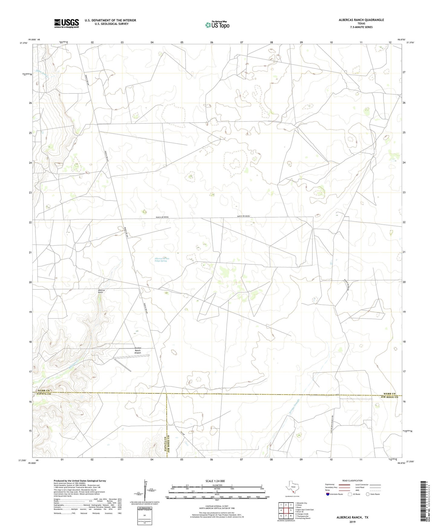
2022 topographic map quadrangle Albercas Ranch in the state of Texas. Scale: 1:24000. Based on the newly updated USGS 7.5' US Topo map series, this map is in the following counties: Webb, Jim Hogg, Zapata. The map contains contour data, water features, and other items you are used to seeing on USGS maps, but also has updated roads and other features. This is the next generation of topographic maps. Printed on high-quality waterproof paper with UV fade-resistant inks.
Quads adjacent to this one:
West: Agua Azul Creek East
Northwest: Mirando City
North: Oilton
Northeast: Bruni
East: Bruni SE
Southeast: Armstrong Ranch
South: Thompsonville
Southwest: Chargos Creek
This map covers the same area as the classic USGS quad with code o27098c8.
Contains the following named places: Albercas de San Felipe Spring, Albercas Ranch, Glen Oil Field, Jacalon Ranch Airport, Quien Sabe Oil Field, San Jose Ranch, ZIP Code: 78369