MyTopo
Lexington Texas US Topo Map
Couldn't load pickup availability
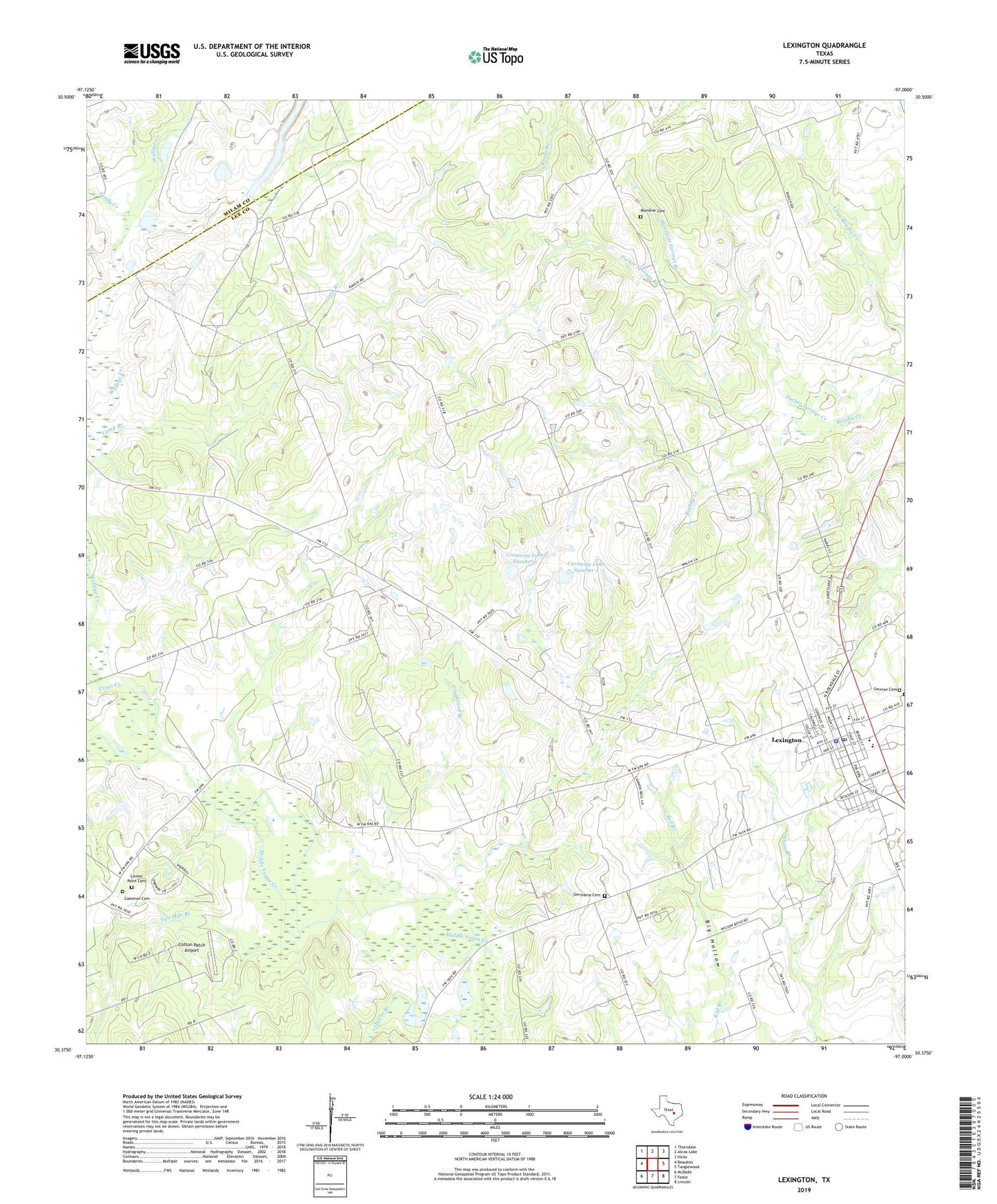
2022 topographic map quadrangle Lexington in the state of Texas. Scale: 1:24000. Based on the newly updated USGS 7.5' US Topo map series, this map is in the following counties: Lee, Milam. The map contains contour data, water features, and other items you are used to seeing on USGS maps, but also has updated roads and other features. This is the next generation of topographic maps. Printed on high-quality waterproof paper with UV fade-resistant inks.
Quads adjacent to this one:
West: Beaukiss
Northwest: Thorndale
North: Alcoa Lake
Northeast: Hicks
East: Tanglewood
Southeast: Lincoln
South: Fedor
Southwest: McDade
This map covers the same area as the classic USGS quad with code o30097d1.
Contains the following named places: Cameron Cemetery, Camp Branch, Caraway Lake Number 1, Caraway Lake Number 1 Dam, Caraway Lake Number 2, Caraway Lake Number 2 Dam, Center Point Cemetery, Cotton Patch Airport, Coupeland Branch, Cross Creek, German Cemetery, Germania Cemetery, Grapevine Gully, Lexington, Lexington City Hall, Lexington Division, Lexington Elementary School, Lexington High School, Lexington Middle School, Lexington Police Department, Lexington Post Office, Lexington Primary School, Lexington Volunteer Emergency Medical Service, Morrison Springs Branch, Mundine Cemetery, Owens Branch, Pucker Springs Branch, Pucker Springs Creek, Sandy Creek, Shaw Branch, Town of Lexington, Two Mile Branch, Walleye Creek, ZIP Code: 78947