
MyTopo
Allen Creek Texas US Topo Map
Couldn't load pickup availability
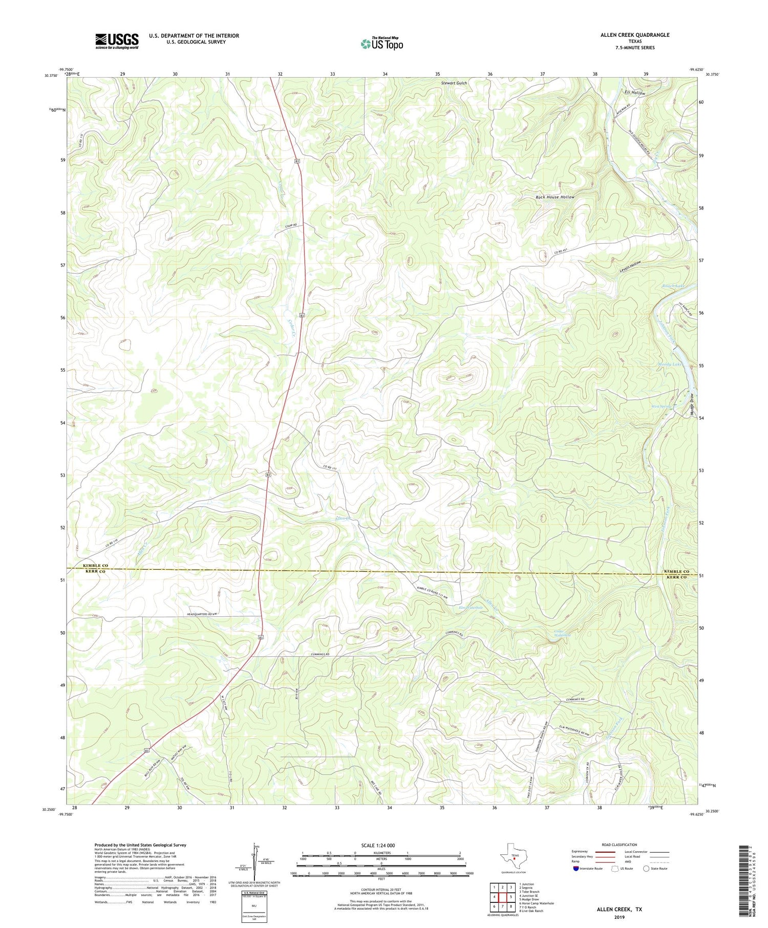
2019 topographic map quadrangle Allen Creek in the state of Texas. Scale: 1:24000. Based on the newly updated USGS 7.5' US Topo map series, this map is in the following counties: Kimble, Kerr. The map contains contour data, water features, and other items you are used to seeing on USGS maps, but also has updated roads and other features. This is the next generation of topographic maps. Printed on high-quality waterproof paper with UV fade-resistant inks.
Quads adjacent to this one:
West: Junction SE
Northwest: Junction
North: Segovia
Northeast: Tobe Branch
East: Mudge Draw
Southeast: Live Oak Ranch
South: Y O Ranch
Southwest: Horse Camp Waterhole
Contains the following named places: Allen Creek, Bee Waterhole Windmill, Big West Windmill, Cedar Waterhole, Eli Hollow, Elm Waterhole, Elm Waterhole Windmill, Joy Creek, Junction Windmill, Levels Hollow, Little West Windmill, Moody Lake, Moody Lake Dam, Mudge Draw, North Windmill, Roach Lake, Rock House Hollow, Two Dot Windmill, West Spring


