MyTopo
Cat Spring Texas US Topo Map
Couldn't load pickup availability
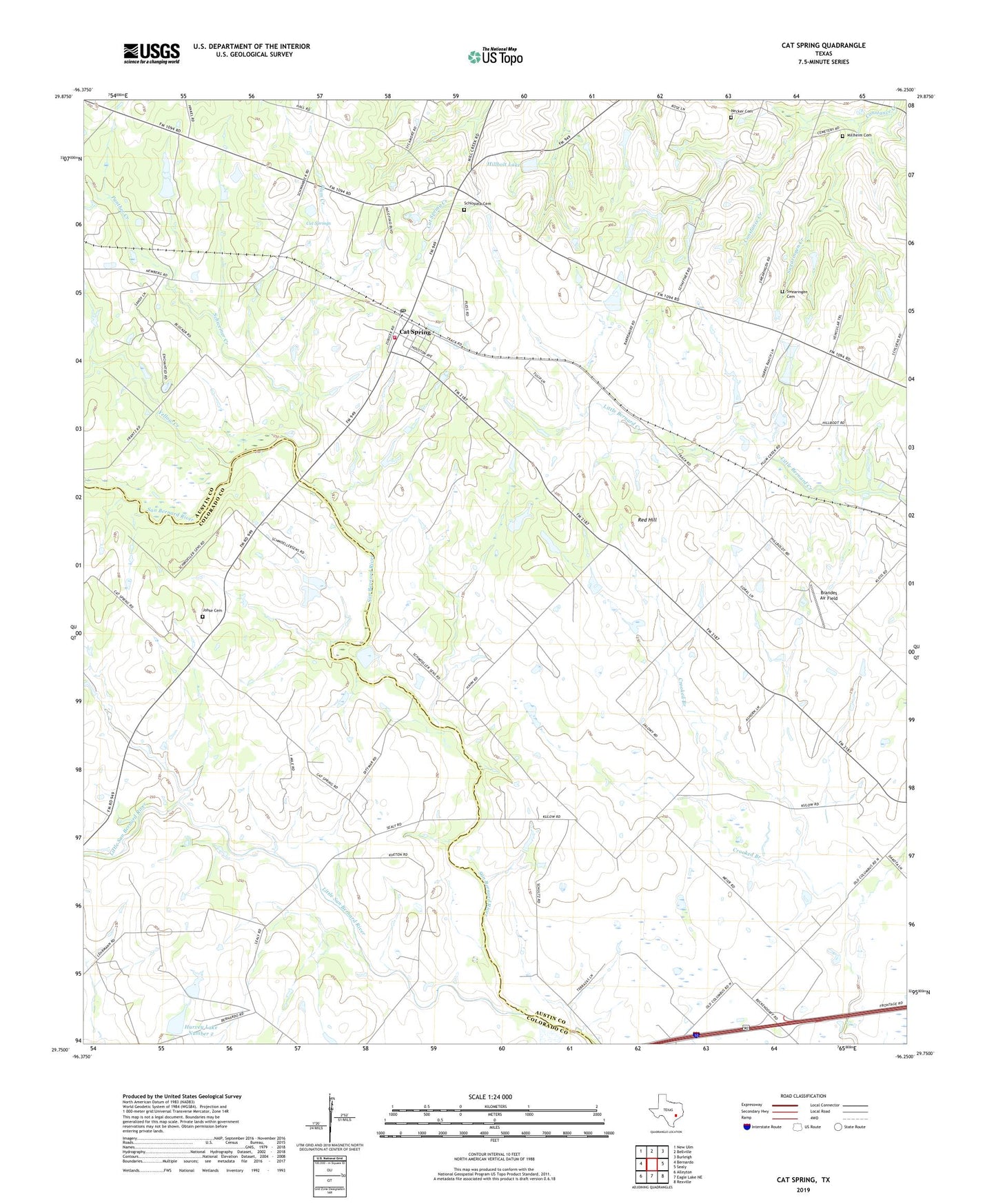
2022 topographic map quadrangle Cat Spring in the state of Texas. Scale: 1:24000. Based on the newly updated USGS 7.5' US Topo map series, this map is in the following counties: Austin, Colorado. The map contains contour data, water features, and other items you are used to seeing on USGS maps, but also has updated roads and other features. This is the next generation of topographic maps. Printed on high-quality waterproof paper with UV fade-resistant inks.
Quads adjacent to this one:
West: Bernardo
Northwest: New Ulm
North: Bellville
Northeast: Burleigh
East: Sealy
Southeast: Rexville
South: Eagle Lake NE
Southwest: Alleyton
This map covers the same area as the classic USGS quad with code o29096g3.
Contains the following named places: Brandes Air Field, Cat Spring, Cat Spring Post Office, Cat Springs, Cat Springs Volunteer Fire Department, Conner Lake, Conner Lake Dam, Hillbolt Lake, Hillbolt Lake Dam, Hurvey Lake Number 1, Hurvey Lake Number 1 Dam, Hurvey Lake Number 2, Hurvey Lake Number 2 Dam, Johse Cemetery, Little San Bernard River, Millheim Cemetery, Moore Lake, Moore Lake Dam, Necker Cemetery, Panther Creek, Plum Creek, Red Hill, Schlopata Cemetery, Schweiner Creek, Swearingen Cemetery, Swearingen Creek, Yellow Creek, ZIP Code: 78933