MyTopo
Altuda Texas US Topo Map
Couldn't load pickup availability
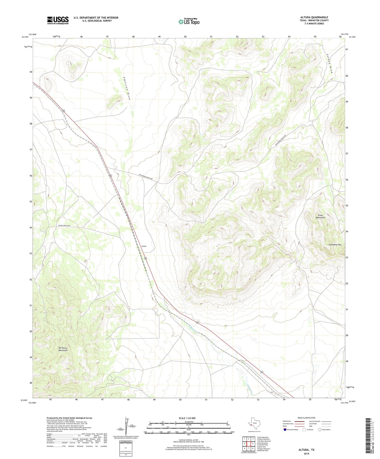
2022 topographic map quadrangle Altuda in the state of Texas. Scale: 1:24000. Based on the newly updated USGS 7.5' US Topo map series, this map is in the following counties: Brewster. The map contains contour data, water features, and other items you are used to seeing on USGS maps, but also has updated roads and other features. This is the next generation of topographic maps. Printed on high-quality waterproof paper with UV fade-resistant inks.
Quads adjacent to this one:
West: Bird Mountain
Northwest: Elam Mountain
North: Bissett Mountain
Northeast: Old Blue Mountain
East: Gilliland Peak
Southeast: Beckwith Hills
South: Dugout Mountain
Southwest: Mount Ord
This map covers the same area as the classic USGS quad with code o30103c4.
Contains the following named places: Altuda, James Ranch, Youngs Ranch