MyTopo
Beckwith Hills Texas US Topo Map
Couldn't load pickup availability
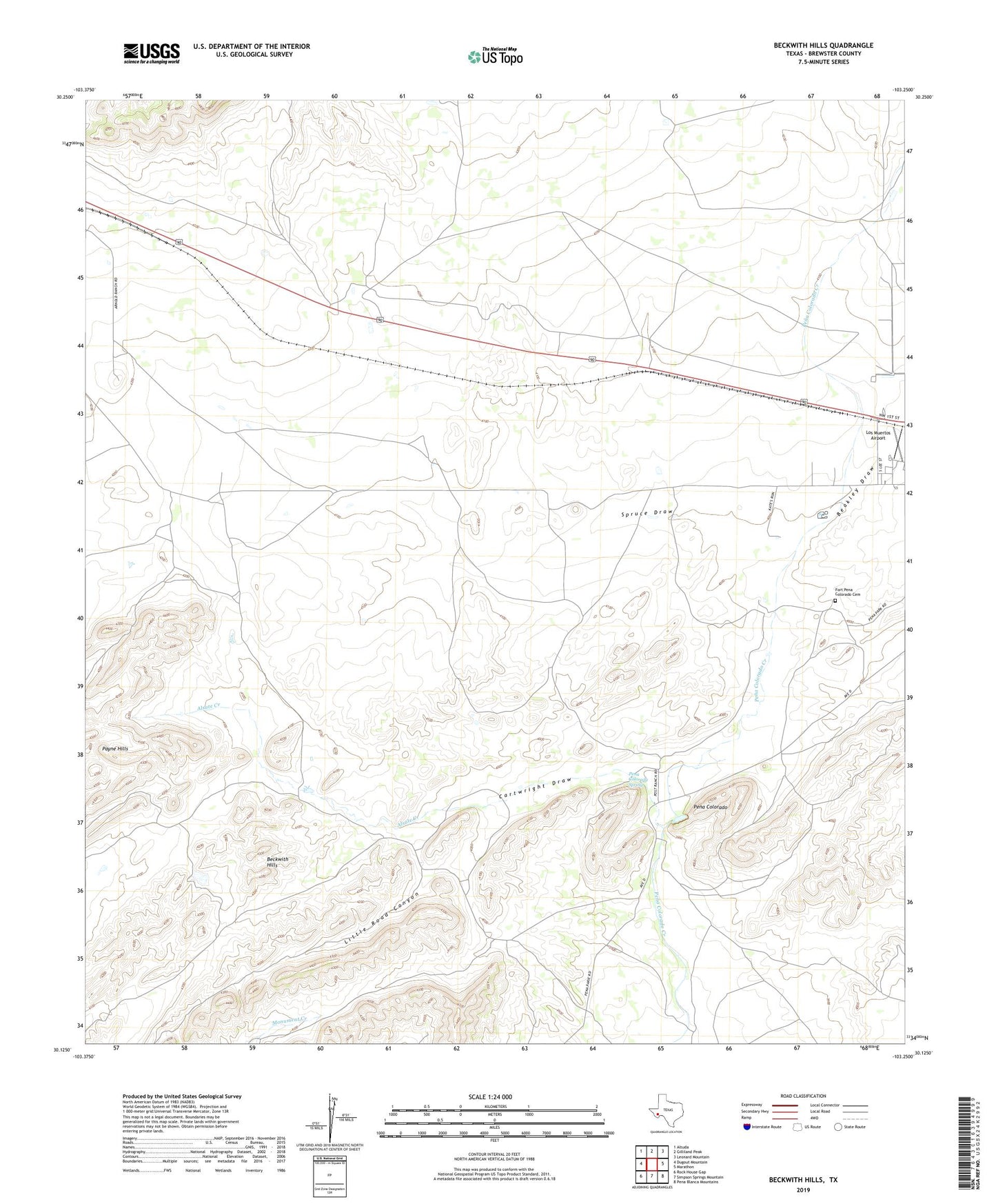
2022 topographic map quadrangle Beckwith Hills in the state of Texas. Scale: 1:24000. Based on the newly updated USGS 7.5' US Topo map series, this map is in the following counties: Brewster. The map contains contour data, water features, and other items you are used to seeing on USGS maps, but also has updated roads and other features. This is the next generation of topographic maps. Printed on high-quality waterproof paper with UV fade-resistant inks.
Quads adjacent to this one:
West: Dugout Mountain
Northwest: Altuda
North: Gilliland Peak
Northeast: Leonard Mountain
East: Marathon
Southeast: Pena Blanca Mountains
South: Simpson Springs Mountain
Southwest: Rock House Gap
This map covers the same area as the classic USGS quad with code o30103b3.
Contains the following named places: Alsate Creek, Arnold Ranch, Beakley Draw, Beckwith Hills, Camp Pena Colorado, Cartwright Draw, Cottonwood Windmill, Decie Ranch, Dragoo Ranch, Fort Pena Colorado, Fort Pena Colorado Cemetery, Fort Pena Colorado Park, Hargus Ranch, Hatch Ranch, Little Road Canyon, Los Muertos Airport, Old Fort Pena Colorada, Payne Hills, Pena Colorada Spring, Pena Colorado, Post Ranch, Road Canyon, Skinner Ranch, Spruce Draw, Spruce Ranch, Yellow Tank Windmill