MyTopo
Box Canyon Texas US Topo Map
Couldn't load pickup availability
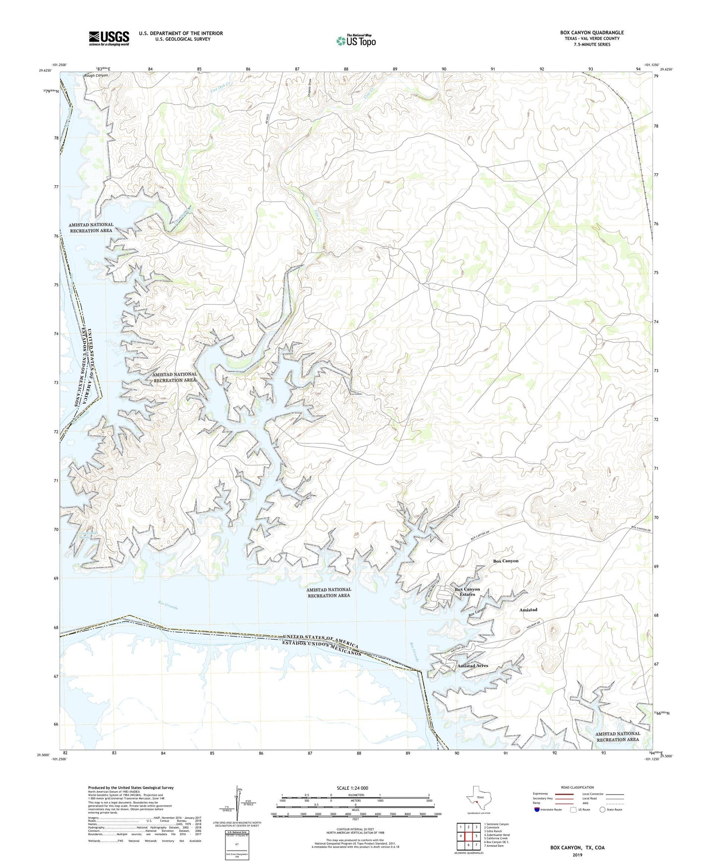
2022 topographic map quadrangle Box Canyon in the state of Texas. Scale: 1:24000. Based on the newly updated USGS 7.5' US Topo map series, this map is in the following counties: Val Verde. The map contains contour data, water features, and other items you are used to seeing on USGS maps, but also has updated roads and other features. This is the next generation of topographic maps. Printed on high-quality waterproof paper with UV fade-resistant inks.
Quads adjacent to this one:
West: Zuberbueler Bend
Northwest: Seminole Canyon
North: Comstock
Northeast: Gillis Ranch
East: California Creek
Southeast: Amistad Dam
South: Box Canyon OE S
This map covers the same area as the classic USGS quad with code o29101e2.
Contains the following named places: Amistad Acres, Amistad Census Designated Place, Box Canyon, Box Canyon Census Designated Place, Box Canyon Estates, Box Canyon-Amistad Census Designated Place, Chapote Draw, Cow Creek, Goodenough Springs, Live Oak Creek, Miguel Waterhole, Rough Canyon