MyTopo
Annona Texas US Topo Map
Couldn't load pickup availability
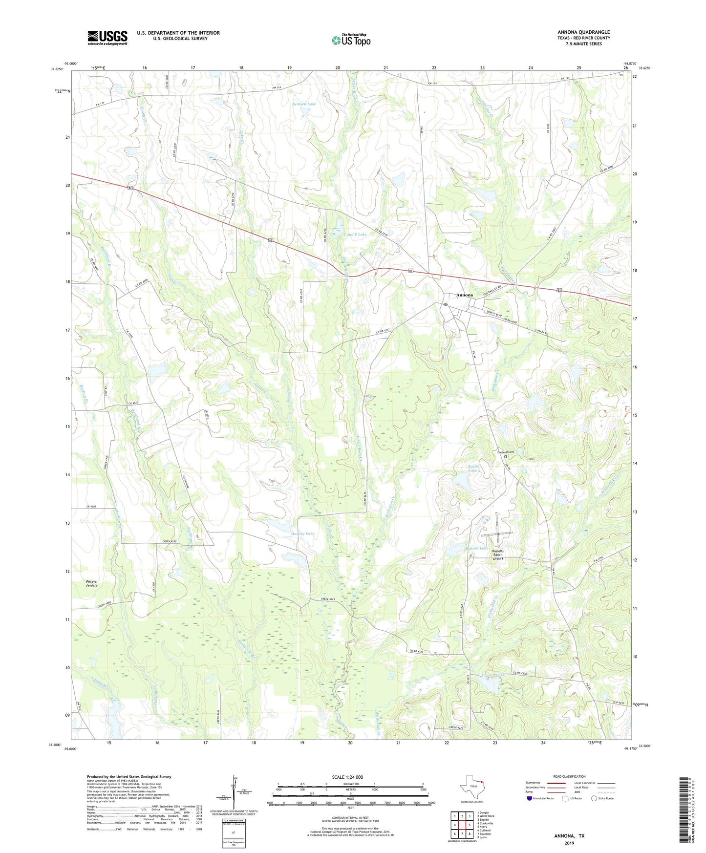
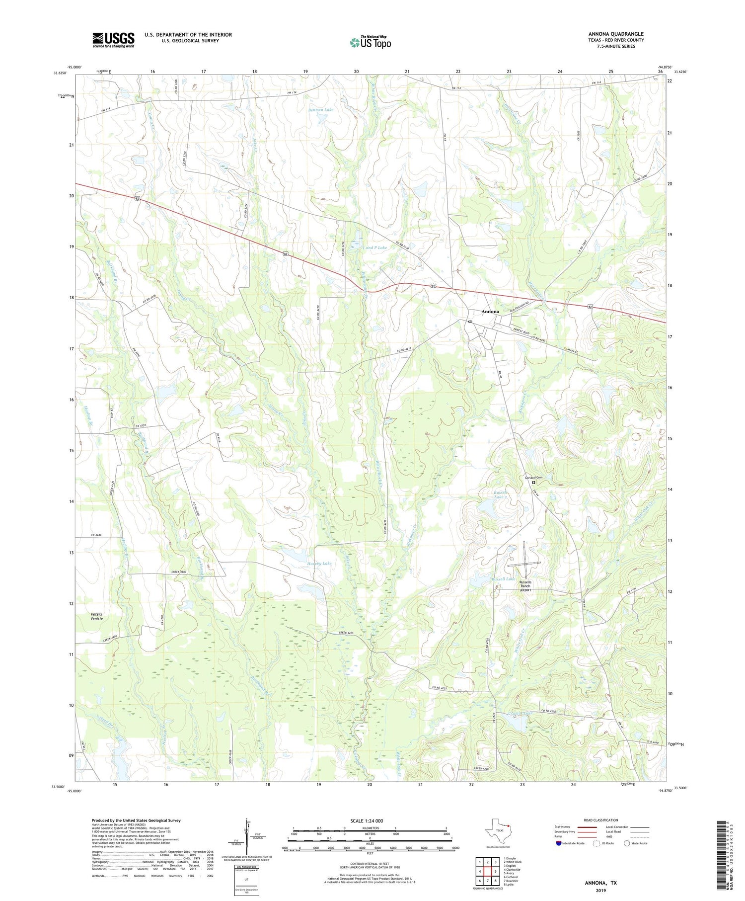
2019 topographic map quadrangle Annona in the state of Texas. Scale: 1:24000. Based on the newly updated USGS 7.5' US Topo map series, this map is in the following counties: Red River. The map contains contour data, water features, and other items you are used to seeing on USGS maps, but also has updated roads and other features. This is the next generation of topographic maps. Printed on high-quality waterproof paper with UV fade-resistant inks.
Quads adjacent to this one:
West: Clarksville
Northwest: Dimple
North: White Rock
Northeast: English
East: Avery
Southeast: Lydia
South: Boxelder
Southwest: Cuthand
Contains the following named places: Annona, Annona City Hall, Annona Post Office, Bentsen Lake, Bentsen Lake Dam, Crystal Lake, Crystal Lake Dam, Garland Cemetery, Harvey Lake, Harvey Lake Dam, Hopewell Church, Hurricane Creek, Jake Creek, Jake Creek School, King Memorial Chapel, Lanes Chapel Cemetery, Lanes Chapel School, Magic Valley Lake, Mena, Oakland School, Peters Prairie, Russell Chapel School, Russell Lake, Russell Lake 2, Russell Lake 2 Dam, Russells Ranch Airport, Swanville Church, T and P Lake, Town of Annona, White Rock Creek