MyTopo
Lydia Texas US Topo Map
Couldn't load pickup availability
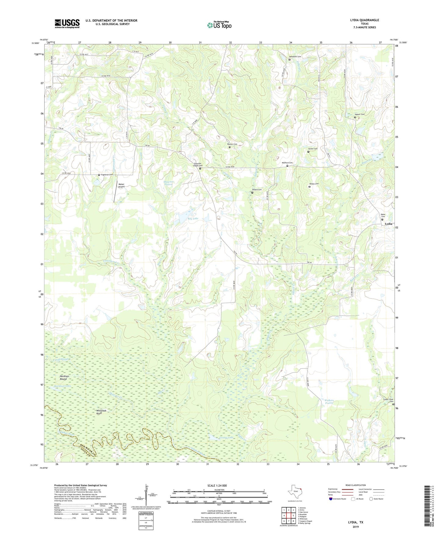
2022 topographic map quadrangle Lydia in the state of Texas. Scale: 1:24000. Based on the newly updated USGS 7.5' US Topo map series, this map is in the following counties: Red River, Titus. The map contains contour data, water features, and other items you are used to seeing on USGS maps, but also has updated roads and other features. This is the next generation of topographic maps. Printed on high-quality waterproof paper with UV fade-resistant inks.
Quads adjacent to this one:
West: Boxelder
Northwest: Annona
North: Avery
Northeast: Oak Grove
East: Hodgson
Southeast: Dalby Springs
South: Coopers Chapel
Southwest: Wilkinson
This map covers the same area as the classic USGS quad with code o33094d7.
Contains the following named places: Baker Cemetery, Caney Creek, Cedar Creek Cemetery, Cottonwood Creek, Cutoff Slough, Dillard Cemetery, Dillard Creek, Elm Creek, Fogelman Cemetery, Grassy Lake, Hardison Lake, Hardison Mound, Key Lake, Key Lake Dam, Long Lake, Lydia, Medford Cemetery, Molair Airport, Peters Creek, Rehobeth Cemetery, Round Lake, Shawnee Chapel Cemetery, Shawnee Church, Shawnee Creek, Shawnee Prairie, Tucker Cemetery, Walker Cemetery, Walkers Prairie, Whiteoak Knoll, Wilkes Cemetery, Wooten Cemetery