MyTopo
Boxelder Texas US Topo Map
Couldn't load pickup availability
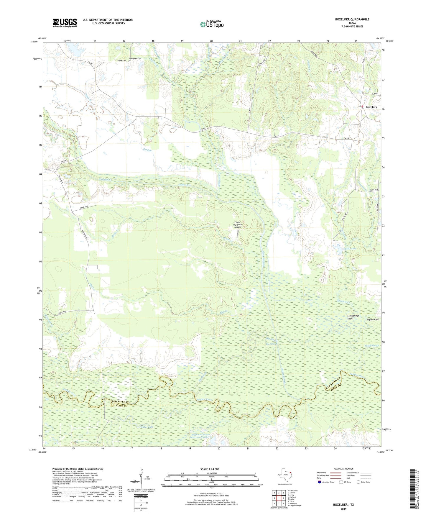
2022 topographic map quadrangle Boxelder in the state of Texas. Scale: 1:24000. Based on the newly updated USGS 7.5' US Topo map series, this map is in the following counties: Red River, Titus. The map contains contour data, water features, and other items you are used to seeing on USGS maps, but also has updated roads and other features. This is the next generation of topographic maps. Printed on high-quality waterproof paper with UV fade-resistant inks.
Quads adjacent to this one:
West: Cuthand
Northwest: Clarksville
North: Annona
Northeast: Avery
East: Lydia
Southeast: Coopers Chapel
South: Wilkinson
Southwest: Talco
This map covers the same area as the classic USGS quad with code o33094d8.
Contains the following named places: Big Slough, Blackmon Farms Reservoir Number 5 Dam, Blackmon Farms Reservoir Number 6, Blackmon Farms Reservoir Number 6 Dam, Boxelder, Boxelder Volunteer Fire Department, Burkhand Branch, Circle WC Ranch Airport, Crooked Creek, Cuthand Creek, Evergreen Cemetery, Flat Creek, Harts Bluff, Heeltap Branch, Kickapoo Creek, Little Grass Lake, Magic Valley Lake Dam, Maple, Maple Creek, Ogilvie Lake, Ogilvie Lake Dam, Oliver Lake, Pigpen Knoll, Salem Church, Sand Branch, Stockbridge Knoll, Turner Lake, White Oak Creek, Whiteoak Creek, ZIP Code: 75550