MyTopo
Antelope Gap Texas US Topo Map
Couldn't load pickup availability
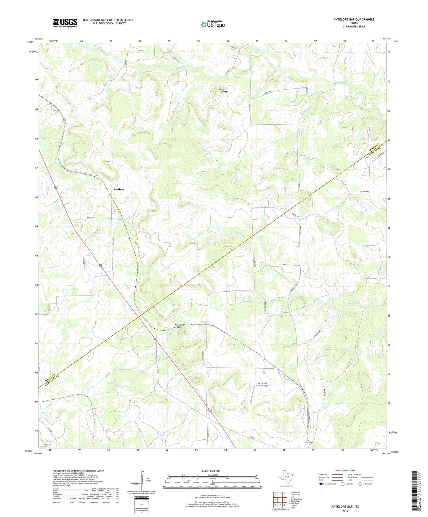
2019 topographic map quadrangle Antelope Gap in the state of Texas. Scale: 1:24000. Based on the newly updated USGS 7.5' US Topo map series, this map is in the following counties: Mills, Lampasas. The map contains contour data, water features, and other items you are used to seeing on USGS maps, but also has updated roads and other features. This is the next generation of topographic maps. Printed on high-quality waterproof paper with UV fade-resistant inks.
Quads adjacent to this one:
West: San Saba Peak
Northwest: Goldthwaite
North: Center City
Northeast: Star
East: Castle Peak
Southeast: Ogles
South: Lometa
Southwest: Wolf Ridge
Contains the following named places: Antelope Gap, Bear Cove Creek, Bee Cove Creek, Birchfield Ranch Airport, Bread Tray Mountain, Clift Lake, Clift Lake Dam, Lee Gap, Long Cove, Long Cove Baptist Church, Long Cove Schoolhouse, Nesbitt Branch, Pleasant Grove, Scallorn