MyTopo
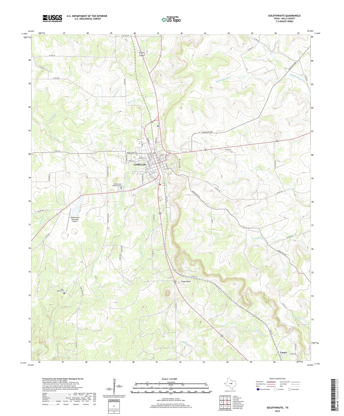
Goldthwaite Texas US Topo Map
Couldn't load pickup availability
2022 topographic map quadrangle Goldthwaite in the state of Texas. Scale: 1:24000. Based on the newly updated USGS 7.5' US Topo map series, this map is in the following counties: Mills. The map contains contour data, water features, and other items you are used to seeing on USGS maps, but also has updated roads and other features. This is the next generation of topographic maps. Printed on high-quality waterproof paper with UV fade-resistant inks.
Quads adjacent to this one:
West: Big Valley North
Northwest: Mullin
North: Lake Merritt
Northeast: Caradan
East: Center City
Southeast: Antelope Gap
South: San Saba Peak
Southwest: Big Valley South
This map covers the same area as the classic USGS quad with code o31098d5.
Contains the following named places: Cedar Knob, City of Goldthwaite, Cryers Branch, Durenville, Eagle Field, East Fork Bull Creek, Goldthwaite, Goldthwaite City Hall, Goldthwaite Division, Goldthwaite Elementary School, Goldthwaite High School, Goldthwaite Memorial Cemetery, Goldthwaite Municipal Airport, Goldthwaite Municipal Park, Goldthwaite Post Office, Goldthwaite Volunteer Fire Department, Joy - Mohler Cemetery, Mills County, Mills County Airport, Mills County Emergency Medical Services, Mills County Historical Museum, Mills County Jail, Mills County Jailhouse, Mills County Sheriff's Office, North Fork Bull Creek, Texas Department of Public Safety Highway Patrol Office, ZIP Code: 76844