MyTopo
Castle Peak Texas US Topo Map
Couldn't load pickup availability
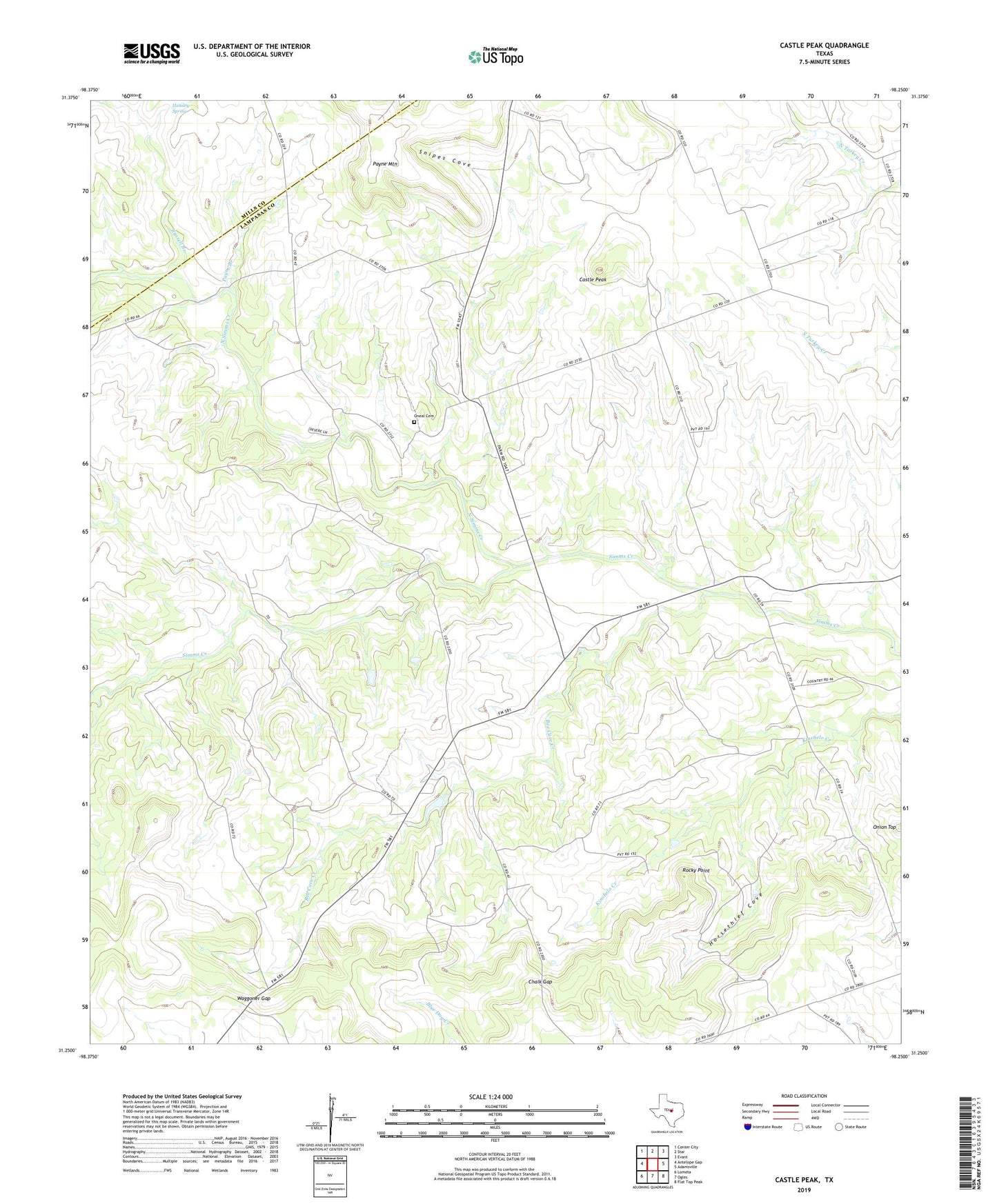
2022 topographic map quadrangle Castle Peak in the state of Texas. Scale: 1:24000. Based on the newly updated USGS 7.5' US Topo map series, this map is in the following counties: Lampasas, Mills. The map contains contour data, water features, and other items you are used to seeing on USGS maps, but also has updated roads and other features. This is the next generation of topographic maps. Printed on high-quality waterproof paper with UV fade-resistant inks.
Quads adjacent to this one:
West: Antelope Gap
Northwest: Center City
North: Star
Northeast: Evant
East: Adamsville
Southeast: Flat Top Peak
South: Ogles
Southwest: Lometa
This map covers the same area as the classic USGS quad with code o31098c3.
Contains the following named places: Bee Cave Creek, Castle Peak, Chalk Gap, Hensley Spring, Horsethief Cove, North Simms Creek, Oneal Cemetery, Onion Top, Payne Branch, Payne Mountain, Rocky Point, Russell Branch, Snipes Cove, Waggoner Gap, ZIP Code: 76853