MyTopo
Center City Texas US Topo Map
Couldn't load pickup availability
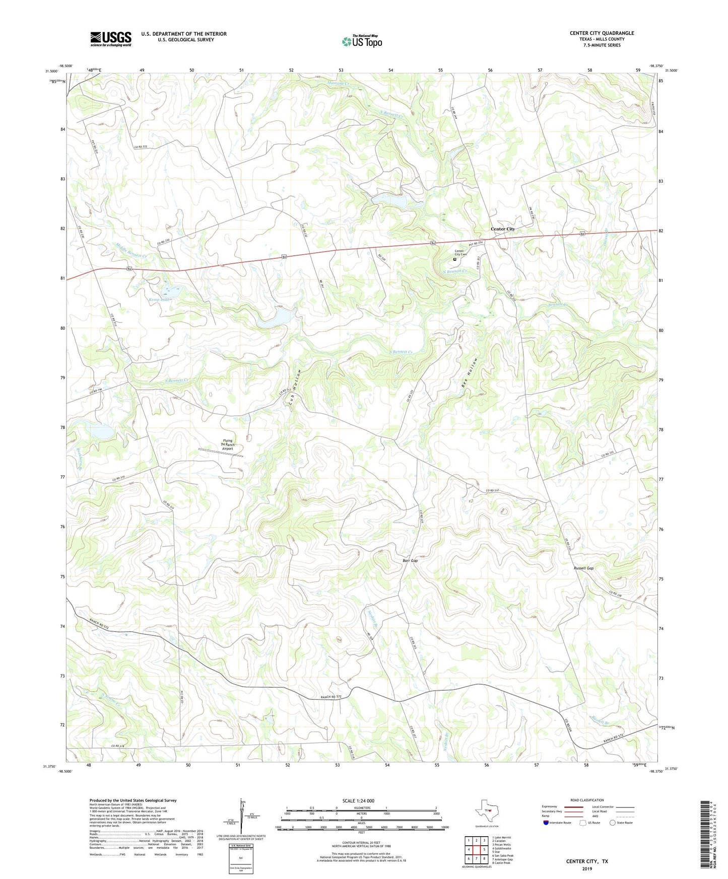
2022 topographic map quadrangle Center City in the state of Texas. Scale: 1:24000. Based on the newly updated USGS 7.5' US Topo map series, this map is in the following counties: Mills. The map contains contour data, water features, and other items you are used to seeing on USGS maps, but also has updated roads and other features. This is the next generation of topographic maps. Printed on high-quality waterproof paper with UV fade-resistant inks.
Quads adjacent to this one:
West: Goldthwaite
Northwest: Lake Merritt
North: Caradan
Northeast: Pecan Wells
East: Star
Southeast: Castle Peak
South: Antelope Gap
Southwest: San Saba Peak
This map covers the same area as the classic USGS quad with code o31098d4.
Contains the following named places: Barr Gap, Bee Hollow, Buckhorn Branch, Center City, Center City Cemetery, Cub Hollow, Flying 7H Ranch Airport, Kemp Lake, Kemp Lake Dam, Middle Bennett Creek, Mustang Creek, North Bennett Creek, Owens Branch, Russell Gap, Shelton Lake, Shelton Lake Dam, Soil Conservation Service Site 1 Dam, Soil Conservation Service Site 1 Reservoir, Soil Conservation Service Site 2 Dam, Soil Conservation Service Site 2 Reservoir, South Bennett Creek, Star Division, Willow Springs Branch