MyTopo
Star Texas US Topo Map
Couldn't load pickup availability
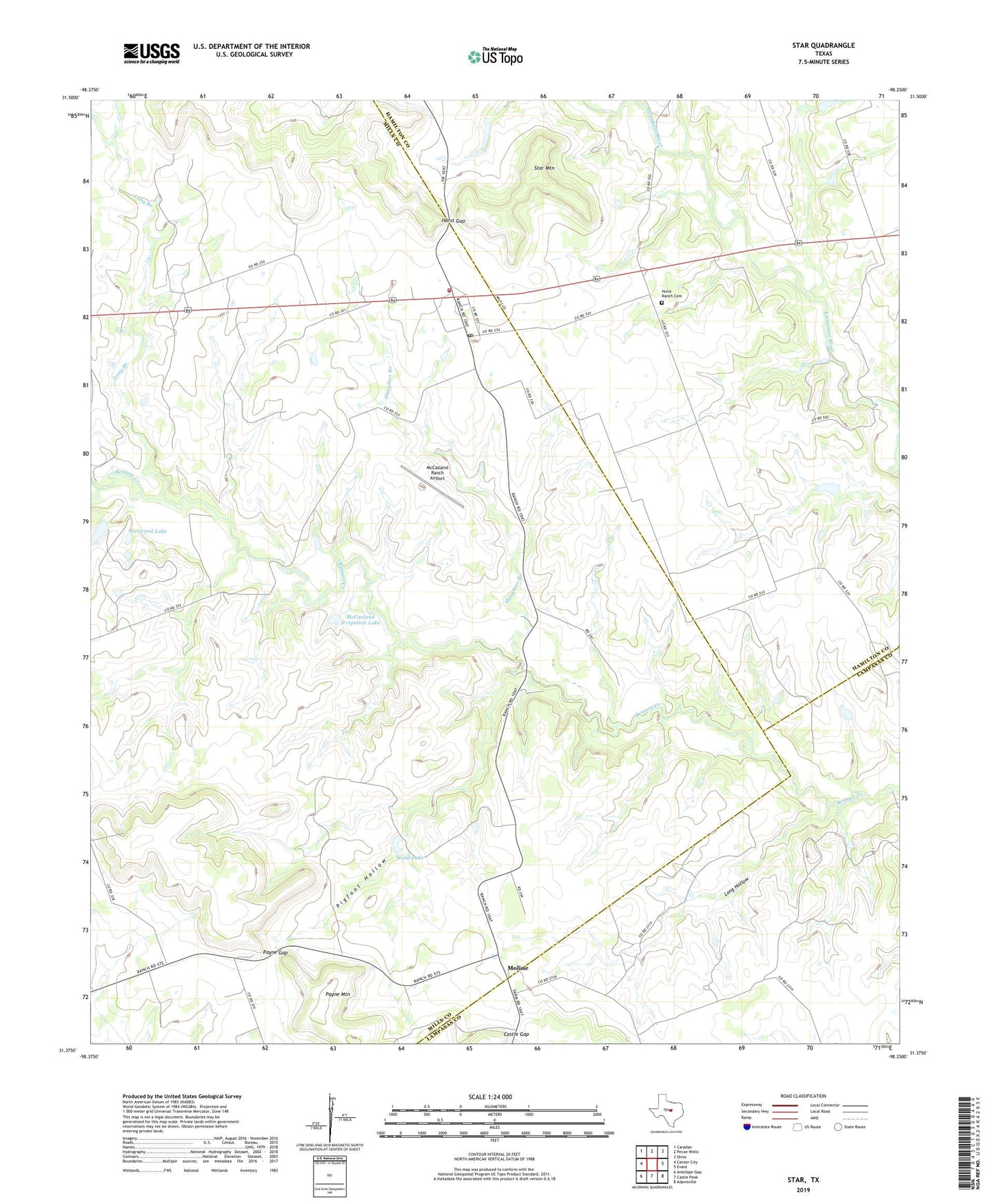
2022 topographic map quadrangle Star in the state of Texas. Scale: 1:24000. Based on the newly updated USGS 7.5' US Topo map series, this map is in the following counties: Mills, Hamilton, Lampasas. The map contains contour data, water features, and other items you are used to seeing on USGS maps, but also has updated roads and other features. This is the next generation of topographic maps. Printed on high-quality waterproof paper with UV fade-resistant inks.
Quads adjacent to this one:
West: Center City
Northwest: Caradan
North: Pecan Wells
Northeast: Shive
East: Evant
Southeast: Adamsville
South: Castle Peak
Southwest: Antelope Gap
This map covers the same area as the classic USGS quad with code o31098d3.
Contains the following named places: Castle Gap, Head Lake, Head Lake Dam, Hurst Gap, Hurst Ranch Cemetery, Long Branch, Long Hollow, McCasland Irrigation Lake, McCasland Irrigation Lake Dam, McCasland Ranch Airport, Moline, Norwood Lake, Norwood Lake Dam, Payne Gap, Pigfoot Hollow, Slaughter Branch, Star, Star Mountain, Star Post Office, Star Volunteer Fire Department