MyTopo
Aquilla Texas US Topo Map
Couldn't load pickup availability
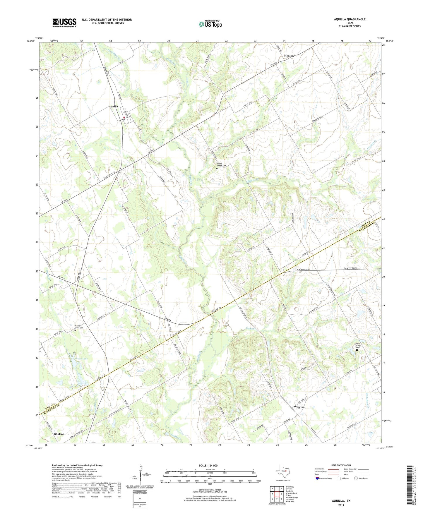
2019 topographic map quadrangle Aquilla in the state of Texas. Scale: 1:24000. Based on the newly updated USGS 7.5' US Topo map series, this map is in the following counties: Hill, McLennan. The map contains contour data, water features, and other items you are used to seeing on USGS maps, but also has updated roads and other features. This is the next generation of topographic maps. Printed on high-quality waterproof paper with UV fade-resistant inks.
Quads adjacent to this one:
West: Smiths Bend
Northwest: Whitney
North: Peoria
Northeast: Abbott
East: West
Southeast: Elm Mott
South: Gholson
Southwest: China Springs
Contains the following named places: Alligator Creek, Aquilla, Aquilla Post Office, Aquilla Volunteer Fire Department, Bold Springs Cemetery, City of Aquilla, Cobb Creek, Coffelt Lake Number 1 Dam, Coffelt Lake Number 2, Coffelt Lake Number 2 Dam, County Line Gin, Dead Horse Creek, Holiness Church, KJNE-FM (Hillsboro), Menlow, Patten Lake, Prairie Grove Cemetery, Scotts Chapel Cemetery, Snake Creek, Square K Airport, Tokio, Tokio Church, Tyson, Vrbas Lake, Vrbas Lake Dam, West Division, Wiggins, ZIP Code: 76622