MyTopo
Whitney Texas US Topo Map
Couldn't load pickup availability
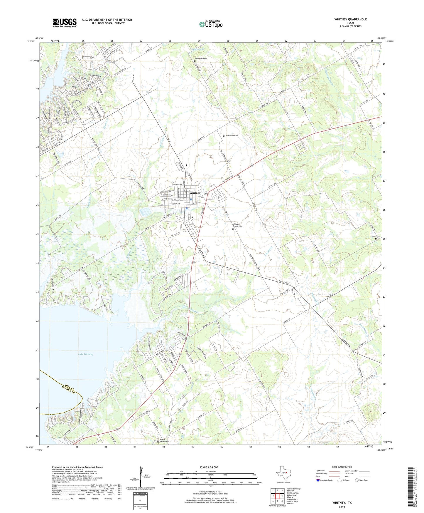
2022 topographic map quadrangle Whitney in the state of Texas. Scale: 1:24000. Based on the newly updated USGS 7.5' US Topo map series, this map is in the following counties: Hill, Bosque. The map contains contour data, water features, and other items you are used to seeing on USGS maps, but also has updated roads and other features. This is the next generation of topographic maps. Printed on high-quality waterproof paper with UV fade-resistant inks.
Quads adjacent to this one:
West: Allen Bend
Northwest: Lakeside Village
North: Blanton
Northeast: Hillsboro West
East: Peoria
Southeast: Aquilla
South: Smiths Bend
Southwest: Laguna Park
This map covers the same area as the classic USGS quad with code o31097h3.
Contains the following named places: Bethlehem Cemetery, Cedar Creek Park, Juniper Cove Park, Lake Whitney Medical Center, Lake Whitney State Park, Lake Whitney State Park Airport, Lake Whitney State Park Hiking Trail, Lofers Bend Park, Missionary Baptist Church, Oak Grove Cemetery, Prairie Valley, Prairie Valley Cemetery, Towash Church, Towash Creek, Town of Whitney, Whitney, Whitney City Hall, Whitney Creek, Whitney Division, Whitney High School, Whitney Junior High School, Whitney Police Department, Whitney Post Office, Whitney-Towash Cemetery, Woodland Hills, Yates Cemetery, ZIP Code: 76692