MyTopo
Lopeno Texas US Topo Map
Couldn't load pickup availability
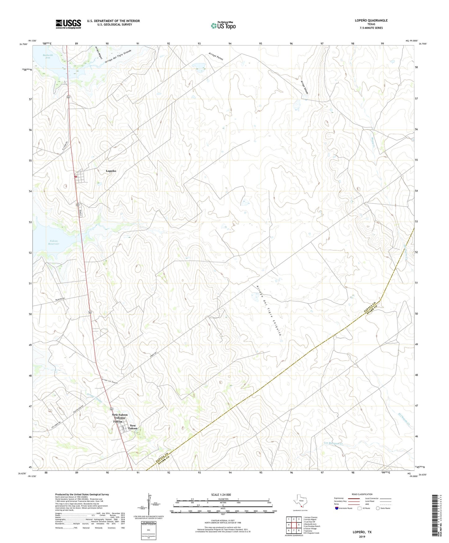
2022 topographic map quadrangle Lopeno in the state of Texas. Scale: 1:24000. Based on the newly updated USGS 7.5' US Topo map series, this map is in the following counties: Zapata, Starr. The map contains contour data, water features, and other items you are used to seeing on USGS maps, but also has updated roads and other features. This is the next generation of topographic maps. Printed on high-quality waterproof paper with UV fade-resistant inks.
Quads adjacent to this one:
West: Beckwith Arm
Northwest: Arroyo Clareno
North: Arroyo Miguel
Northeast: Cuevitas SW
East: Las Escobas Ranch
Southeast: El Chapote Creek
South: Salineno
Southwest: Falcon Village
This map covers the same area as the classic USGS quad with code o26099f1.
Contains the following named places: Arroyo del Tigre Chiquita, Arroyo del Tigre Grande, Arroyo Los Guajes, Arroyo Miguel, Falcon, Lopeno, Lopeno Census Designated Place, Lopeno Gas Field, Lopeno Post Office, New Falcon, New Falcon Census Designated Place, New Falcon Colonia, Zapata County Fire Department Station 3, ZIP Code: 78564